Soibugh
Soibugh is a town in Budgam district in the Indian-administered union territory of Jammu and Kashmir. It is 8.5 km (5.3 mi) from the summer capital of Jammu and Kashmir, Srinagar. It is one of the highly populated area of district Budgam.[1][2] Soibugh is one of the 17 blocks of Budgam district.[3]
Soibugh | |
|---|---|
Town | |
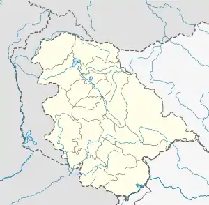
 Soibugh Location in Jammu and Kashmir, India  Soibugh Soibugh (India) | |
| Coordinates: 34.0760°N 74.7052°E | |
| Country | |
| Union Territory | Jammu and Kashmir |
| District | Budgam |
| Area | |
| • Total | 6.04 km2 (2.33 sq mi) |
| Population (2011) | |
| • Total | 9,873 |
| • Density | 1,600/km2 (4,200/sq mi) |
| Languages | |
| • Official | Kashmiri, Urdu, Hindi, Dogri, English[4][5] |
| Time zone | UTC+5:30 (IST) |
| Area code | 000624 |
Geography
Total geographical area of Soibugh is 604.20 ha (6.0420 km2). It is located at 34.0760°N 74.7052°E, at an elevation of 1,587 metres.[6] Soibugh is located 8.5 km (5.3 mi) from Srinagar, the summer capital of union territory of Jammu and Kashmir.
Demography
As of 2011, the population of Soibugh is 9,873 of which 5,066 are males while the remaining 4,807 are females as per the report released by census of India.[7] Population of the children with age 0-6 is 1,539. Total number of households in this village is 1,471. The location code of Soibugh is 000624.[7] The number of literates are 4,095 in which 2,391 are males and 1,704 are females.[7]
References
- "Soibugh". wikimapia.org. Retrieved 10 February 2021.
- "Soibugh Pin Code | Postal Code (Zip Code) of Soibugh, Budgam, Jammu & Kashmir, India". www.indiatvnews.com. Retrieved 10 February 2021.
- "Blocks | District Budgam , Government of Jammu & Kashmir | India". Budgam.nic.in. Retrieved 15 March 2021.
- "The Jammu and Kashmir Official Languages Act, 2020" (PDF). The Gazette of India. 27 September 2020. Retrieved 27 September 2020.
- "Parliament passes JK Official Languages Bill, 2020". Rising Kashmir. 23 September 2020. Retrieved 30 May 2021.
- "Soibugh, Budgam, India on the Elevation map". Elevation Map. Retrieved 11 February 2021.
- "Budgam district census 2011 handbook" (PDF). Census India. 11 March 2021. Retrieved 11 February 2021.