Sonnette, Montana
Sonnette is an unincorporated community in west central Powder River County, Montana, United States. The community is situated near the headwaters of Pumpkin Creek, just west of the Custer National Forest. It lies along local roads northwest of the town of Broadus, the county seat of Powder River County.[2]
Sonnette | |
|---|---|
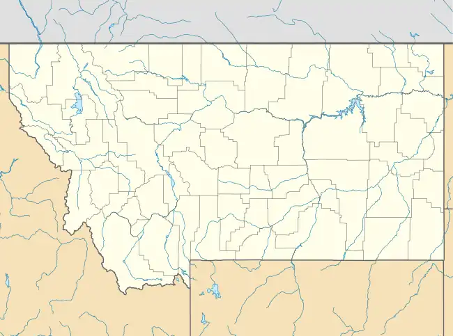 Sonnette Location within the state of Montana | |
| Coordinates: 45°24′47″N 105°49′53″W | |
| Country | United States |
| State | Montana |
| County | Powder River |
| Elevation | 3,767 ft (1,148 m) |
| Time zone | UTC-7 (Mountain (MST)) |
| • Summer (DST) | UTC-6 (MDT) |
| GNIS feature ID | 790852[1] |
Climate
According to the Köppen Climate Classification system, Sonnette has a semi-arid climate, abbreviated "BSk" on climate maps.[3]
| Climate data for Sonnette, Montana, 1991–2020 normals, extremes 1965–present | |||||||||||||
|---|---|---|---|---|---|---|---|---|---|---|---|---|---|
| Month | Jan | Feb | Mar | Apr | May | Jun | Jul | Aug | Sep | Oct | Nov | Dec | Year |
| Record high °F (°C) | 68 (20) |
70 (21) |
80 (27) |
87 (31) |
103 (39) |
105 (41) |
107 (42) |
103 (39) |
100 (38) |
91 (33) |
77 (25) |
71 (22) |
107 (42) |
| Mean maximum °F (°C) | 54.2 (12.3) |
56.5 (13.6) |
68.7 (20.4) |
77.4 (25.2) |
83.9 (28.8) |
91.3 (32.9) |
98.0 (36.7) |
96.8 (36.0) |
92.9 (33.8) |
81.1 (27.3) |
66.1 (18.9) |
54.3 (12.4) |
99.3 (37.4) |
| Average high °F (°C) | 36.8 (2.7) |
38.7 (3.7) |
48.8 (9.3) |
57.3 (14.1) |
66.6 (19.2) |
76.5 (24.7) |
86.5 (30.3) |
85.9 (29.9) |
75.3 (24.1) |
59.6 (15.3) |
46.5 (8.1) |
36.8 (2.7) |
59.6 (15.3) |
| Daily mean °F (°C) | 23.2 (−4.9) |
25.0 (−3.9) |
34.7 (1.5) |
43.0 (6.1) |
52.3 (11.3) |
61.7 (16.5) |
69.7 (20.9) |
68.5 (20.3) |
58.5 (14.7) |
44.8 (7.1) |
32.5 (0.3) |
23.6 (−4.7) |
44.8 (7.1) |
| Average low °F (°C) | 9.5 (−12.5) |
11.3 (−11.5) |
20.6 (−6.3) |
28.8 (−1.8) |
38.1 (3.4) |
46.8 (8.2) |
53.0 (11.7) |
51.1 (10.6) |
41.7 (5.4) |
30.0 (−1.1) |
18.4 (−7.6) |
10.4 (−12.0) |
30.0 (−1.1) |
| Mean minimum °F (°C) | −17.4 (−27.4) |
−14.4 (−25.8) |
−3.5 (−19.7) |
10.3 (−12.1) |
21.6 (−5.8) |
34.0 (1.1) |
41.6 (5.3) |
37.8 (3.2) |
26.7 (−2.9) |
9.9 (−12.3) |
−4.7 (−20.4) |
−13.2 (−25.1) |
−25.7 (−32.1) |
| Record low °F (°C) | −38 (−39) |
−42 (−41) |
−33 (−36) |
−8 (−22) |
11 (−12) |
26 (−3) |
33 (1) |
25 (−4) |
10 (−12) |
−16 (−27) |
−25 (−32) |
−44 (−42) |
−44 (−42) |
| Average precipitation inches (mm) | 0.50 (13) |
0.70 (18) |
0.91 (23) |
1.85 (47) |
2.95 (75) |
2.69 (68) |
1.67 (42) |
1.10 (28) |
1.09 (28) |
1.38 (35) |
0.56 (14) |
0.51 (13) |
15.91 (404) |
| Average snowfall inches (cm) | 3.9 (9.9) |
6.6 (17) |
5.0 (13) |
3.4 (8.6) |
0.2 (0.51) |
0.0 (0.0) |
0.0 (0.0) |
0.0 (0.0) |
0.0 (0.0) |
1.3 (3.3) |
3.1 (7.9) |
5.6 (14) |
29.1 (74.21) |
| Average precipitation days (≥ 0.01 in) | 3.8 | 5.6 | 4.9 | 7.3 | 8.7 | 7.9 | 6.5 | 5.1 | 4.6 | 5.8 | 3.8 | 3.6 | 67.6 |
| Average snowy days (≥ 0.1 in) | 1.9 | 2.4 | 1.3 | 1.0 | 0.1 | 0.0 | 0.0 | 0.0 | 0.0 | 0.8 | 1.3 | 2.0 | 10.8 |
| Source 1: NOAA[4] | |||||||||||||
| Source 2: National Weather Service[5] | |||||||||||||
References
- U.S. Geological Survey Geographic Names Information System: Sonnette, Montana
- Rand McNally. The Road Atlas '08. Chicago: Rand McNally, 2008, p. 61.
- Climate Summary for Sonnette, Montana
- "U.S. Climate Normals Quick Access". National Oceanic and Atmospheric Administration. Retrieved August 7, 2022.
- "NOAA Online Weather Data". National Weather Service. Retrieved August 7, 2022.
Municipalities and communities of Powder River County, Montana, United States | ||
|---|---|---|
| Town | 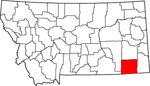 Powder River County map | |
| CDP | ||
| Other communities | ||
This article is issued from Wikipedia. The text is licensed under Creative Commons - Attribution - Sharealike. Additional terms may apply for the media files.