South Island (Kenya)
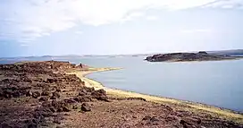
South Island, or Hohnel Island (named after Ludwig von Höhnel who helped with Teleki's expedition), is a fissure-formed volcanic island and the largest one out of 3 other major islands in Lake Turkana, Kenya. This volcano was discovered in 1888 while it was erupting by Count Teleki, a Hungarian explorer who led the first expedition into the region. It is a part of the Lake Turkana National Parks, which is a UNESCO World Heritage Site.
| South Island (Hohnel Island) | |
|---|---|
 | |
| Highest point | |
| Elevation | 2,625 ft (800 m)[1] |
| Coordinates | 02°37′48″N 36°36′00″E[1] |
| Geography | |
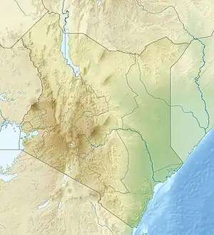
 South Island (Hohnel Island) Location within Kenya | |
| Location | Lake Turkana, Kenya |
| Geology | |
| Age of rock | Unknown[2] |
| Mountain type | Fissure vent |
| Last eruption | 1888[1] |
| UNESCO World Heritage Site | |
|---|---|
| Location | Kenya |
| Part of | Lake Turkana National Parks |
| Criteria | Natural: (viii)(x) |
| Reference | 801bis-002 |
| Inscription | 1997 (21st Session) |
| Extensions | 2001 |
| Area | 500 ha (1,200 acres) |
Geography
The island is a 12 km by 5 km island, covered almost completely by recent lava flows erupted by the volcano. Around the island can be found some smaller islets.[2]
Climate
The island generally has a hot and arid climate which lasts from December to March. The coolest months on the island are June and July. Strong winds are a common occurrence from May to September. The annual rainfall at the island averages at 250mm.[3]
Discovery
In 1888, Samuel Teleki, a Hungarian explorer, set off to a trip in Eastern Africa specifically in northern Kenya and southern Ethiopia with Ludwig von Höhnel, an Austrian naval officer and explorer. They were the first Europeans to see many places including Lake Turkana which was named Lake Rudolf (named after the Crown Prince Rudolf of Austria) when it was discovered, Lake Chew Bahir which was named Lake Stefanie (named after Princess Stephanie of Belgium) back then, the Teleki's Volcano (named after Teleki) and more including South Island. Teleki and Höhnel made many observations and discoveries about the local geography, the tribe community and others. All of their work was published in a book called The Discovery of Lakes Rudolf and Stefanie in 1892 by Höhnel himself.[4]
Geological setting
The island sits in the southern portion of Lake Turkana which was formed by the East African Rift System (EARS). Along the EARS sits many volcanoes, the closest ones to South Island including Central Island, North Island, The Barrier and more.
The EARS, a rift zone which extends all the way from Mozambique to Eritrea, is a divergent boundary that is separating the African Plate and the Somali Plate apart at a rate of a few millimeters per year. As a result, seismic activity is caused which can sometimes have larger earthquakes as well as a belt of volcanoes being fed by the rift since in this case the tectonics and the volcanism are closely related.[5]
Magma processes
The volcano sits on a rift zone, which means that tectonic movement is one of the main factors which generates magma. In this case, tectonic movement is a factor as volcanic edifice or materials underground loads into the crust, which modifies the differential stress and affects the upper crust relative to the volcanic materials' radius. Meanwhile, the principal stress' trajectory focuses to the greatest load within the materials. This focusing action (mostly with an asymmetrical stress field) leads to the creation of a magma chamber.[5]
.jpg.webp)
Structure

On South Island can be found a N-S (north to south) trending volcanic ridge which rises to about a height of 300 m. Along this ridge can be found several volcanic cones, which some rise to about a height of 800 m (above sea level, 320 m above the lake level). Several N-S trending faults can also be found on the east and west side of the main ridge, which proves that the island sits on a horst. Morphologically, the east and western side of the island differs from each other. To the east, basaltic lava flows originating near the ridge spill all the way down to the shore which completely covers the eastern portion. In comparison, the western portion is mostly covered in unconsolidated ash, likely from southwesterly winds. The lava flows and pyroclastic rocks are built upon older tuffs and smaller pillow lavas. Sandy beaches can be seen along the west side of the island. Elsewhere, small, isolated black sand beaches and rocky areas are located at small coves along the western and northern shores.[2]
The oldest rocks and minerals on the island are sequences of basaltic lavas found on the terrace of the northeastern shore and the Enwoiti Islet (located 100m east of South Island). The sequence of rocks, from the base to top, includes hyaloclastites, pillow lavas, and massive lava flows. This sequence is estimated to be 30-40 meters thick. These units of older rocks are covered by an alluvium terrace which goes all the way to the western flank of the ridge.[2]
_(20774009550).jpg.webp)
Geologic history
Much isn't known about the geological and eruptive history of South Island, however 1 eruption was witnessed in the 19th century.
1888 eruption
When Count Teleki was in an expedition in Kenya, an explosive eruption of the Teleki's Volcano (The Barrier) was observed, which reportedly triggered lava flows and pyroclastic flows.[6] Reportedly, meanwhile this eruption was ongoing, Count Teleki witnessed another but smaller eruption from a scoria cone in South Island from a volcano which prompted a lava flow, perhaps in relation to the eruption at The Barrier volcano.[1]
See also
References
- "South Island". Global Volcanism Program. Smithsonian Institution. Retrieved 2022-12-30.
- Karson, J. A.; Curtis, P. C. (5 July 1993). "Quaternary volcanic centres of the Turkana Rift, Kenya". Journal of African Earth Sciences. 18 (1): 15–35. doi:10.1016/0899-5362(94)90051-5. Retrieved 30 December 2022.
- "South Island National Park Kenya". Amboseli National Park. Retrieved December 30, 2022.
- Balàzs Borsos, "Whose merit is it anyway? The Evaluation of Count Teleki and Ritter von Höhnel's roles in the Teleki expedition to East Africa in 1887–1888." In Archiv für Völkerkunde. 54, 2004, ISSN 0066-6513 S. 27–47.
- Wadge, G.; Biggs, J.; Lloyd, R.; Kendall, J.-M. (30 September 2016). "Historical Volcanism and the State of Stress in the East African Rift System". Frontiers in Earth Science. 4. doi:10.3389/feart.2016.00086. hdl:1983/f9ea9723-1135-4ab9-bdf0-40c1661e5303.
- Champion, A. M. (7 January 1935). "Teleki's Volcano and the Lava Fields at the Southern End of Lake Rudolf". The Geographical Journal. 85 (4): 323–336. doi:10.2307/1785591. JSTOR 1785591. Retrieved 30 December 2022.