Stanstead, Quebec (township)
Stanstead is a township municipality of about 1,100 people in the Memphrémagog Regional County Municipality in the Estrie region of Quebec. It is not to be confused with the city of Stanstead, which is nearby although not directly adjacent (the municipality of Ogden lies in between).
Stanstead | |
|---|---|
.jpg.webp) Amy Corners Area | |
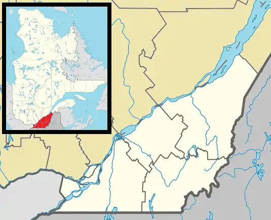
_Quebec_location_diagram.PNG.webp) Location within Memphrémagog RCM | |
 Stanstead Location in southern Quebec | |
| Coordinates: 45°05′N 72°08′W[1] | |
| Country | |
| Province | |
| Region | Estrie |
| RCM | Memphrémagog |
| Constituted | July 1, 1855 |
| Government | |
| • Mayor | Eric Evans |
| • Federal riding | Compton—Stanstead |
| • Prov. riding | Orford |
| Area | |
| • Total | 135.70 km2 (52.39 sq mi) |
| • Land | 113.20 km2 (43.71 sq mi) |
| Population (2021)[4] | |
| • Total | 1,148 |
| • Density | 10.1/km2 (26/sq mi) |
| • Pop 2016-2021 | |
| • Dwellings | 957 |
| Time zone | UTC−5 (EST) |
| • Summer (DST) | UTC−4 (EDT) |
| Postal code(s) | |
| Area code | 819 |
| Highways | |
| Website | www |
Formally, the township consists of two villages: Fitch Bay (founded in 1855) and Georgeville (founded in the 1890s). Both villages formed as a result of English-speaking migrants from the United States state of Vermont until borderline customs stations were established after 1920. Today, the population is bilingual with predominance in French language (about 64%).
Demographics
In the 2021 Census of Population conducted by Statistics Canada, Stanstead had a population of 1,148 living in 553 of its 957 total private dwellings, a change of 10.8% from its 2016 population of 1,036. With a land area of 113.2 km2 (43.7 sq mi), it had a population density of 10.1/km2 (26.3/sq mi) in 2021.[5]
References
- "Reference number 60705 in Banque de noms de lieux du Québec". toponymie.gouv.qc.ca (in French). Commission de toponymie du Québec.
- Ministère des Affaires municipales, des Régions et de l'Occupation du territoire: Stanstead (township)
- Parliament of Canada Federal Riding History: COMPTON--STANSTEAD (Quebec)
- 2021 Statistics Canada Census Profile: Stanstead (township), Quebec
- "Population and dwelling counts: Canada, provinces and territories, and census subdivisions (municipalities), Quebec". Statistics Canada. February 9, 2022. Retrieved August 28, 2022.
External links
 Media related to Stanstead, Quebec (township) at Wikimedia Commons
Adjacent Municipal Subdivisions | ||||||||||||||||
|---|---|---|---|---|---|---|---|---|---|---|---|---|---|---|---|---|
| ||||||||||||||||
| Cities & Towns | |
|---|---|
| Municipalities | |
| Townships | |
| Villages | |
| |