Steggerda
Steggerda (West Frisian: Steggerde) is a village of the Dutch municipality of Weststellingwerf. The village consists of one long stretch with housing and has a population of 1,049.[3]
Steggerda | |
|---|---|
Village | |
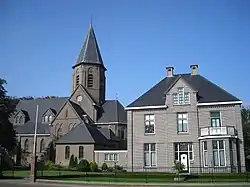
 St Frederic Church | |
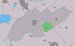
 Location in Weststellingwerf municipality | |
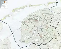
 Steggerda Location in the Netherlands  Steggerda Steggerda (Netherlands) | |
| Coordinates: 52°51′24″N 6°04′27″E | |
| Country | |
| Province | |
| Municipality | |
| Area | |
| • Total | 15.41 km2 (5.95 sq mi) |
| Elevation | 2.3 m (7.5 ft) |
| Population (2021)[1] | |
| • Total | 1,055 |
| • Density | 68/km2 (180/sq mi) |
| Postal code | 8395[1] |
| Dialing code | 0561 |
| Website | Website |
The village was first mentioned in 1408 as Steggerden. The etymology is unknown.[4] Steggerda is a Catholic enclave in a predominantly Protestant region. In 1759, a clandestine church was built on top of a horse barn. In 1839, the first church was built which was replaced in 1921.[5]
Steggerda was home to 560 people in 1840.[5] In 1915, a dairy factory was opened. The factory was supposed to be demolished, however a group of villagers salvaged the steam engine. In 2011, a dairy steam museum opened.[6]
Gallery
 Farm in Steggerda
![Wim Braakman [nl] in front his house of birth](../I/Geboortehuis-braakman.jpg.webp) Wim Braakman in front his house of birth
Wim Braakman in front his house of birth Landscape along the Linde
References
- "Kerncijfers wijken en buurten 2021". Central Bureau of Statistics. Retrieved 2 April 2022.
- "Postcodetool for 8395KV". Actueel Hoogtebestand Nederland (in Dutch). Het Waterschapshuis. Retrieved 2 April 2022.
- Villages - Weststellingwerf municipality (in Dutch)
- "Steggerda - (geografische naam)". Etymologiebank (in Dutch). Retrieved 2 April 2022.
- "Steggerda". Plaatsengids (in Dutch). Retrieved 2 April 2022.
- "Het Stoommuseum". Steggerda (in Dutch). Retrieved 2 April 2022.
External links
![]() Media related to Steggerda at Wikimedia Commons
Media related to Steggerda at Wikimedia Commons
This article is issued from Wikipedia. The text is licensed under Creative Commons - Attribution - Sharealike. Additional terms may apply for the media files.