Steventon Island
Steventon Island (77°15′S 148°15′W) is a broad ice-covered island about 39 km (24 mi) long off of Antarctica, lying west of Court Ridge in the Sulzberger Ice Shelf. It is 45 km (28 mi) long and 27 km (17 mi) wide, and covers an area of around 780 km2 (300 sq mi). It was mapped from surveys by the United States Geological Survey (USGS) and U.S. Navy air photos (1959–65), and named by the Advisory Committee on Antarctic Names (US-ACAN) for Richard F. Steventon, USN, Petty Officer in charge of Eights Station, 1963.
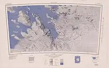
Topographic map sheet Boyd Glacier 1:250,000
![]() This article incorporates public domain material from "Steventon Island". Geographic Names Information System. United States Geological Survey.
This article incorporates public domain material from "Steventon Island". Geographic Names Information System. United States Geological Survey.
This article is issued from Wikipedia. The text is licensed under Creative Commons - Attribution - Sharealike. Additional terms may apply for the media files.