Râmnicu Vâlcea
Râmnicu Vâlcea (also spelled Rîmnicu Vîlcea or, in the past, Rîmnic-Vâlcea, Romanian pronunciation: [ˈrɨmniku ˈvɨlt͡ʃe̯a]) (population: 93,151 as per the 2021 Romanian census) is the county seat town (Romanian: Oraș reședință de județ) and also the largest urban settlement of Vâlcea County, central-southern Romania (in the historical province of Oltenia).
Râmnicu Vâlcea | |
|---|---|
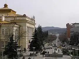 The Tudor Vladimirescu street in Râmnicu Vâlcea, Romania (in early 2010) | |
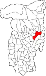 Location in Vâlcea County | |
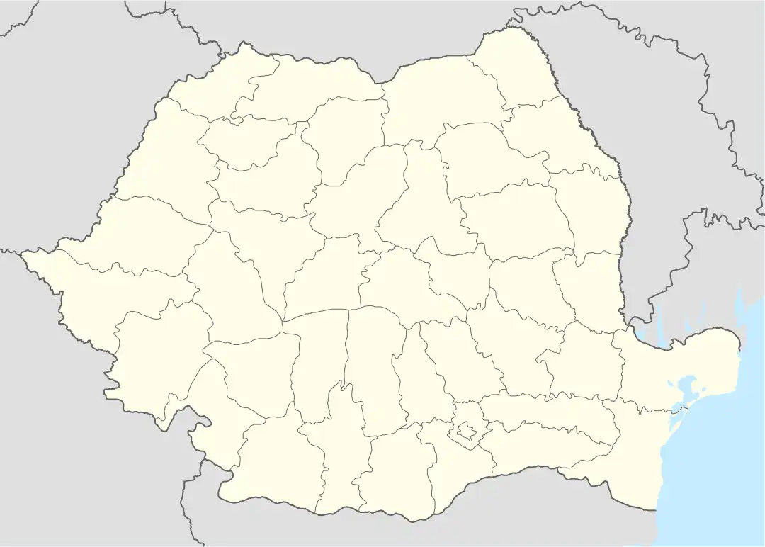 Râmnicu Vâlcea Location in Romania | |
| Coordinates: 45°6′17″N 24°22′32″E | |
| Country | Romania |
| County | Vâlcea |
| Established | 1388 (first mention) |
| Government | |
| • Mayor (2020–2024) | Madu Rucãlãu[1] (PER) |
| Area | 89.52 km2 (34.56 sq mi) |
| Elevation | 250 m (820 ft) |
| Population (2021-12-01)[2] | 93,151 |
| • Density | 1,000/km2 (2,700/sq mi) |
| Time zone | EET/EEST (UTC+2/+3) |
| Postal code | 240xxx |
| Area code | (+40) 02 50 |
| Vehicle reg. | VL |
| Website | www |

Geography and climate
.jpg.webp)
Râmnicu Vâlcea is situated in the central-south area of Romania and is the county capital of Vâlcea County. Set at the foothills of the Southern Carpathians, the town is located at about 12 kilometres (7.5 mi) from the Cozia Mountains and about 40 kilometres (25 mi) from the Făgăraș and Lotrului Mountains. The southern limit of the city is formed by the Getic Plateau (Romanian: Platoul Getic) and the Olt River valley.
The E81 road (a road of European interest) and one of the main national railway routes cross the town.
According to Köppen climate classification, the climate of the town is defined as Dfa (humid continental with warm summers) bordering Cfa (humid subtropical). Precipitation amount is higher in the summer, although not high enough in order to be a "Dwa" type climate.
The table below highlights climate data for Râmnicu Vâlcea between 1981 and 2010, detailing the average high temperature, the average low temperature, the average precipitation (in mm/inches) as well as the average precipitation days throughout all of the months of one year.
| Month | Jan | Feb | Mar | Apr | May | Jun | Jul | Aug | Sep | Oct | Nov | Dec | Year |
|---|---|---|---|---|---|---|---|---|---|---|---|---|---|
| Average high °C (°F) | 3.9 (39.0) |
6.2 (43.2) |
11.5 (52.7) |
17.5 (63.5) |
22.9 (73.2) |
26.3 (79.3) |
28.6 (83.5) |
28.4 (83.1) |
23.3 (73.9) |
17.3 (63.1) |
10.2 (50.4) |
4.6 (40.3) |
16.7 (62.1) |
| Average low °C (°F) | −4.1 (24.6) |
−2.9 (26.8) |
1.0 (33.8) |
6.0 (42.8) |
10.8 (51.4) |
14.1 (57.4) |
15.8 (60.4) |
15.6 (60.1) |
11.4 (52.5) |
6.7 (44.1) |
1.5 (34.7) |
−2.5 (27.5) |
6.1 (43.0) |
| Average precipitation mm (inches) | 34.9 (1.37) |
32.4 (1.28) |
33.9 (1.33) |
56.4 (2.22) |
74.1 (2.92) |
83.2 (3.28) |
77.2 (3.04) |
81.3 (3.20) |
55.9 (2.20) |
47.8 (1.88) |
46.5 (1.83) |
53.0 (2.09) |
676.6 (26.64) |
| Average precipitation days | 10 | 8.7 | 9.7 | 12.2 | 13 | 12.4 | 9.6 | 9.5 | 8.9 | 8.2 | 9.6 | 11.4 | 123.2 |
| Source: World Weather Information[3] | |||||||||||||
History
| Year | Pop. | ±% |
|---|---|---|
| 1912 | 9,628 | — |
| 1930 | 15,648 | +62.5% |
| 1948 | 17,238 | +10.2% |
| 1956 | 18,984 | +10.1% |
| 1966 | 23,867 | +25.7% |
| 1977 | 66,321 | +177.9% |
| 1992 | 113,624 | +71.3% |
| 2002 | 107,656 | −5.3% |
| 2011 | 92,573 | −14.0% |
| 2022 | 93,151 | +0.6% |
| Source: Romanian census data | ||
The area has been inhabited since Dacian and Roman times, and was the site of a castrum (known as Buridava or Burridava, previously a Dacian town). A new fortress was built on the location during the Middle Ages. Râmnicu Vâlcea was first attested during the rule of Prince Mircea cel Bătrân, as "the princely town of Râmnic" (4 September 1388), and confirmed as the seat of a Vâlcea County during the same period (8 January 1392).
The town seal dates to 1505. Cetățuia, the actual fortress, served as the residence of Oltenian Bans and, from 1504, of the Orthodox bishops of the Râmnic Diocese; in 1529, Prince Radu of Afumați was killed in Cetățuia by a boyar conspiracy.
During the rules of Matei Basarab and Constantin Brâncoveanu, it became an important cultural center. It was here where the first paper mill and printing press in Romania were built (see Anthim the Iberian). The town was heavily damaged during the Habsburg monarchy's takeover of Oltenia which lasted between 1718 and 1739, and its purpose was again reduced to that of a fortress.
During the Wallachian Revolution, on 29 July 1848, Deșteaptă-te, române! (the current national anthem of Romania), with lyrics written by Andrei Mureșanu and music composed by Anton Pann (whose memorial house lies in the center of the town), was sung for the first time in Râmnicu Vâlcea.
Gheorghe Magheru gathered his military force in Râureni, now part of the town, in an attempt to face the anti-revolutionary forces of Imperial Russia and the Ottoman Empire.
In the 1980s, the town was completely rebuilt in a style combining socialist realism with local vernacular architecture (of Brâncovenesc style).
The town was the center and peak point of the path of total darkness of the Solar eclipse of 11 August 1999. Around 2005, the town gained notoriety as a centre of cybercrime.[4]
Politics
The mayor of Râmnicu Vâlcea is Mircia Gutău of the Romanian Ecologist Party (PER), following the 2020 Romanian local elections. The Râmnicu Vâlcea Municipal Council, elected at the 2020 local elections, consists of 23 councillors, with the following party composition:[5]
| Party | Seats | Current Council | |||||||||
|---|---|---|---|---|---|---|---|---|---|---|---|
| National Liberal Party (PNL) | 9 | ||||||||||
| Social Democratic Party (PSD) | 6 | ||||||||||
| Ecologist Party (PER) | 5 | ||||||||||
| Save Romania Union (USR) | 3 | ||||||||||
Sports
Râmnicu Vâlcea is home to SCM Râmnicu Vâlcea, which is a women's handball club that competes traditionally in the EHF Champions League. At football, the town was previously known for its now dissolved local football club Chimia Râmnicu Vâlcea which won one Romanian cup in 1973. It briefly participated in the UEFA Cup Winners' Cup/European Cup Winners' Cup during one season (namely in 1973–1974) for just one round (more specifically the first one) against Northern Irish side Glentoran F.C. which subsequently went on to the quarter-finals.
Villages
The city administers thirteen villages: Aranghel, Căzănești, Copăcelu, Dealu Malului, Fețeni, Goranu, Lespezi, Poenari, Priba, Râureni, Săliștea, Stolniceni, and Troian. Goranu, Fețeni, Lespezi, and Săliștea were a separate commune, Goranu, until 1996, when they were merged into the town.
Notable people
- Radu Berceanu (born 1953), engineer and politician
- Dan Burghelea (born 1943), mathematician
- Florin Cîțu (born 1972), politician who served as Prime Minister
- Bogdan-Daniel Deac (born 2001), chess grandmaster
- Doru Dudiță (born 1977), footballer
- Ion Emanuel Florescu (1819–1893), general who served as Chief of the General Staff and Prime Minister
- Gheorghe I. Lahovary (1838–1909), engineer and writer
- Gabriel Liiceanu (born 1942), philosopher
- Nicolae Manolescu (born 1939), literary critic
- Marian-Jean Marinescu (born 1952), politician
- Maria Marinela Mazilu (born 1991), skeleton racer
- Horia Moculescu (born 1937), pianist and composer
- Mihail Oromolu (1875–1945), magistrate and politician
- Alexandru Papadopol (born 1975), actor
- Dem Rădulescu (1931–2000), theatre, film, and television actor, and academic
- Dorel Zugrăvescu (1930–2019), geophysicist
Gallery
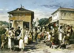
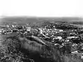 Râmnicu Vâlcea at the turn of the 20th century
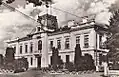 Râmnicu Vâlcea town hall at the beginning of the 20th century
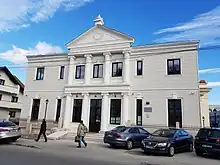
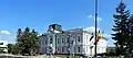 Râmnicu Vâlcea town hall in September 2020
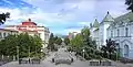 Revolution Square
_02.jpg.webp) Alexandru Lahovari National College (then secondary school) at the beginning of the 20th century
Alexandru Lahovari National College (then secondary school) at the beginning of the 20th century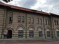 Alexandru Lahovari National College
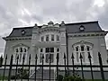 Historical house on Vasile Olănescu Street
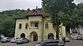 Historical house on Gabriel Stoianovici Street
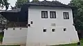 Anton Pann memorial house
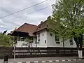 Nicolae Balotescu memorial house
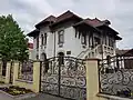 Historical house on Tudor Vladimirescu Street
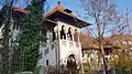 Constantin Tetoianu historical house
See also
References
- "Results of the 2020 local elections". Central Electoral Bureau. Retrieved 8 June 2021.
- "Populaţia rezidentă după grupa de vârstă, pe județe și municipii, orașe, comune, la 1 decembrie 2021" (XLS). National Institute of Statistics.
- "World Weather Information Service". Retrieved November 25, 2016.
- Bhattacharjee, Yudhijit (2011-01-31). "How a Remote Town in Romania Has Become Cybercrime Central". Wired. Vol. 19, no. 2. ISSN 1059-1028. Retrieved 2019-10-17.
- "Rezultatele finale ale alegerilor locale din 2020" (Json). Autoritatea Electorală Permanentă. Retrieved 2020-11-02.
External links
- Râmnicu Vâlcea City Hall official site (in Romanian)

County seats of Romania (alphabetical order by county) | ||
|---|---|---|
| ||