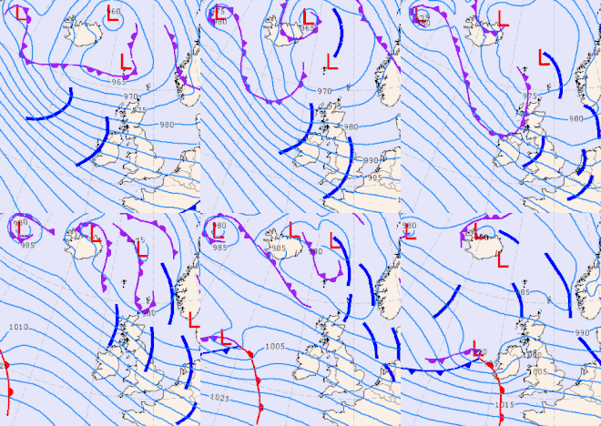
2017–18 European windstorm season
The 2017–2018 European windstorm season was the third instance of seasonal European windstorm naming. France, Spain and Portugal took part in winter storm naming for the first time this season.
| First storm formed | 12 September 2017 |
|---|---|
| Last storm dissipated | 17 June 2018 |
| Strongest storm1 | Fionn – 935 hPa (27.6 inHg) |
| Strongest wind gust | Ana – 249 km/h (155 mph; 134 kn), Austrian Alps (11 December). |
| Total storms | 18 |
| Total damage | over £7.3 billion (€8.6 billion) |
| Total fatalities | 130 |
| 1Strongest storm is determined by lowest pressure and maximum recorded non-mountainous wind gust is also included for reference. ← 2016–17 (British Isles) 2018–19 → | |
The season started on 12 September 2017 with the formation of Storm Aileen. It was subsequently marked by many high-impact storms which caused severe loss of life and widespread damage, including Ophelia, Eleanor, David and Emma. The season concluded on 17 June 2018 with the dissipation of off-season Storm Hector.
Background and naming
In 2015, the Met Office and Met Éireann announced a pilot project to name storm warnings as part of the Name our Storms project for wind storms and asked the public for suggestions. The meteorological offices produced a full list of names for 2015–16 and 2016–17, common to both the UK and Ireland. A new list of names was released on 6 September 2017 for the 2017–18 season.[1] Names in the UK will be based on the National Severe Weather Warning Service, when a storm is assessed to have the potential for an Amber 'be prepared' or Red 'take action (danger to life)' warning.
A storm will be named when it is deemed able to have a "substantial" impact on the UK or Ireland. They will be taken from the list, in alphabetical order, alternating between male and female names – the same naming convention that is used by the United States for tropical cyclones. In the case of storms resulting from ex-tropical storms and hurricanes, the original name allocated by the US National Hurricane Center will be used, an example of which during this season being Ophelia. Met Éireann name any storm which triggers a status Orange or Red weather warning for wind. The basis for such, as outlined on their weather warning service, are mean wind speeds in excess of 80 km/h (50 mph; 43 kn) or gusts over 130 km/h (81 mph; 70 kn).[2] Similarly, the Met Office name storms that have the potential to cause medium (Amber) or high (Red) impacts to the UK. It describes the wind strength relative to observations such as "falling trees or tiles, other items like garden furniture being blown around and even a number of properties left without electrical power."
On 1 December 2017, the national meteorological services of Spain (Aemet), France (Météo-France) and Portugal (IPMA) announced that they would begin naming storms affecting their nations in co-ordination, under the auspices of EUMETNET.[3][4][5]
United Kingdom and Ireland
|
|
|
The Met Office's and Met Éireann's announcement of the season's names also noted that Fionn is to be pronounced Fyunn, Niall is to be pronounced Nye-ul and Tali is to be pronounced Tarly.[6]
France, Spain and Portugal
|
|
Other naming systems
One former Atlantic hurricane transitioned into a European windstorm and retained its name as assigned by the National Hurricane Center in Miami, Florida:
Another internationally recognised, but unofficial, naming system for European windstorms is the Adopt a Vortex program of the Free University of Berlin.[7] Participants can ask the FUB to give their names, for example as a birthday present, to high or low pressure systems that affect European weather. The naming service of the FUB is commercial and is the main meteorological naming system in Germany. The names Xavier and Herwart were given by the FUB to major storms this season. Its naming program is recognised in some other European countries, although the British-Irish and the French-Spanish-Portuguese naming co-operations are gaining importance. Furthermore, besides of the three internationally recognised naming systems (the two European co-operations and the FUB system), many European countries (Norway, Finland, Denmark etc.) give their own names to cyclones. One of the 16 storms of the season was not named by the three main naming systems: instead it was called Cora in Norway and Aku in Finland.
Season summary

The 2017–18 UK and Ireland windstorm season began on September with storm Aileen, which brought strong winds to Scotland and Northern England on 13 September. Then followed Ophelia which was once a Category 3 major hurricane and the easternmost major hurricane on record; a red (severe) wind warning was issued for many parts in Ireland. Less than a week later, storm Brian rapidly intensified from a trough of low pressure out in the Atlantic. After a rather quiet November without any named systems (like quiet Septembers and Octobers of the previous two years), Caroline and Dylan formed in December followed by Eleanor early in January 2018. In the middle of January, the extremely deep and large arctic low Fionn affected both the UK and Ireland and steered David, a smaller but more intense storm, on a westerly track over Ireland, the UK and Central Europe. The last storm in January was Georgina, a cyclone that mainly affected Ireland and Scotland.
A total of 10 storms affected both the UK and Ireland in that season. Three of these – Ophelia, David and Emma – were named by foreign agencies. Six storms were named by the new co-operation of the meteorological services of France, Spain and Portugal. Two of these – David and Emma – also affected Britain and Ireland significantly.
The impact of the deadly winter storm Emma was intensified by the collision with the Beast from the East cold wave (anticyclone Hartmut). Cora, another significant windstorm, affected Scandinavia, Norway and Sweden in particular. Cora delivered the highest known gust of the European windstorm season. As a European total, 18 windstorms (one "off-season") affected the continent.
Storms
Storm Aileen
| Aileen | |
|---|---|
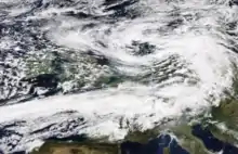 Aileen located over the North Sea on 13 September 2017 | |
| Area affected | Northwestern Europe |
| Date of impact | 12–18 September[8][9] |
| Maximum wind gust | 161 km/h (100 mph; 87 kn) Borkum Island, Germany[10] |
| Lowest pressure | 978 hPa (28.9 inHg)[11] |
| Fatalities | 3[12] |
| Power outages | 69,000 |
| Damage | > £8 million (€10 million)[13] |
Aileen formed on 12 September, with the Met Office issuing an Amber wind warning, becoming the first named storm of the season. Aileen affected Cheshire, Lancashire, Derbyshire, Yorkshire, Nottinghamshire and Lincolnshire during the evening of 12 September and into the morning of 13 September with winds of over 65 km/h (40 mph; 35 kn). Gusts up to around 110 km/h (68 mph; 59 kn)[14] were also seen in exposed locations such as along coastlines and over high ground in these areas.[15] A Yellow weather warning for rain was also issued for parts of Northern Ireland, northern England and southern Scotland, as Aileen dropped 30–40 mm (1.2–1.6 in) of rain within 6–9 hours in these areas, causing some disruption from localised flooding.[15] The heaviest rainfall was recorded at Bainbridge, North Yorkshire, with 35.4 mm (1.39 in) falling overnight.[16]
During Aileen, approximately 60,000 homes in Wales and almost 9,000 across England suffered power cuts.[16][17] The strongest gusts, of 83 mph (134 km/h; 72 kn), were recorded at The Needles, Isle of Wight.[16] The strongest gust on mainland Britain, of 74 mph (119 km/h; 64 kn), was recorded at Mumbles, Wales.[16]
Aileen later crossed the North Sea and intensified, going on to affect Germany, where it was known as Cyclone Sebastian.[18]
Ex-Hurricane Ophelia
| Ophelia | |
|---|---|
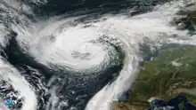 Ex-Hurricane Ophelia moving over Ireland on 16 October | |
| Area affected | Portugal, Spain, France, Ireland, United Kingdom, Faroe Islands, Norway |
| Date of impact | 16–20 October[19][20] |
| Maximum wind gust | 191 km/h (119 mph; 103 kn) at Fastnet Rock, Ireland[21] |
| Lowest pressure | 958 hPa (28.3 inHg)[22] |
| Fatalities | 3 |
| Power outages | 360,000 |
| Damage | > £75 million (€90 million)[23] |
On 12 October, the Met Office issued yellow weather warnings relating to the extra-tropical remnants of the former Hurricane Ophelia, estimated to affect the UK and Ireland on 16 October.[24] Met Éireann issued an update on 12 October in response to media coverage about possible impacts which might occur in Ireland, highlighting the uncertainties still in the forecast modelling. Met Éireann asked people to keep up to date with changes in the forecast as the storm evolved and confidence in any likely impacts increased.[25] On 14 October Met Éireann issued a red warning for the counties of Galway, Mayo, Clare, Cork and Kerry for 16–17 October,[26] (extended to Limerick, Waterford and Wexford on 15 October)[27] with an orange warning for the rest of the country.[28] Red warnings were extended again on the evening of 15 October to the whole of Ireland.[29] On 15 October the Met Office issued amber warnings for the six counties of Northern Ireland, and updated the yellow warnings in place for England, Wales and Scotland.[30] The Met Office updated its amber warnings to include parts of west Wales, southwest Scotland and the Isle of Man on the morning of 16 October.[31]
In County Waterford, a woman was killed when a tree fell on her car, caused by the winds from Ophelia's remnants.[32] A man died near Dundalk, County Louth, after a tree struck his car.[33] A man was killed in Cahir, County Tipperary, while trying to clear a fallen tree with a chainsaw.[33] Two more people were subsequently killed in Ireland from the combined effects of Ophelia and the subsequent Storm Brian.
Storm Brian
| Brian | |
|---|---|
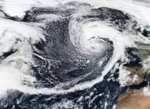 Brian located over the eastern Atlantic on 20 October | |
| Area affected | Ireland, United Kingdom, northern France |
| Date of impact | 19–23 October[34][35] |
| Maximum wind gust | 137 km/h (85 mph; 74 kn) Needles, United Kingdom[36] |
| Lowest pressure | 956 hPa (28.2 inHg)[37] |
| Fatalities | 3 |
| Power outages | Unspecified |
| Damage | Minimal |
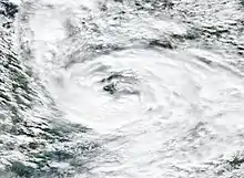
On 13 October, the US National Hurricane Center designated a tropical wave in the Atlantic Ocean to the east of the Lesser Antilles as Invest 92L, giving the system a 40% chance of developing into a tropical cyclone. The NHC continued monitoring the system as it moved slowly north-west, bringing heavy rainfall and flooding to Puerto Rico and the British and US Virgin Islands before turning to the north-east.[38] However, on 16 October, the NHC discontinued monitoring the system as it passed Bermuda without any considerable impact, having failed to transition into a tropical cyclone.
Subsequently, the area of low pressure began to rapidly intensify as it accelerated eastward across the open Atlantic, developing into a powerful extratropical cyclone.[37] On 19 October, Met Éireann issued an orange wind warning for 21 October in counties Galway and Mayo, thus naming storm Brian.[39] On 20 October Met Éireann extended orange warnings to the counties of Clare, Kerry, Waterford and Wexford.[40] The UK Environment Agency warned that storm Brian could combine with high tides and lead to a heightened risk of flooding on the south coast of the UK.[41]
Brian moved over Ireland close to Galway around 07:00 local time on 21 October.[42]
A 67-year-old man drowned after being swept from the sea wall at Dawlish during the storm.[43] Two more people were killed in Ireland from the combined effects of Brian and the prior Ex-Hurricane Ophelia.
Storm Caroline
| Caroline | |
|---|---|
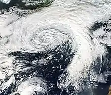 Caroline approaching Britain and Ireland on 5 December | |
| Area affected | Ireland, Scotland, Faroe Islands, Norway |
| Date of impact | 6–11 December[44][45] |
| Maximum wind gust | 150 km/h (93 mph; 81 kn) Fair Isle, United Kingdom[46] |
| Lowest pressure | 958 hPa (28.3 inHg)[47] |
| Fatalities | 1 |
| Power outages | Unspecified |
| Damage | Minimal |
The Met Office named storm Caroline on 5 December to affect Scotland on 7 December, with a yellow warning for wind,[48] which was upgraded on 6 December to an amber warning for the Western Isles, Northern Isles and northern Scotland. Met Éireann issued a yellow warning for wind to the counties of Donegal, Galway, Leitrim, Mayo, Sligo, Clare and Kerry.[49] In its wake, the storm delivered snowy and icy conditions to parts of England and Wales as the winds turned to the north as the system moved into Scandinavia on 8 December, accumulations of 11 cm were recorded on lower ground in Northern Ireland, with a few centimetres of snow in Wales and North-western England. Even with Caroline being located around Scandinavia, Caroline was still impacting the UK weather with a continuation of cold, Arctic air.
Storm Ana
| Ana | |
|---|---|
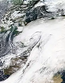 Storm Ana over northwestern France | |
| Area affected | Portugal, Spain, France, Germany, Belgium, Netherlands, Austria, Switzerland, Italy, Scandinavia, Russia |
| Date of impact | 10–16 December[50][51] |
| Maximum wind gust | 249 km/h (155 mph; 134 kn) Austrian Alps (11 December). |
| Lowest pressure | 957 hPa (28.3 inHg) |
| Fatalities | 1 |
| Power outages | Unspecified |
| Damage | > £175 million (€200 million)[52] |
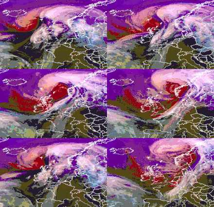
Storm Ana was the first storm to ever be officially named by Météo-France, Aemet and IPMA. It formed on 10 December as an area of low pressure that underwent explosive cyclogenesis[Note 1] to the northwest of Iberia passing through the Bay of Biscay into France on the morning of 11 December.[4] It then took a northeasterly direction to affect the Low Countries, Germany, Austria, Scandinavia and eventually Russia.
The highest gusts from Ana reached 249 km/h (155 mph; 134 kn) in the Austrian Alps, and its minimal pressure reached 957 hPa (28.3 inHg) on the morning of 11 December. Severe flooding was reported in the Emilia-Romagna region of northern Italy on 12 December, caused by heavy rainfall from a trailing front from Ana and rapid snowmelt due to a large temperature rise caused by Ana's passage. Damage from flooding in Italy reached €105 million.
Storm Bruno
| Bruno | |
|---|---|
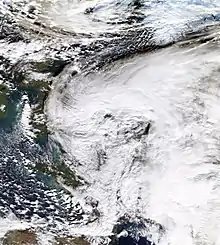 Storm Bruno over the North Sea | |
| Area affected | Portugal, Spain, France |
| Date of impact | 26–30 December[53][54] |
| Maximum wind gust | 154 km/h (96 mph; 83 kn) |
| Lowest pressure | 976 hPa (28.8 inHg)[55] |
| Fatalities | 3 |
| Power outages | Unspecified |
| Damage | > £60 million (€70 million)[52] |
On 26 December 2017, wind warnings were issued in Spain for an area of low pressure that was expected to undergo explosive cyclogenesis. Ultimately, Storm Bruno brought over 25 cm (9.8 in) of snow, wind gusts exceeding 100 km/h (62 mph; 54 kn), and waves as high as 8 m (26 ft) to Spain. One fatality occurred after a man drowned while windsurfing in rough seas. Another fatality occurred after a man was swept off his balcony by high winds and onto his patio, where he immediately succumbed to his injuries.
Storm Dylan
| Dylan | |
|---|---|
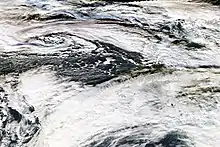 Dylan approaching Britain and Ireland on 30 December 2017 | |
| Area affected | Ireland, Northern Ireland |
| Date of impact | 30 December–3 January[54][56] |
| Maximum wind gust | 124 km/h (77 mph; 67 kn)[57] |
| Lowest pressure | 966 hPa (28.5 inHg) |
| Fatalities | 0 |
| Power outages | 7,500+[58] |
| Damage | Minimal |
Storm Dylan affected the UK on New Year's Eve. This was the sixth storm of the 2017/2018 winter, and was a fairly typical Atlantic Storm, with winds gusting at 58 mph around exposed coastlines. There were reports of fallen trees across Northern Ireland, fallen trees in the south-west of England and some travel disruption. Snow and ice caused some travel disruption over the Pennines too. Weathermen were required to know which way the wind blew as many were forced to take shelter from the storm. As typical for Storm Dylan, a hard rain did indeed fall, buckets of it in fact, with many caught blowing in the wind, though never quite becoming a hurricane.[59]
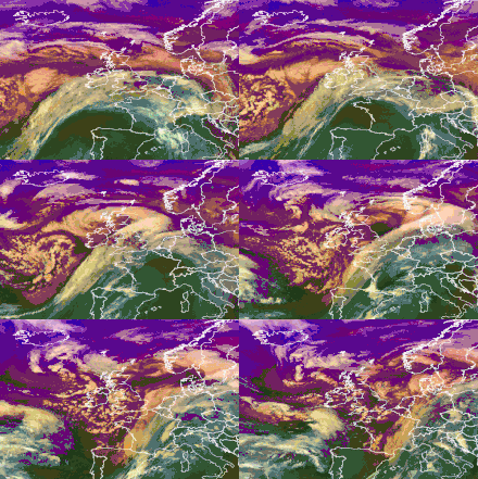
Storm Carmen
| Carmen | |
|---|---|
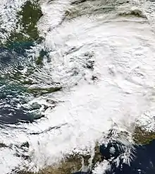 Storm Carmen over northern France | |
| Area affected | France, Belgium |
| Date of impact | 31 December–3 January[60][56] |
| Maximum wind gust | 161 km/h (100 mph; 87 kn), Mount Aigoual[61] (alt 1,567 m [5,141 ft]) |
| Lowest pressure | 989 hPa (29.2 inHg)[62] |
| Fatalities | 1 |
| Power outages | 65,000+[63] |
| Damage | > £800 million (€900 million)[64] |
Storm Carmen began as an area of low pressure in late December 2017. The storm went under some intensification before affecting France and other western European countries with strong winds. A man was killed by Carmen as a tree had fallen on his car during new year celebrations, and a 60-metre-tall (200 ft) wind turbine was blown over in the western Vendée region due to extreme winds.[65]
Storm Eleanor
| Eleanor | |
|---|---|
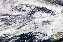 Eleanor approaching Britain and Ireland on 2 January 2018 | |
| Area affected | Ireland, Great Britain, Belgium, France, Germany, Netherlands and Switzerland |
| Date of impact | 2–5 January[66][67] |
| Maximum wind gust | 226 km/h (140 mph; 122 kn), Goldau[68] |
| Lowest pressure | 966 hPa (28.5 inHg)[69] |
| Fatalities | 7 |
| Power outages | 150,000+[70] |
| Damage | > £850 million (€1 billion)[71] |
Named by Met Éireann on 1 January with Amber Wind Warning in force for 2 January. Forecast to bring gusts of 110–130 km/h (68–81 mph; 59–70 kn) into the evening. The Met Office also issued a Yellow Wind Warning for 2–3 January, only to upgrade it to an amber warning across Northern England and Southern Scotland 3 hours prior making landfall in the UK.

As Eleanor neared Ireland, it brought heavy rainfall and squally weather followed by very strong gusts of 156 km/h (97 mph; 84 kn) in Knock Airport in Republic of Ireland.[72] As Eleanor tracked further North-east she continued to strengthen as a sting-jet like feature was evident, however, it did not form. Eleanor also produced thunderstorms and intense hail across England and Wales. The worst damage happened in Northern Ireland.
According to the UK Met Office, gusts reached 90 mph (140 km/h; 78 kn) in Orlock Head, while a mountain weather station in Great Dun Fell recorded 100 mph (160 km/h; 87 kn) gusts.[73]
Storm Fionn
| Fionn | |
|---|---|
 Storm Fionn west of Ireland on 16 January | |
| Area affected | Ireland, Iceland, Greenland, United Kingdom, France, Central Europe |
| Date of impact | 14–21 January[74][75] |
| Maximum wind gust | 237 km/h (147 mph; 128 kn) (Botnsheidi, Iceland)[76] |
| Lowest pressure | 935 hPa (27.6 inHg)[77] [Note 1] |
| Fatalities | 0 |
| Power outages | Unspecified |
| Damage | Minimal |
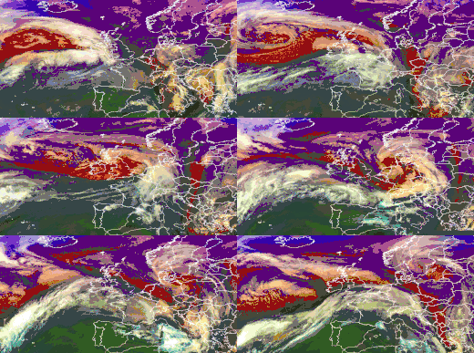
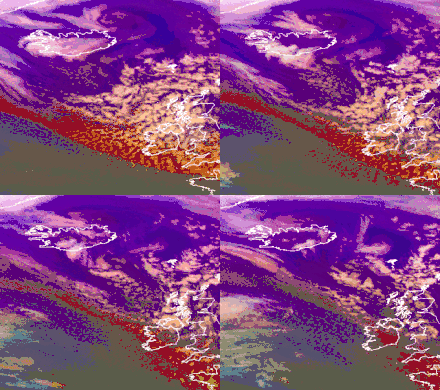
On 16 January Met Éireann issued orange marine weather warnings for wind to storm force from Roches Point to Slyne Head to Malin Head,[78] along with orange national weather warnings for Donegal, Galway, Leitrim, Mayo, Sligo, Clare, Cork and Kerry for 16–17 January, so naming storm Fionn.[79][80] This system, also called Evi by the FUB, was meteorologically speaking a very deep and large Icelandic low that bottomed out at a central pressure of 935 hPa (27.6 inHg) and dominated the weather in the North Atlantic and Northern Europe for several days in the middle of January 2018. This low had a large and intense wind field on its southern flank, fuelling a strong jetstream that steered the less deep but much more catastrophic Cyclone David into the UK and Ireland and Central Europe on 18 January. After the arrival of David, Fionn weakened and David became the more dominant low, leading to the decay and dissipation of Fionn.
As Fionn neared Ireland, it brought heavy winds to Donegal, Sligo, Mayo, Clare, Leitrim and Cork.
On 16 January the Met Office sent out a clarifying tweet that Fionn was only expected to bring strong winds to western Ireland, with impacts to the UK to be expected to be below their warning thresholds. In the tweet they pointed to a separate weather system to affect the UK on 17–18 January,[82] later named David by MeteoFrance, this name was reciprocally adopted by the Met Office and Met Eireann. The low David was named Friederike by the Free University of Berlin, with the name Georgina at that time remaining unused.[83]
Met Éireann's decision to name Fionn was met with some criticism from some meteorologists, Liam Dutton tweeted that he thought the warning did not strictly accompany a cyclonic area of low pressure, but a "squeeze of isobars" circulating a low hundreds of kilometres (miles) distant in the region of the Faroes, stating that it "needed no more than a standard weather warning".[81] He highlighted the difference in criteria for naming storms employed by the Met Office and Met Éireann (the UK Met Office uses an impact-based criteria, based on the level of expected impacts the weather will bring, whereas the Irish Met Éireann uses fixed numerical criteria, meaning a storm will be named when mean wind speeds are likely to occur, between 65 and 80 km/h [40 and 50 mph; 35 and 43 kn] and/or gusts between 110 and 130 km/h [68 and 81 mph; 59 and 70 kn]).[81]
Evelyn Cusack of Met Éireann said that she understood Dutton's point, stating that his criticisms were well made.[84] She reiterated that the orange warning issued by Met Éireann fulfilled their criteria for naming the storm, producing severe winds, coastal flooding and high waves on the Irish coast, even if the centre of circulation was distant.[84]
_2018.png.webp)
Storm David/Friederike
| David (FRA), Friederike (GER) | |
|---|---|
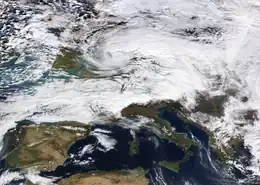 David on 18 January, centred over Benelux or Western Germany | |
| Area affected | Britain, Ireland, France, Benelux, Central Europe, Italy, Eastern Europe |
| Date of impact | 17–21 January[85][75] |
| Maximum wind gust | 203 km/h (126 mph; 110 kn), Brocken, Saxony-Anhalt[86] (at altitude) 150 km/h (93 mph; 81 kn), Capel Curig, Wales[87] (alt 216 m [709 ft])[88] |
| Lowest pressure | 974 hPa (28.8 inHg)[86] |
| Fatalities | 13[89][90][91][92] |
| Power outages | 471,000+[93][94][90][95] |
| Damage | > £3.5 billion (€4.2 billion)[71] |
Storm David (also named Friederike),[96] affected an area of Europe from northern France and England, through the Netherlands, Belgium, Germany and the Alps to Poland and the Czech Republic, starting on the evening of 17 January until 19 January.[97] David brought heavy snowfall on its northern flank and high winds (sustained winds up to Bft. 11, widespread hurricane-force gusts) on its southern flank.[98] In some locations, both the high winds and the snowfall occurred, creating blizzard conditions.[99] Amsterdam Airport Schiphol was closed,[100] as well as some airports in Germany. European railroad companies (e.g. the Deutsche Bahn in Germany) could only offer very limited transportation services, if any.[101] Road traffic was similarly disrupted by windthrow, snow, ice, high crosswinds, and by traffic jams that were caused by incidents related to the storm. Widespread damage to manmade structures and to forests occurred.[102] Germany was the worst-hit country as there were 10 known deaths as well as a damage total as high as several hundreds of millions. David/Friederike was the most devastating windstorm in Germany after Cyclone Kyrill in 2007. Coincidentally, Friederike and Kyrill both struck Central Europe on 18 January, albeit 11 years apart.
This storm, which proved to have catastrophic effects, originated from a low pressure trough in the Western Atlantic that stretched from the Southern Caribbean to Newfoundland on 14 January — 16.[103] After gaining a closed circulation near or over Newfoundland on 16 January, the new cyclone entered the very strong southern wind field of the Icelandic Low Fionn, crossing the Atlantic in less than two days and being steered into Europe. Upon the formation of the precursor trough, the GFS and ECMWF correctly predicted that system to impact Europe as a windstorm. Between 14 and 19 January, the binary storm complex that consisted of Fionn and David brought high winds and snowfall to large portions of Europe. After the storms have passed, they left behind an improved weather situation in Europe that was calmer, drier and warmer.
The storm also brought some hurricane-force gusts and heavy snowfall to Britain and Ireland and caused 140,000 power cuts there. Nevertheless, the storm impacted the Netherlands and Germany in a much more dramatic way. The UK Met Office did not give David a name from its own storm naming list as it did not expect the storm to have a significant impact on Britain, which proved to be an underestimation.
Storm Georgina
| Georgina | |
|---|---|
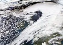 Excellently well-defined low pressure centre of Georgina passing just north of Scotland | |
| Area affected | Ireland, Northern Ireland, Scotland, Norway |
| Date of impact | 23–27 January[104][105] |
| Maximum wind gust | 225 km/h (140 mph; 121 kn),[106] Glencoe Ski area, United Kingdom |
| Lowest pressure | 959 hPa (28.3 inHg)[107] |
| Fatalities | 0 |
| Power outages | Unspecified |
| Damage | Minimal |
Georgina was a fairly typical winter storm with maximum gust speeds of 60 to 70 mph around exposed coastlines, but gusts approached 60 mph inlands across parts of England and Wales.The strongest winds were near the centre of the low across northern Scotland, with the highest gust of 85 mph at South Uist, Western Isles. Winds gusted close to 115 mph across the tops of the Scottish mountains and here there were very challenging conditions with snow at high levels adding to already very significant accumulations for the winter so far. The storm hampered the search for a missing hillwalker on Ben Nevis who had previously fallen through a cornice.[108]
Storm Emma
| Emma (POR), Ulrike (GER) | |
|---|---|
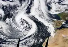 Emma, an extensive cyclone and potential blizzard, on 26 February while being centred near the Azores and threatening Portugal | |
| Area affected | Azores, Madeira, Canary Islands, Morocco, Portugal, Spain, France, Great Britain and Ireland |
| Date of impact | 26 February–7 March[109][110] |
| Maximum wind gust | 228 km/h (142 mph; 123 kn), Mont Aigoual, France (alt 1,567 m [5,141 ft])[111][Note 2] |
| Lowest pressure | 963 hPa (28.4 inHg)[112] |
| Fatalities | 95[71] |
| Power outages | Unspecified |
| Damage | > £1.8 billion (€2.1 billion)[71] |
Storm Emma (also named Ulrike) was named while it was centred over the Azores and threatened to strike Western Europe as a blizzard. The cyclone affected Iberia, Great Britain and Ireland on its track, causing high winds and snowfall, leading to blizzard conditions.[113]
As Emma neared southwest England, it brought new cold air to the UK and Ireland, prolonging the cold period.[114] Meteorologists observed the collision of Emma and Anticyclone Hartmut dubbed the Beast from the East by the press, and the interaction of the two highly different air masses worsened the wind and snowfall posed by Emma. Starting on 1 March 2018, the collision of Emma and Hartmut triggered numerous hurricane-force gusts in southern Europe and the United Kingdom. The highest of these gusts occurred in the morning of 1 March on Mount Aigoual in southern France at 228 km/h (142 mph; 123 kn).[111]
On 1 March 2018, UK authorities issued a red warning in Wales and south-west England as citizens in Scotland spent up to 20 hours in their cars stuck in traffic in frigid weather and a 46-year-old Southampton man died in a motor vehicle accident on the A34. Schools across the UK were closed in the face of oncoming blizzards, strong winds, and heavy snowfall. Traffic was significantly hindered by the Beast from the East.[115] In Lincolnshire commuters near Boston were stranded by snow and had to freed by farmers with tractors, a minimum of 20 cars and HGVs were snowed in on the A46 close to Faldingworth. The Royal Air Force deployed 4×4 vehicles to transport health and emergency workers.[116] Trains were cancelled across the UK, with over 20 rail operators running at reduced capacity; London's Paddington Station closed for about three hours and 50 stations in Kent closed because of inclement weather. Air travel has been similarly curtailed, as terminals all over the country cancel flights.[115] At least three people died in the UK as a result of the storm.[117]
In Ireland snow began to fall in the east of the country on Tuesday 27 February. Snow continued in the east on Wednesday the 28th, with well over 15 cm (5.9 in) reported in many areas. Schools closed on Wednesday the 28th in affected areas. Panic buying of food was seen as Storm Emma approached. Emma made landfall on the south coast on Thursday 1 March and swept northward. All schools were closed on Thursday 1 March and Friday the 2nd nationwide with a red weather warning put in place by Met Eireann. High winds and heavy snowfall on top of the already lying snow led to drifting and severe disruption. Many roads were left impassable, particularly in rural areas and in North Kildare, West Wicklow and Wexford respectively. Power outages and water cuts were reported widely. A Lidl supermarket was torn down and looted in Fortunestown, Tallaght during the chaos caused by the storm. Over 50 cm (20 in) of lying snow was reported in some locations, with drifts many feet high on many rural routes. Some rural villages were cut off for many days. A slow thaw ensued. Many schools remained closed in Kildare, Wicklow and Wexford on Monday 5 March as local authorities continued to attempt to clear roads. [118]
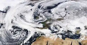
Storm Felix
| Felix | |
|---|---|
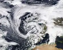 Felix in the Bay of Biscay on 11 March | |
| Area affected | Azores, Madeira, Canary Islands, Portugal, Spain, France |
| Date of impact | 9–16 March[120][121] |
| Maximum wind gust | 150 km/h (93 mph; 81 kn), Madeira, Portugal |
| Lowest pressure | 967 hPa (28.6 inHg)[122] |
| Fatalities | 0 |
| Power outages | Unspecified |
| Damage | > £7.5 million (€9 million)[123] |
Storm Felix formed from the remnants of the nor'easter which affected the eastern United States in early March 2018. After moving out into the Atlantic, the low-pressure system which caused the nor'easter quickly deepened to a minimum pressure of 967 hPa (28.6 inHg). Felix was subsequently named by IPMA of Portugal on 9 March, as orange weather warnings were issued for Madeira and surrounding islands. Winds gusting up to 150 km/h (93 mph; 81 kn) were recorded in the mountains of Madeira and up to 120 km/h (75 mph; 65 kn) at Madeira Airport.[124]
Felix subsequently approached mainland Portugal, where red wind warnings were issued along the central coast and winds reaching 100 km/h (62 mph; 54 kn) were observed. Red warnings were also issued ahead of the storm in northern Spain, as Felix veered northwards into the Bay of Biscay.[124] Felix weakened as it moved further east, making landfall in central France as a minimal storm.
Storm Gisele
| Gisele | |
|---|---|
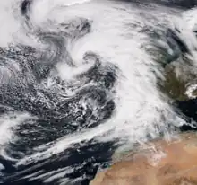 Gisele on 14 March | |
| Area affected | Azores, mainland Portugal, Spain |
| Date of impact | 14–18 March[125][126] |
| Maximum wind gust | 110 km/h (68 mph; 59 kn) |
| Lowest pressure | 968 hPa (28.6 inHg) |
| Fatalities | 0 |
| Power outages | Unspecified |
| Damage | > £7.5 million (€9 million)[123] |
Storm Gisele was named by the Spanish AEMET agency on 14 March, as the system was undergoing rapid intensification in the central Atlantic. Around the same time, IPMA in Portugal issued orange wind warnings for the Azores archipelago as Gisele approached. Across the islands, winds of up to 100 km/h (62 mph; 54 kn) were recorded. Gisele subsequently continued northeastwards; orange wind warnings were issued for mainland Portugal and northern Spain, warning of wind impacts and coastal damage. Gisele then made landfall in mainland Portugal, with mesovortices within an unstable cold front bringing isolated gusts of up to 110 km/h (68 mph; 59 kn) and at least one confirmed tornado.[124]
Storm Hugo
| Hugo | |
|---|---|
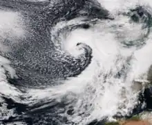 Hugo on 23 March | |
| Area affected | Portugal |
| Date of impact | 23–29 March[127][128] |
| Maximum wind gust | 120 km/h (75 mph; 65 kn) |
| Lowest pressure | 971 hPa (28.7 inHg) |
| Fatalities | 0 |
| Power outages | Unspecified |
| Damage | Minimal |
Storm Hugo was named by AEMET on 23 March, as it was undergoing explosive intensification in the mid-Atlantic; as a result, the agency issued a Special Warning regarding the formation of Hugo. Subsequently, AEMET issued red weather warnings for northern Portugal and orange warnings for the remainder of the mainland coast, with yellow warnings of wind and snow being issued further inland. Wind gusts of up to 100 km/h (62 mph; 54 kn) were recorded widely, with gusts of up to 120 km/h (75 mph; 65 kn) recorded in coastal areas in the north of the country.[124]
Storm Irene
| Irene | |
|---|---|
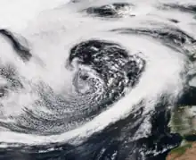 Irene on 16 April | |
| Area affected | Azores |
| Date of impact | 15–25 April[129][130] |
| Maximum wind gust | 110 km/h (68 mph; 59 kn) |
| Lowest pressure | 952 hPa (28.1 inHg) |
| Fatalities | 0 |
| Power outages | Unspecified |
| Damage | Minimal |
Storm Irene was named by the Azores Regional Department of Portugal's IPMA meteorological agency on 16 April. Moving swiftly northwards, Irene intensified into an unusually strong low for the region at this time of year, crossing the Azores archipelago with a minimum pressure of 952 hPa (28.1 inHg) and winds of up to 110 km/h (68 mph; 59 kn). As a result, orange weather warnings were issued for the islands. After crossing the Azores, Irene moved northwestwards into the open Atlantic and weakened, dissipating over the northern Atlantic without again affecting land.[124]
Storm Hector
| Hector | |
|---|---|
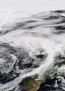 Hector north of the British Isles on 14 June | |
| Area affected | Ireland, United Kingdom and Norway |
| Date of impact | 13–17 June[131][132] |
| Maximum wind gust | 110 km/h (70 mph; 61 kn), Cairngorms, Scotland[133] |
| Lowest pressure | 971 hPa (28.7 inHg)[134] |
| Fatalities | 0 |
| Power outages | Unspecified |
| Damage | Minimal |
Hector was the last-named storm of the 2017–2018 season which brought heavy rain and strong winds across the north of the UK and Ireland throughout 13 and 14 June. Met Éireann named the storm as an orange warning for wind was issued on 13 June. The storm arrived after a week-long spell of hot and sunny weather. Strong winds brought disruption to road and rail services, with widespread reports of fallen trees. The Forth and Tay bridges in Scotland were restricted to high sided vehicles as was the Tees flyover in northern England. Ferry services were also affected. Reports of flying debris hospitalised one individual in Edinburgh. Meanwhile, rough seas battered coastal communities. Widespread loss of power was reported in areas of Northern Ireland with up to 26,000 homes and businesses affected. Storm Hector did however bring a boost to the UK's energy supply in the form of wind power.[135]
Other systems
Several notable extratropical cyclones affecting Europe went officially unnamed throughout the season as they did not affect any of the countries involved in issuing names; however, many of these did receive unofficial names from the Free University of Berlin. Cyclone Thomas rapidly deepened as it crossed Romania on 17–18 September,[9] bringing intense straight-line winds to the country. Eight people were killed, with more than 137 injuries and 7,000 damage claims reported, totalling around US$9.4 million in damage.[13]
Cyclone Xavier crossed northern Europe in early October 2017. Germany was the worst affected country, with high winds between 4 and 6 October causing severe damage, including in and around Berlin. Further damage was reported in the Czech Republic, where the highest winds of up to 201 km/h (125 mph; 109 kn) were recorded, and in Poland. In total, Xavier killed nine people – seven in Germany and two in Poland – and caused at least £180 million (€200 million) in damage.[23]
Cyclone Herwart initially formed as a secondary low to a more northerly centre of low pressure (named Grischa) coming southward from the Svalbard Islands region in late October. Herwart then went through the Fujiwhara effect with this system, rotating counterclockwise around the main low pressure area, passing over Norway, Sweden, Latvia and then losing power while moving over western Russia. In Denmark, which was hit on 28 October, the storm was named Ingolf. In Hungary, the storm was named Nárcisz (Narcissus), a Hungarian female name whose name day is on 29 October. In total, Herwart killed ten people across central Europe and caused £800 million (€950 million) in damage.[136]
Cyclone Reinhard (also known locally as Storm Ylva) made landfall in Norway on 23 November, with high winds and heavy rainfall causing millions of euros worth of damage. There were hundreds of reports of damage across southern Norway, but no reports of injuries or fatalities.[137]
A low-pressure area known as Storm Cora in Norway and Ex-Blizzard Aku in Finland brought wind gusts of up to 274 km/h (170 mph; 148 kn) to these areas in January 2018.
Season effects
| Storm | Dates active | Highest wind gust | Lowest pressure | Casualties | Damages | Affected areas |
|---|---|---|---|---|---|---|
| Aileen | 12–18 September | 160 km/h (100 mph; 87 kn) | 978 hPa (28.9 inHg) | 3 | £8 million (€10 million) | Ireland, United Kingdom, Netherlands, Germany |
| Ophelia | 16–20 October | 191 km/h (119 mph; 103 kn)[21] | 958 hPa (28.3 inHg) | 3 | £75 million (€90 million) | Azores, Portugal, Spain, France, Ireland, United Kingdom, Faroe Islands, Norway, Sweden, Finland, Estonia, Russia |
| Brian | 19–23 October | 137 km/h (85 mph; 74 kn)[36] | 956 hPa (28.2 inHg) | 3 | Minimal | Ireland, United Kingdom, northern France |
| Caroline | 6–11 December | 150 km/h (93 mph; 81 kn)[138] | 958 hPa (28.3 inHg) | 1 | Minimal | Ireland, Scotland, Faroe Islands, Norway |
| Ana | 10–16 December | 249 km/h (155 mph; 135 kn) | 957 hPa (28.3 inHg) | 1 | £175 million (€200 million) | Portugal, Spain, France, Germany, Belgium, Netherlands, Austria, Switzerland, Scandinavia, Russia |
| Bruno | 26–30 December | 154 km/h (96 mph; 83 kn) | 976 hPa (28.8 inHg) | 3 | £60 million (€70 million) | Portugal, Spain, France |
| Dylan | 30 December–3 January | 124 km/h (77 mph; 67 kn)[139] | 966 hPa (28.5 inHg)[140] | 0 | Minimal | Ireland, Northern Ireland |
| Carmen | 31 December–3 January | 160 km/h (100 mph; 87 kn) | 989 hPa (29.2 inHg) | 1 | £800 million (€900 million) | France, Belgium |
| Eleanor | 2–5 January | 230 km/h (140 mph; 120 kn)[141] | 966 hPa (28.5 inHg) | 7 | £850 million (€1 billion) | Ireland, Great Britain, Belgium, France, Germany, Netherlands, Switzerland |
| Fionn | 14–21 January | 237 km/h (147 mph; 128 kn) | 935 hPa (27.6 inHg)[77] [Note 1] | 0 | Minimal | Ireland, Scotland, Iceland, Greenland, United Kingdom, France, Central Europe |
| David | 17–21 January | 203 km/h (126 mph; 109 kn) | 974 hPa (28.8 inHg)[86] | 13 | £3.5 billion (€4.2 billion) | United Kingdom, Ireland, France, Netherlands, Belgium, Luxembourg, Germany, Austria, Switzerland, Italy, Poland, Czech Republic, Slovakia, Hungary, Belarus, Ukraine, Russia |
| Georgina | 23–27 January | 230 km/h (140 mph; 120 kn) | 959 hPa (28.3 inHg) | 0 | Minimal | Ireland, Northern Ireland, Scotland, Norway |
| Emma | 26 February–7 March | 229 km/h (142 mph; 123 kn) | 963 hPa (28.4 inHg) | 95 | £1.8 billion (€2.1 billion) | Azores, Madeira, Canary Islands, Morocco, Portugal, Spain, France, Great Britain and Ireland |
| Felix | 9–16 March | 150 km/h (93 mph; 81 kn) | 967 hPa (28.6 inHg) | 0 | £7.5 million (€9 million) | Azores, Madeira, Canary Islands, Portugal, Spain, France |
| Gisele | 14–18 March | 109 km/h (68 mph; 59 kn) | 968 hPa (28.6 inHg) | 0 | £7.5 million (€9 million) | Azores, mainland Portugal, Spain |
| Hugo | 23–29 March | 121 km/h (75 mph; 65 kn) | 971 hPa (28.7 inHg) | 0 | Minimal | Portugal |
| Irene | 15–25 April | 109 km/h (68 mph; 59 kn) | 952 hPa (28.1 inHg) | 0 | Minimal | Azores |
| Hector | 13–17 June | 110 km/h (70 mph; 61 kn) | 971 hPa (28.7 inHg) | 0 | Minimal | Ireland and Great Britain |
| 18 windstorms | 12 September 2017 – 17 June 2018 | 249 km/h (155 mph; 135 kn) | 935 hPa (27.6 inHg) | 130 | £7.3 billion (€8.6 billion) |
Storms named by European meteorological services
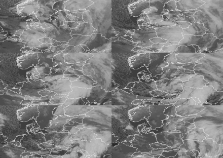

- Aileen (UK/IE), Sebastian (Free University of Berlin), 12–13 September.
- Xavier (Free University of Berlin), 4–6 October.
- Brian (UK/IE), Elmar (Free University of Berlin), 21 October.
- Herwart (FUB),[142] Ingolf (dk)[143] Grzegorz (Polish derivative of the FUB name)[144], 28–29 October.
- Ylva (No),[145] Reinhard (FUB),[146] 22–23 November.
- Caroline (UK/IE), Walter (FUB), Aina (No),[147] 7–8 December 2017.
- Ana (Fr/Es/Pt),[3] Yves (FUB), 10–11 December.
- Birk (No-for heavy rainfall),[148] Diethelm (FUB), 23 December 2017.
- Bruno (Fr/Es/Pt), Edilbert (FUB), 26–27 December 2017.[149]
- Dylan (UK/IE), Horst (FUB), 29–31 December 2017.[150]
- Carmen (Fr/Es/Pt), Ingmar (FUB), 1 January 2018.[151]
- Eleanor (UK/IE), Burglind (FUB), 2–3 January 2018.[152]
- Aku (Fin),[153] Cora (No),[154] Unnamed (FUB) -later absorbed by Christine, 7 January 2018.
- Fionn (UK/IE), Evi (FUB), 16 January 2018.
- David (Fr/Es/Pt),[155] Friederike (FUB),[156] 18 January 2018.
- Georgina (UK/IE),[157] Helene (FUB), 23–24 January 2018.
- Emma (Fr/Es/Pt), Ulrike (FUB), 26 February-5 March 2018
- Felix (Fr/Es/Pt),[158] Yuliya (FUB), 10–11 March 2018
- Gisele (Fr/Es/Pt),[159] Zsuzsa (FUB), 14 March 2018.
- Hugo (Fr/Es/Pt)[160] Carola (FUB) 24–25 March 2018.
- Irene (Fr/Es/Pt) 30 March–10 April 2018.
See also
- Cyclone Numa, a medicane in November 2017
- 2018 Great Britain and Ireland cold wave
- 2017–2018 North American winter
Notes
- ^ Lowest pressure for the cyclonic centre of Fionn was achieved on 14 January to the north of Iceland, at the time of Fionn's naming on 16 January the cyclonic centre had substantially filled to about 961 hPa (28.4 inHg).[161]
- ^ The 228-kilometre-per-hour (142 mph; 123 kn) gust occurred in the squeezed isobar region between the centres of Emma and Hartmut, thus it was probably caused by the mixed effects of the two systems due to their collision.[162]
References
- "Storm names for 2017–18 announced". BBC Weather. British Broadcasting Corporation. 6 September 2017. Retrieved 6 September 2017.
- "Met Éireann Weather Warning System Explained". Met Éireann. Retrieved 2 January 2016.
- France, Meteo (4 December 2017). "Météo-France nomme les tempêtes". meteofrance.fr (in French). Archived from the original on 10 December 2017. Retrieved 9 December 2017.
- Meteorología, Agencia Estatal de (7 December 2017). "Aemet, MéteoFrance y el IMPA, pondrán nombre a las borrascas profundas que puedan afectar a España, Francia o Portugal. – Agencia Estatal de Meteorología – AEMET. Gobierno de España". aemet.es (in Spanish). Retrieved 9 December 2017.
- "Météo-France, junto con AEMET e IPMA, nombra a las borrascas intensas con fuertes vientos – Revista del Aficionado a la Meteorología". Revista del Aficionado a la Meteorología (in European Spanish). 4 December 2017. Retrieved 9 December 2017.
- "Storm names for 2017–18 announced". Met Office. 6 September 2017. Retrieved 6 September 2017.
- Duemmel, Sebastian Boelling, Thomas; otto@bibo.met.fu-berlin.de, sebastian.boelling@rz.hu-berlin.de; Informationssysteme, Freie Universitaet Berlin – Meteorologisches Institut – Meteorologische Kommunikations- und; www@www.met.fu-berlin.de (1 January 2000). "Homepage – und Kommunikationssysteme der Freien Universitaet Berlin". www.met.fu-berlin.de. Archived from the original on 27 February 2007. Retrieved 5 March 2018.
{{cite web}}: CS1 maint: multiple names: authors list (link) - "Analysis chart". met.fu-berlin. 12 September 2017.
- "Analysis chart". met.fu-berlin. 18 September 2017.
- "Windböen, 1std, Messwerte Niederlande vom 13.09.2017, 12:00 Uhr". Kachelmannwetter - Jetzt Lesezeichen setzen.
- "Analysis chart". wetter3.de.
- "Drei Tote wegen Unwetters – Rollstuhlfahrer in Fluss geweht". welt.de. 13 September 2017. Retrieved 13 March 2017.
- "Global Catastrophe Recap" (PDF). AON Benfeld. September 2017. Archived from the original (PDF) on 7 October 2017. Retrieved 22 July 2022.
- "Storm Aileen to bring strong winds to south of country". RTÉ.ie. 12 September 2017.
- "Storm Aileen first named storm of Autumn 2017". Met Office. 12 September 2017. Retrieved 12 September 2017.
- "Storm Aileen leaves thousands without power". The Times. 13 September 2017. Retrieved 13 September 2017.
- "Storm Aileen: 60,000 homes lost power during 75 mph winds". BBC News. 13 September 2017. Retrieved 13 September 2017.
- Root, Jordan (12 September 2017). "Aileen's damaging winds to sweep across UK while Germany braces for Sebastian". AccuWeather. Archived from the original on 12 September 2017. Retrieved 12 September 2017.
- "Analysis chart". met.fu-berlin.de. 16 October 2017. Retrieved 22 July 2022.
- "Analysis chart". met.fu-berlin.de. 20 October 2017. Retrieved 22 July 2022.
- "Annual Summary 2017" (PDF). Met Éireann. 3 January 2018. Archived from the original (PDF) on 4 January 2018. Retrieved 4 January 2018.
- "Analysis Chart". wetter3.de.
- "Global Catastrophe Recap" (PDF). AON Benfeld. October 2017. Archived from the original (PDF) on 15 November 2017. Retrieved 22 July 2022.
- Office, Met (13 June 2023). "Weather warnings". www.metoffice.gov.uk.
- "Update on Ophelia – Weather News – Met Éireann – The Irish Meteorological Service Online". Met Éireann. 13 October 2017. Archived from the original on 13 October 2017. Retrieved 13 October 2017.
- Met Éireann [@MetEireann] (14 October 2017). "RED WIND WARNING ISSUED For Cork, Kerry, Clare, Galway & Mayo Valid: Mon 9am – Tues 3am Gusts in excess of 130 km/h" (Tweet) – via Twitter.
- Farrow, Jo (15 October 2017). "Ireland and Ophelia, winds, waves and disruption". netweather.tv. Retrieved 15 October 2017.
- "Weather Warnings – Met Éireann – The Irish Meteorological Service Online". Met Éireann. 14 October 2017. Archived from the original on 14 October 2017. Retrieved 14 October 2017.
- "Status red wind warning extended across the country". RTE.ie. 15 October 2017. Retrieved 15 October 2017.
- Met Office [@metoffice] (15 October 2017). "A yellow weather warning for #wind has been updated: bit.ly/WxWarning Stay #weatheraware @metofficeuk" (Tweet) – via Twitter.
- Farrow, Jo (17 October 2017). "What a storm. Bizarre hurricane, dangerous gusts & waves and that sky! Ophelia – Blog by Jo Farrow". Netweather.tv. Retrieved 17 October 2017.
- "Hurricane Ophelia: Woman killed as tree hits car". BBC News. 16 October 2017.
- "Hurricane Ophelia: Three people die as storm hits Ireland". BBC News. 16 October 2017. Retrieved 16 October 2017.
- "Analysis chart". met.fu-berlin.de. 19 October 2017.
- "Analysis chart". met.fu-berlin.de. 23 October 2017.
- "Storm Brian – Met Office Barometer". metoffice.gov.uk. Archived from the original on 3 January 2018. Retrieved 4 January 2018.
- Finnis, Nick (20 October 2017). "Storm Brian – Key Messages on UK & Ireland Impacts". Netweather.tv. Retrieved 20 October 2017.
- "Invest 92L Could Develop into a Tropical Depression or Tropical Storm Early This Week While Tracking Toward Bermuda". The Weather Channel.
- "Weather Warnings – Met Éireann – The Irish Meteorological Service Online". Met Éireann. 19 October 2017. Archived from the original on 19 October 2017. Retrieved 19 October 2017.
- "Weather Warnings – Met Éireann – The Irish Meteorological Service Online". Met Éireann. 20 October 2017. Archived from the original on 20 October 2017. Retrieved 20 October 2017.
- "Storm Brian to arrive this weekend". Met Office. 19 October 2017. Retrieved 19 October 2017.
- "UK rainfall radar data for 21 October 2017". The Weather Outlook. 21 October 2017. Retrieved 22 October 2017.
- Henderson, Guy (26 October 2017). "Body found on beach: Man's last words were phone call about size of Storm Brian waves". Devonlive. Retrieved 27 October 2017.
The 67-year-old Paignton man spoke on the phone about the size of the waves hitting the sea wall at Dawlish and drowned moments later, an inquest has heard
- "Analysis chart". met.fu-berlin.de. 6 December 2017.
- "Analysis chart". met.fu-berlin.de. 11 December 2017.
- @metoffice (7 December 2017). "Here are some of the strongest gusts from #StormCaroline today. Friday will be another blustery day but the winds should be a little lighter for most #weatheraware" (Tweet) – via Twitter.
- "Chart". wetter3.de.
- "Storm Caroline bringing gales to Scotland". Met Office. 5 December 2014. Retrieved 5 December 2017.
- "Weather Warnings – Met Éireann – The Irish Meteorological Service Online". Met Éireann. 5 December 2017. Archived from the original on 5 December 2017. Retrieved 5 December 2017.
- "Analysis chart". met.fu-berlin.de. 10 December 2017.
- "Analysis chart". met.fu-berlin.de. 16 December 2017.
- "Global Catastrophe Recap" (PDF). AON Benfeld. December 2017. Retrieved 22 July 2022.
- "Analysis chart". met.fu-berlin.de. 26 December 2017.
- "Analysis chart". met.fu-berlin.de. 30 December 2017.
- "Analysis chart". wetter3.de.
- "Analysis chart". met.fu-berlin.de. 3 January 2018.
- "Storm Dylan – Met Office Barometer". www.metoffice.gov.uk. Archived from the original on 3 January 2018. Retrieved 3 January 2018.
- "Storm Dylan passes with minimal disruption to electricity supply". www.esbnetworks.ie. Archived from the original on 3 January 2018. Retrieved 2 January 2018.
- "Storm Dylan".
- "Analysis chart". met.fu-berlin.de. 31 December 2017.
- "Windböen, 6std, Messwerte Languedoc-Roussillon vom 01.01.2018, 19:00 Uhr". Kachelmannwetter - Jetzt Lesezeichen setzen.
- "Analysis chart". wetter3.de.
- "About 65,000 French homes without power due to winter storm". France 24. 1 January 2018. Retrieved 27 February 2018.
- "Global Catastrophe Recap" (PDF). AON Benfeld. January 2018. Retrieved 22 July 2022.
- France, Meteo (2 January 2018). "Storm Eleanor heads for France after Carmen chaos". Archived from the original on 10 December 2017. Retrieved 27 February 2018.
- "Analysis chart". met.fu-berlin.de. 2 January 2018.
- "Analysis chart". met.fu-berlin.de. 5 January 2018.
- "Windböen, 1std, Messwerte Zug vom 03.01.2018, 12:00 Uhr". Kachelmannwetter - Jetzt Lesezeichen setzen.
- Holland, Peter (17 January 2018). "Eleanor/Burglind: Another "Near-miss" for Europe? | The RMS Blog". rms.com. Retrieved 17 January 2018.
- "Crews continue to restore power to customers affected by Storm Eleanor". www.esbnetworks.ie. Archived from the original on 4 January 2018. Retrieved 3 January 2018.
- "Weather, Climate & Catastrophe Insight" (PDF). Retrieved 31 July 2022.
- Éireann, Met. "Update on storm Eleanor: Highest gust recorded at Knock Airport at 84 kts at 7pm this evening".
- Office, Met. "It's been a wild and stormy night for some us, all courtesy of the passage of #StormEleanor. Still very windy out there so take care if you're heading out. *Great Dun Fell is a mountain weather stationpic.twitter.com/I1jHoFmhHq".
- "Analysis chart". met.fu-berlin.de. 14 January 2018.
- "Analysis chart". met.fu-berlin.de. 21 January 2018.
- "Windböen, 1std, Messwerte Höfuðborgarsvæði vom 14.01.2018, 05:00 Uhr". Kachelmannwetter - Jetzt Lesezeichen setzen.
- "1800 UTC 14 Jan 2018 Analysis chart". Met Office. Retrieved 20 January 2018.
- "Weather Warnings – Met Éireann – The Irish Meteorological Service Online". Met Éireann. 16 January 2018. Archived from the original on 16 January 2018. Retrieved 16 January 2018.
- @MetEireann (16 January 2018). "Status orange warning for wind For Donegal, Galway, Leitrim, Mayo, Sligo, Clare, Cork and Kerry-Storm Fionn" (Tweet) – via Twitter.
- "Weather Warnings – Met Éireann – The Irish Meteorological Service Online". Met Éireann. 16 January 2018. Archived from the original on 16 January 2018. Retrieved 16 January 2018.
- Dutton, Liam (18 January 2018). "Why I criticised Met Eireann for naming Storm Fionn". Channel 4 News. Retrieved 24 January 2018.
- @metoffice (16 January 2018). "The 6th named storm of the season has been named by @MetEireann #StormFionn will bring strong winds to western Ireland tonight, but impacts are currently expected to be below warning limits in the UK. A separate weather system will bring more windy weather to the UK Weds night" (Tweet) – via Twitter.
- Noble, Jason. "Fionn, Georgina, Friederike, David – what is the name of the storm? Find out here". East Anglian Daily Times. Archived from the original on 19 January 2018. Retrieved 24 January 2018.
- "Here's what Evelyn Cusack has to say about Channel 4 weather presenter's criticism of Storm Fionn naming – Independent.ie". Independent.ie. 18 January 2018. Retrieved 25 January 2018.
- "Analysis chart". met.fu-berlin.de. 17 January 2018.
- Wetterdienst, Deutscher. "Orkantief FRIEDERIKE wütet am 18. Januar 2018 über Europa" (PDF) (in German). Retrieved 29 January 2018.
- "Britain is battered by 95 mph winds". Swazi Observer. 19 January 2018. Retrieved 19 January 2018.
- Office, Met. "Capel Curig climate". www.metoffice.gov.uk. Retrieved 28 January 2018.
- "Wetterdienst: "Das ist ein Extremorkan"". Mitteldeutscher Rundfunk. 18 January 2018. Archived from the original on 19 January 2018. Retrieved 18 January 2018.
- "Orkantief "Friederike" – "Die Bäume fallen um wie Streichhölzer"". SPIEGEL ONLINE. 18 January 2018. Retrieved 18 January 2018.
- "Storm Friederike kills at least seven across western Europe with winds of 200 km/h". Euronews. 18 January 2018. Retrieved 19 January 2018.
- "Die Bahn fährt wieder – teilweise". ZDF. 19 January 2018. Retrieved 19 January 2018.
- "Thousands lose power after gales hit UK". BBC News. 18 January 2018. Retrieved 18 January 2018.
- "Liveblog: Orkan "Friederike" fordert zwei Todesopfer – Fernverkehr bundesweit eingestellt". wz.de. 18 January 2018. Retrieved 18 January 2018.
- "Storm David sweeps northern Europe". TECH2. 19 January 2018. Archived from the original on 26 January 2018. Retrieved 26 January 2018.
- "Tempête David sur le Nord". meteofrance.fr (in French). 18 January 2018. Archived from the original on 20 January 2018. Retrieved 19 January 2018.
- "Mehrere Tote durch Sturmtief "Friederike" in Europa". Salzburger Nachrichten. 18 January 2018. Retrieved 19 January 2018.
- "Orkan: Tote und Bahn-Chaos". ZDF. 18 January 2018. Retrieved 19 January 2018.
- "Met Office criticised for not naming storm which battered Britain as fresh weather warnings are issued". The Telegraph. 18 January 2018. Retrieved 19 January 2018.
- "Sturm "Friederike" verursacht Verkehrschaos in den Niederlanden". Wochenblatt. 18 January 2018. Archived from the original on 26 January 2018. Retrieved 19 January 2018.
- "Sechs Todesopfer, 140.000 Haushalte ohne Strom". welt.de. 18 January 2018. Retrieved 19 January 2018.
- "Sturm "Friederike" kostet Versicherer etwa 500 Millionen Euro". SPIEGEL ONLINE. 18 January 2018. Retrieved 19 January 2018.
- "Mosaic satellite image, 1500z surface analysis, Sunday Jan 14 2018". www.wpc.ncep.noaa.gov. Retrieved 23 January 2018.
- "Analysis chart". met.fu-berlin.de. 23 January 2018.
- "Analysis chart". met.fu-berlin.de. 27 January 2018.
- "Storm Georgina hits Scotland with heavy rain, gusts up to 225 km/h (140 mph)". The Watchers. 25 January 2018. Retrieved 25 January 2018.
- "0600 UTC 24 Jan 2018 UKMET Analysis chart". Retrieved 20 January 2018.
- "Storm Georgina".
- "Analysis chart". met.fu-berlin.de. 26 February 2018.
- "Analysis chart". met.fu-berlin.de. 7 March 2018.
- "Windböen, 1std, Messwerte Languedoc-Roussillon vom 01.03.2018, 07:00 Uhr". Kachelmannwetter - Jetzt Lesezeichen setzen.
- "Analysis chart". wetter3.de.
- "Seven counties in Ireland on snow alert as Storm Emma approaches". The Irish Post. 26 February 2018. Retrieved 27 February 2018.
- Greenfield, Patrick (26 February 2018). "UK braces for 'beast from the east' as Met Office warns of snow". The Guardian. Retrieved 27 February 2018.
- "Storm Emma: Red warning in Wales and south-west England". BBC News. BBC. 1 March 2018. Retrieved 2 March 2018.
- "Motorists stuck as snow blocks major roads in Lincolnshire". BBC News. BBC. 1 March 2018. Retrieved 1 March 2018.
- Duggan, Joe (2 March 2018). "Forty cars involved in huge pile-up as Brits battle home in treacherous weather". Daily Mirror.
- "Storm Emma: At a glance". RTÉ.ie. 4 March 2018.
- "Worldview: Explore Your Dynamic Planet". worldview.earthdata.nasa.gov.
- "Analysis chart". met.fu-berlin.de. 9 March 2018.
- "Analysis chart". met.fu-berlin.de. 16 March 2018.
- "Analysis chart". wetter3.de.
- "Global Catastrophe Report" (PDF). AON Benfeld. March 2018. Archived from the original (PDF) on 8 April 2018. Retrieved 22 July 2022.
- "Storm naming: the First Season of Naming by the South-west Group: Spain-Portugal-France" (PDF). euroforecaster.org. Retrieved 22 July 2022.
- "Analysis chart". met.fu-berlin.de. 14 March 2018.
- "Analysis chart". met.fu-berlin.de. 18 March 2018.
- "Analysis chart". met.fu-berlin.de. 23 March 2018.
- "Analysis chart". met.fu-berlin.de. 29 March 2018.
- "Analysis chart". met.fu-berlin.de. 15 April 2018.
- "Analysis chart". met.fu-berlin.de. 25 April 2018.
- "Analysis chart". met.fu-berlin.de. 13 June 2018.
- "Analysis chart". met.fu-berlin.de. 17 June 2018.
- "Strong Winds from Storm Hector".
- "Past weather events".
- "Storm Hector".
- "Weather, Climate & Catastrophe Insight" (PDF). Archived from the original (PDF) on 30 April 2022. Retrieved 31 July 2022.
- "Global Catastrophe Recap" (PDF). AON Benfeld. November 2017. Archived from the original (PDF) on 12 December 2017. Retrieved 22 July 2022.
- "Storm Caroline – Met Office Barometer". metoffice.gov.uk. Archived from the original on 3 January 2018. Retrieved 4 January 2018.
- "Weather Summary for December 2017". met.ie. Met Éireann. 3 January 2018. Retrieved 4 January 2018.
- "Analysis chart". wetter3.de.
- "Storm Eleanor – Met Office Barometer". metoffice.gov.uk. Archived from the original on 4 January 2018. Retrieved 4 January 2018.
- "Wetter und Klima – Deutscher Wetterdienst – Thema des Tages – Archiv – "HERWART" – ein weiterer Herbststurm steht vor der Tür". dwd.de (in German). 28 October 2017. Retrieved 28 October 2017.
- "Følg et blæsevejr med dmi.dk: DMI". dmi.dk (in Danish). 28 October 2017. Archived from the original on 28 October 2017. Retrieved 28 October 2017.
- "Nad Polskę nadciąga orkan Grzegorz. IMGW wydało ostrzeżenia". WPROST.pl (in Polish). 27 October 2017. Retrieved 28 October 2017.
- Svendsen, Roy Hilmar; Rommetveit, Astrid (22 November 2017). "Ekstremværet "Ylva" treffer Nord-Norge". NRK (in Norwegian). Retrieved 23 November 2017.
- "Thema des Tages – Archiv – Reinhard oder Ylva – Wie Tiefs zu ihren Namen kommen". dwd.de (in German). 24 November 2017. Retrieved 29 November 2017.
- "Nå kommer "Aina": – Vi frykter store ødeleggelser". Bergens Tidende (in Norwegian Bokmål). 7 December 2017. Retrieved 7 December 2017.
- "Ekstremværet "Birk"". NRK (in Norwegian Bokmål). Retrieved 23 December 2017.
- "Manche. Un coup de vent et une tempête à douze heures d'intervalle". Ouest-France.fr (in French). Retrieved 27 December 2017.
- "Weather Warnings – Met Éireann – The Irish Meteorological Service Online". 29 December 2017. Archived from the original on 29 December 2017. Retrieved 29 December 2017.
- "Une nouvelle tempête, "Carmen", pourrait frapper la France pendant le Nouvel an". FIGARO (in French). 29 December 2017. Retrieved 29 December 2017.
- (www.dw.com), Deutsche Welle. "Storm Eleanor – also known as Burglind – batters Europe". DW.COM. Retrieved 3 January 2018.
- "Aku-myrskyn tuulet ovat nousseet jo myrskylukemiin – Myrsky pätkii sähköjä länsirannikolla". Yle Uutiset (in Finnish). 7 January 2018. Retrieved 7 January 2018.
- "Ekstremværet "Cora" treffer Midt-Norge søndag – kan bli orkan på kysten". NRK (in Norwegian Bokmål). 7 January 2018. Retrieved 7 January 2018.
- @meteofrance (17 January 2018). "La #tempêteDavid d'intensité moyenne va traverser le Nord-Pas-de-Calais demain jeudi en tout début de journée. Rafales prévues jusqu'à 120 km/h sur les côtes, 100/110 km/h dans les terres. Restez prudents" (Tweet) – via Twitter.
- "Alerte vent: des rafales proches des 100 km/h cette nuit et ce jeudi matin". RTBF Info (in French). 17 January 2018. Retrieved 17 January 2018.
- @MetEireann (23 January 2018). "Storm Georgina Status Orange Warning for Ireland" (Tweet) – via Twitter.
- "AVISO ESPECIAL DE FENÓMENOS ADVERSOS AVISO ESPECIAL NÚMERO 18/2018" (PDF) (in Spanish). AEMET. 8 March 2018. Archived from the original (PDF) on 9 March 2018. Retrieved 8 March 2018.
- "Instituto Português do Mar e da Atmosfera" (in Portuguese). IPMA. 14 March 2018. Archived from the original on 14 March 2018. Retrieved 14 March 2018.
- "PREDICCIÓN ESPECIAL DE LA AGENCIA ESTATAL DE METEOROLOGÍA PARA LA SEMANA SANTA (Elaborada el 22-3-2018)" (PDF) (in Spanish). AEMET. 22 March 2018. Archived from the original (PDF) on 23 March 2018. Retrieved 22 March 2018.
- "Met Office Chart 18 UTC 16 January 2018". Met Office. Retrieved 25 January 2018.
- "Met Office Chart 06 UTC 01 March 2018". Met Office. Retrieved 3 March 2018.
External links
- UK Storm Centre Archived 3 October 2016 at the Wayback Machine
- Met Éireann
- Met Office past weather events: Ophelia
