Tépe
Tépe is a village in Hajdú-Bihar county, in the Northern Great Plain region of eastern Hungary.
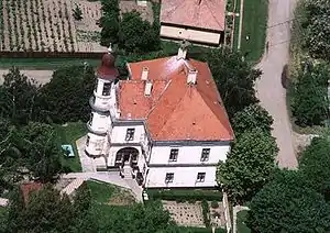
Aerial photography of Tépe
Tépe | |
|---|---|
 Coat of arms | |
| Country | |
| County | Hajdú-Bihar |
| Area | |
| • Total | 23.22 km2 (8.97 sq mi) |
| Population (2015) | |
| • Total | 1,104[1] |
| • Density | 47.5/km2 (123/sq mi) |
| Time zone | UTC+1 (CET) |
| • Summer (DST) | UTC+2 (CEST) |
| Postal code | 4132 |
| Area code | 54 |
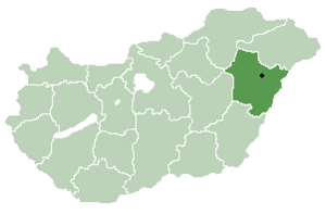
Location of Hajdú-Bihar county in Hungary
Geography
It covers an area of 23.22 km2 (9 sq mi) and has a population of 1104 people (2015).[1]
| City with county rights |
|   |
|---|---|---|
| Towns | ||
| Large villages | ||
| Villages |
| |
| Other topics |
| |
References
- Gazetteer of Hungary, 1 January 2015. Hungarian Central Statistical Office. 3 September 2015
This article is issued from Wikipedia. The text is licensed under Creative Commons - Attribution - Sharealike. Additional terms may apply for the media files.