Talaud Islands Regency
The Talaud Islands Regency (Indonesian: Kabupaten Kepulauan Talaud) is a regency of North Sulawesi province, Indonesia. The Talaud Islands form an archipelago situated to the north-east of Sulawesi, with a land area of 1,251.02 km2. It had a population of 83,434 at the 2010 Census,[2] increasing to 94,521 at the 2020 Census;[3] the official estimate as at mid 2022 was 95,545.[1] The largest island is Karakelong, on which lies the regency seat in the town of Melonguane. To its south lie the islands of Salibabu and Kabaruan, while the Nanusa group lies to the northeast of Karakelong, and Miangas island is situated midway between Karakelong and the Philippines. It is one of the three regencies to the north of North Sulawesi that are located between Sulawesi and the Philippines, along with the Sitaro Islands Regency and Sangihe Islands Regency; originally these formed a single regency, but on 110 April 2002 the Talaud Islands were split off to form their own Regency. The island of Miangas is the most northerly island in the regency and widely regarded as the northernmost point of Indonesia. As the result, it is often referenced to describe the territorial integrity of Indonesia in various patriotic statements and songs together with Sabang, Merauke, and Rote Island.
Talaud Islands Regency
Kabupaten Kepulauan Talaud | |
|---|---|
 Tuhan Yesus Raja Memberkati monument | |
 Seal | |
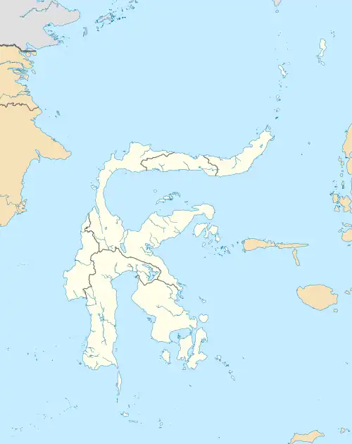
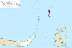 Location within North Sulawesi | |
| Coordinates: 4.31178°N 126.78085°E | |
| Country | |
| Province | |
| Regency seat | Melonguane |
| Government | |
| • Regent | Elly Engelbert Lasut |
| • Vice Regent | Moktar A Parapaga |
| Area | |
| • Total | 1,251.02 km2 (483.02 sq mi) |
| Lowest elevation | 0 m (0 ft) |
| Population (mid 2022 estimate)[1] | |
| • Total | 95,545 |
| • Density | 76/km2 (200/sq mi) |
| Time zone | UTC+8 (ICST) |
| Area code | (+62) 433 |
| HDI (2019) | |
| Website | talaudkab.go.id |

History
The islands were known as Maleon, Sinduane, Tamarongge, Batunampato, and Tinonda. Human settlements in the region have been present since prehistoric time, shown by several artifacts of hand axe and chopper from 6,000 BC. There were also remains of chinaware, suggesting there has been continuous trading activity between the natives of the islands and outside world.[4]
It was thought that inhabitants of the islands were originated from Southern Philippines especially Mindanao and also traders from Ternate.[5]
Geography


Grouping Talaud together with Sangihe, there are 77 islands in the Talaud-Sangihe archipelagos, of which 56 are inhabited. Compared with the Sangihe archipelago, the islands are low lying and forested, with hills rising to 2,231 feet (680 metres).[6] The coast of Karakelong Island is steep except on the southern shore, which is fringed by a wide reef.[7]
The region is regularly rocked by large earthquakes and volcanic eruptions, as the Molucca Sea Plate is being consumed in both directions.[8] A notable earthquake was the 2009 Talaud Islands earthquake, which was felt in the Philippines as well.[9]
Governance
The Regency is divided into nineteen districts (kecamatan), tabulated below with their areas and their populations at the 2010 Census[2] and 2020 Census,[3] together with the official estimates as at mid 2022.[1] The table also includes the locations of the district administrative centres.
| Name of District (kecamatan) | Area in km2 | Pop'n Census 2010 | Pop'n Census 2020 | Pop'n estimate mid 2022 | Admin Centre |
|---|---|---|---|---|---|
| Kabaruan | 66.03 | 5,472 | 5,860 | 5,853 | Mangaran |
| East Kabaruan | 49.58 | 4,127 | 4,530 | 4,551 | Damau |
| Total Kabaruan Island | 115.61 | 9,599 | 10,390 | 10,404 | |
| Lirung | 31.11 | 6,137 | 6,330 | 6,283 | Lirung |
| Salibabu | 21.80 | 5,566 | 6,330 | 6,401 | Salibabu |
| Kalongan | 24.81 | 3,060 | 3,460 | 3,490 | Kalongan |
| Moronge | 20.35 | 3,505 | 3,880 | 3,903 | Moronge |
| Total Salibabu Island | 98.07 | 18,268 | 20,000 | 20,077 | |
| Melonguane | 77.39 | 10,463 | 11,920 | 12,058 | Melonguane |
| East Melonguane | 48.35 | 2,964 | 3,750 | 3,870 | Bowombaru |
| Beo | 70.93 | 5,521 | 5,980 | 5,997 | Beo |
| North Beo | 144.85 | 3,609 | 4,350 | 4,453 | Lobbo |
| South Beo | 63.87 | 3,475 | 3,960 | 4,011 | Tarohan |
| Rainis | 80.68 | 5,959 | 7,180 | 7,346 | Rainis |
| Tampan 'Amma | 124.18 | 5,497 | 6,450 | 6,564 | Dapalan |
| Pulutan | 58.81 | 1,953 | 2,350 | 2,398 | Pulutan |
| Essang | 94.76 | 3,397 | 3,870 | 3,914 | Essang |
| South Essang | 75.02 | 3,198 | 3,680 | 3,725 | Sambuara |
| Gemeh | 137.71 | 5,470 | 6,430 | 6,539 | Gemeh |
| Total Karakelong Island | 976.55 | 51,506 | 59,920 | 60,875 | |
| Nanusa Islands | 58.40 | 3,333 | 3,400 | 3,373 | Karatung |
| Miangas | 2.39 | 728 | 810 | 816 | Miangas |
| Total Regency | 1,251.02 | 83,434 | 94,520 | 95,545 |
Economy
The regency's GRDP was valued at 2,266 billion rupiahs in 2020, an increase of 59 billion rupiahs from previous year. The regency's economy is still dominated by agriculture, fishing, and forestry-related industries. The agriculture sector alone made up 42.57% of the regency's GRDP. The second biggest sector in the regency was trade and retail, which made up 13.22% of the regency's GRDP in 2020. Other significant sectors are construction with contribution of 11.64%, administration and social security with 11.58%, and transportation with 4.50%. Overall economic growth of the regency was 4.69% on 2019 but then declined to 0.43% on 2020.[10]

The fastest growing sector in the regency in 2020 was electricity and gas with growth of 9.14%, followed by health sector with growth of 8.93%, insurance and financial services with 7.55%, and information and communication sector with 7.01%. Food services sector experienced sharp decline of 9.03% on the same year, while transportation sector also declined 5.34% due to COVID-19 pandemic.[10][11]
There were 1,635 registered merchants classified as small-scale business, while 26 merchant business were classified as medium-sized as of 2020. In addition, there are 150 registered cooperatives on the same year in the regency. Leading agriculture product from the regency is banana, with output of 34,384 quintals in 2020. Other fruit produced by the regency is mango with 913 quintals, durian with 509 quintals, papaya with 9,046 quintals, and salak with 297 quintals. Other than banana, coconut is also a major cash crop in the regency which coconut plantation occupied 22,146 hectares of land as of 2020. The production of coconut in 2020 was 19,185 tons, followed by nutmeg production of 4,113 tons. There's also significant chili production which results in 59,917 tons as of 2020.[10]
People and culture

The population of the Talaud Islands was 94,520 according to the 2020 census.[3] The total population of the Talaud, Sangihe and Sitaro Islands was 304,600 in 2020.[3]
Most of the population are involved in agriculture, which includes coconuts, vanilla, nutmeg, cloves, ebony and ironwood as well as copra and sago. Numerous volcanoes produce very fertile volcanic soil on many of the islands.[12] Fishing is an important aspect of Talaud livelihood, culture and economy.
The Austronesian Talaud language is spoken on the islands[13] by the native ethnic group, the Talaud.[14]
Christianity is the majority religion of the islands (protestantism).[13][15]
Biodiversity
The Talaud Islands are a hotspot of endemism and zoological diversity, and are situated in the Sulawesi lowland rain forests ecoregion.[16]
Endemic mammals include the endangered Talaud flying fox (Acerodon humilis), the critically endangered Talaud bear cuscus (Ailurops melanotis), the endangered Short-tailed Talaud mosaic-tailed rat (Melomys caurinus), and the endangered Long-tailed Talaud mosaic-tailed rat (Melomys talaudium). Birds endemic to the Talaud Islands include the vulnerable Talaud bush-hen (Amaurornis magnirostris), the endangered Talaud rail (Gymnocrex talaudensis), the near threatened Talaud kingfisher (Todiramphus enigma) and the vulnerable Red-and-blue lory (Eos histrio), which formerly lived across the Talaud and Sangihe islands, now restricted only to Karakelang. The Talaud black birdwing (Troides dohertyi) is a butterfly endemic to the Sangihe and Talaud Islands.
Sangihe and Talaud were largely deforested by 1920, and there is minimal natural forest remaining on these islands. A survey has been proposed to determine appropriate locations for additional protected areas around remaining forest (Stattersfield et al. 1998).[6] There is a Wildlife Reserve on Karakelong [246.69 km2 (95.25 miles2)].[17]
Infrastructure
Education
There are 74 kindergartens, 117 elementary schools, 43 junior high schools, and 24 senior high schools, in addition of 13 vocational high schools. From the 24 senior high schools, five of them are Christian senior high school (SMAK) which are administered by the Ministry of Religious Affairs instead of the Ministry of Education, Culture, Research, and Technology.[10]
There's only one college in the regency, Rajawali Computer Science College which is private. It was established after MoU between the regency government and IPB University in 2006. The main campus was previously located in a temporary location in Melonguane town, but later relocated to town of Beo in 2011 where newly built campus complex was located.[18][19][10]
Healthcare
There are two main hospitals, 42 puskesmas, and six registered pharmacies in the regency; 17 puskesmas have inpatient care. There are also 153 healthcare centers in the regency as of 2020.[10] Talaud Regional Hospital, which is the main hospital of the regency, is located at the town of Melonguane and classified by Ministry of Health as C-class hospital. The other hospital is located at town of Gemeh, is RSB Gemeh Talaud which has smaller building and classified as D-class hospital.[20][21]
Transportation

Total length of road in the regency as of 2020 was 470.771 kilometers out of which 265.44 kilometers are sealed with asphalt and 38.147 kilometers were gravel surface. Almost half of the roads are under the authority of the regency government, while the other half are under the authority of the province. Only 66.05 kilometers are under direct authority of the central government. The main port in the regency is Melonguane Port, located in the town of Melonguane. It is connected to other smaller ports scattered around the regency as well as big ports in mainland Sulawesi by Sea Toll Program.[22] In addition, the Melonguane Port also host an Indonesian Navy naval base.[23][10]
The regency is mainly served by Melangguane Airport, which has regular flight to Manado. There's also recently built Miangas Airport serving the island of Miangas which has flights to Manado and also Melonguane. It is one of the most remote airports in Indonesia and was inaugurated by Joko Widodo in 2017.[24] As of 2021, there's one proposed airport that would be built in Marampit, which has been approved by Ministry of National Development Planning.[25]
Notes
- The islands of the Talaud group are: (ordered from South to North)
- Kabaruang Island
* Salibabu Island
* Sara Besar Island (off Salibabu's east coast)
* Nusa Dolong and Nusa Topor (off Karakelong's central west coast)
* Karakelong Island
* the Nanusa Islands: (ordered S to N) Kakalotan Island, Kakarotan Island, Intata Island, Magupu Island, Karatung Island, Merampit Island (largest) and Garat Island
* Miangas (not visible on map[6])
- Kabaruang Island
- Photo was taken during the Siboga Expedition of 1899-1900.
References
- Badan Pusat Statistik, Jakarta, 2023, Kabupaten Kepulauan Talaud Dalam Angka 2023 (Katalog-BPS 1102001.7104)
- Biro Pusat Statistik, Jakarta, 2011.
- Badan Pusat Statistik, Jakarta, 2021.
- "Sejarah Kabupaten Kepulauan Talaud". Pemerintah Kabupaten Kepulauan Talaud (in Indonesian). 2020-08-14. Retrieved 2021-12-12.
- Itsnaini, Faqihah Muharroroh. "Suku Sangir Taulud dari Sulawesi Utara, Asal Usul, Karakteristik, dan Kebudayaannya". detikedu (in Indonesian). Retrieved 2021-12-12.
- "Indonesia: Island of Sulawesi | Ecoregions | WWF". World Wildlife Fund. Retrieved 2021-04-05.
- "Talaud Islands | islands, Indonesia". Encyclopedia Britannica. Retrieved 2021-04-08.
- Moore, G.F; Kadarisman, D; Evans, C.A; Hawkins, J.W (1981). "Geology of the Talaud Islands, molucca sea collision zone, northeast Indonesia". Journal of Structural Geology. 3 (4): 467–475. Bibcode:1981JSG.....3..467M. doi:10.1016/0191-8141(81)90046-8.
- "M 7.2 – 196 km SSE of Sarangani". earthquake.usgs.gov. Philippines: United States Geological Survey. Archived from the original on April 21, 2022. Retrieved 2023-04-16.
- "Badan Pusat Statistik Kabupaten Kepulauan Talaud". talaudkab.bps.go.id. Retrieved 2021-12-09.
- RRI 2021, LPP. "Bangkitkan Ekonomi di Masa Pandemi, Pemkab Talaud Buka Gerai UMKM". rri.co.id. Retrieved 2021-12-09.
- "Sangihe Talaud Islands, North Sulawesi, Indonesia". North-sulawesi.org. Archived from the original on 2015-04-29. Retrieved 2015-06-12.
- "Talaud". Ethnologue. Retrieved 2021-04-08.
- "Talaud Language | Joshua Project". joshuaproject.net. Retrieved 2021-04-08.
- Jacobsen, Michael (2002-04-22). "'To Be or What to Be – That is the Question' : On factionalism and seccessionism in North Sulawesi Province, Indonesia" (PDF). Southeast Asia Research Centre Seminar – Working Papers Series. pp. 16–17 – via City University of Hong Kong.
- Eric Wikramanayake; Eric Dinerstein; Colby J. Loucks (2002). Terrestrial Ecoregions of the Indo-Pacific: a Conservation Assessment. Washington DC: Island Press.
{{cite book}}: CS1 maint: multiple names: authors list (link) - "North Karakelang Wildlife Reserve · Indonesian Forest". Indonesian Forest. 2017-07-15. Retrieved 2021-04-05.
- Studn.id. "Sekolah Tinggi Ilmu Komputer Rajawali | Studn.id". studn.id. Retrieved 2021-12-09.
- "PDDikti - Pangkalan Data Pendidikan Tinggi". pddikti.kemdikbud.go.id. Retrieved 2021-12-09.
- "Informasi SDM Kesehatan Nasional". bppsdmk.kemkes.go.id. Retrieved 2021-12-09.
- "Informasi SDM Kesehatan Nasional". bppsdmk.kemkes.go.id. Retrieved 2021-12-09.
- "6 Trayek Laut Baru Perkuat Konektivitas ke Talaud | Ekonomi". Bisnis.com (in Indonesian). 2019-03-31. Retrieved 2021-12-09.
- "Lanal Melonguane Lengkapi Tiga Pelabuhan Utama Di Kabupaten Kepulauan Talaud Dengan Gerbang Desinfektan Karya Prajurit Guna Mendukung Gugus Tugas Covid-19 Talaud". koarmada2.tnial.mil.id (in Indonesian). 2020-06-01. Archived from the original on April 12, 2021. Retrieved 16 April 2023.
- Antony, Noval Dhwinuari. "Telan Biaya Rp 205 M, Begini Wujud Bandara Miangas yang Diresmikan Jokowi". detikfinance (in Indonesian). Retrieved 2021-12-09.
- RRI 2021, LPP. "Wow!!! Menjadi Sejarah, Talaud Miliki 3 Bandar Udara". rri.co.id. Retrieved 2021-12-12.