Te Mārua
Te Mārua (previously also known as Te Marua) is the easternmost urban suburb of Upper Hutt. For reasons of location and distance from the city, the area is often classified as rural. Te Mārua is well known for its Plateau Reserve where remnants of the old Rimutaka Railway path can be found, which now form part of a historic walk. Mt Climie, the highest peak of the Remutaka Range, can also be reached from the reserve.[3] The suburb is also the location of the Wellington Speedway, a nationally important venue for stock car racing,[4] and of the Wellington Naturist Club's club grounds, venue of the historic 2016 World Congress of the International Naturist Federation.[5]
Te Mārua | |
|---|---|
 | |
| Coordinates: 41.09785°S 175.13151°E | |
| Country | New Zealand |
| Region | Wellington Region |
| Territorial authority | Upper Hutt |
| Electorates | |
| Government | |
| • Territorial Authority | Upper Hutt City Council |
| • Regional council | Greater Wellington Regional Council |
| • Mayor of Upper Hutt | Wayne Guppy |
| • Remutaka MP | Chris Hipkins |
| • Ikaroa-Rāwhiti MP | Cushla Tangaere-Manuel |
| Area | |
| • Total | 5.57 km2 (2.15 sq mi) |
| Population (June 2023)[2] | |
| • Total | 1,050 |
| • Density | 190/km2 (490/sq mi) |
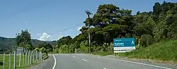
Te Mārua is situated on State Highway 2, and is the last significant township (and shop) on the road before it reaches the head of the Hutt Valley and crosses the Remutaka Range into the Wairarapa. Te Mārua is situated in the original floodplain of the Hutt River and parts, particularly the Golf course, have been subject to flooding.
Just north of Te Mārua is the Te Mārua water treatment plant and the twin Stuart Macaskill Lakes. Water is taken from the Hutt River at Kaitoke, and either goes directly to the treatment plant or is stored in the lakes for future use. The water treatment plant supplies 40 percent of Wellington's water requirements, including all of Upper Hutt, Manor Park and Stokes Valley in Lower Hutt, all of Porirua, and the northern and western suburbs of Wellington City.[6]
Te Mārua residents are represented by the local community body, the Upper Hutt Rural Residents Association, and served by Maymorn railway station.
In December 2019, the approved official geographic name of the locality was gazetted as "Te Mārua".[7]
Demographics
Te Mārua statistical area covers 5.57 km2 (2.15 sq mi).[1] It had an estimated population of 1,050 as of June 2023,[2] with a population density of 189 people per km2.
| Year | Pop. | ±% p.a. |
|---|---|---|
| 2006 | 918 | — |
| 2013 | 969 | +0.78% |
| 2018 | 975 | +0.12% |
| Source: [8] | ||
Te Mārua had a population of 975 at the 2018 New Zealand census, an increase of 6 people (0.6%) since the 2013 census, and an increase of 57 people (6.2%) since the 2006 census. There were 351 households, comprising 510 males and 468 females, giving a sex ratio of 1.09 males per female. The median age was 42.2 years (compared with 37.4 years nationally), with 189 people (19.4%) aged under 15 years, 165 (16.9%) aged 15 to 29, 507 (52.0%) aged 30 to 64, and 111 (11.4%) aged 65 or older.
Ethnicities were 89.2% European/Pākehā, 15.7% Māori, 4.6% Pasifika, 1.5% Asian, and 1.5% other ethnicities. People may identify with more than one ethnicity.
The percentage of people born overseas was 20.0, compared with 27.1% nationally.
Although some people chose not to answer the census's question about religious affiliation, 56.0% had no religion, 30.2% were Christian, 1.8% had Māori religious beliefs, 0.3% were Hindu, 0.6% were Buddhist and 2.5% had other religions.
Of those at least 15 years old, 123 (15.6%) people had a bachelor's or higher degree, and 129 (16.4%) people had no formal qualifications. The median income was $40,600, compared with $31,800 nationally. 192 people (24.4%) earned over $70,000 compared to 17.2% nationally. The employment status of those at least 15 was that 456 (58.0%) people were employed full-time, 129 (16.4%) were part-time, and 21 (2.7%) were unemployed.[8]
Education
Plateau School, located in Te Mārua, is a co-educational state primary school for Year 1 to 6 students.[9][10] It has a roll of 144 as of April 2023.[11]
References
- "ArcGIS Web Application". statsnz.maps.arcgis.com. Retrieved 4 June 2021.
- "Population estimate tables - NZ.Stat". Statistics New Zealand. Retrieved 25 October 2023.
- Mt Climie Track
- Hutt Valley Family Speedway
- "Wellington Naturist Club". Wellington Naturist Club. Retrieved 15 January 2020.
- "Te Marua water treatment plant". Greater Wellington Regional Council. Retrieved 19 August 2014.
- "NZGB notices – December 2019". Land Information New Zealand. 10 December 2019. Retrieved 15 December 2019.
- "Statistical area 1 dataset for 2018 Census". Statistics New Zealand. March 2020. Te Mārua (242700). 2018 Census place summary: Te Mārua
- "Plateau School Official School Website". plateau.school.nz.
- "Plateau School Ministry of Education School Profile". educationcounts.govt.nz. Ministry of Education.
- "Education Review Office Report". ero.govt.nz. Education Review Office.