Te Pou Hawaiki
Te Pou Hawaiki (also known as Epsom Avenue or Ōwhatihue) is a volcano in the Auckland volcanic field in New Zealand. It was a small, low scoria cone south-east of Mount Eden that was quarried away in the early 20th century.
| Te Pou Hawaiki | |
|---|---|
| Epsom Avenue, Ōwhatihue | |
_(Te_Pou_Hawaiki).jpg.webp) Te Pou Hawaiki, seen from Mount Eden in 1884 | |
| Highest point | |
| Coordinates | 36.88247°S 174.766726°E |
| Geography | |
| Location | North Island, New Zealand |
| Geology | |
| Age of rock | 153,000 years[1] |
| Volcanic arc/belt | Auckland volcanic field |
Geology
The volcano was located approximately 600 metres south-southeast of the Maungawhau / Mount Eden crater, and was between 100 and 150 metres in diameter.[2] Te Pou Hawaiki is older than Maungawhau / Mount Eden.[3] Because of this, it is estimated to have erupted at least 28,000 years ago,[4] with estimates suggesting the volcano's eruption occurred 153,000 years ago or earlier.[1]
History

Te Pou Hawaiki was used as a place for rituals for Tāmaki Māori. Soil from Hawaiki (the Māori homeland) was placed at the site during the early settlement period, and rituals were performed here prior to major hunting and fishing expeditions.[5] The volcano was the site of a small pā known as Ōwhatihue,[5] and a path known as Aratakihaere ("The Path of Single File") led between Maungawhau / Mount Eden and Te Pou Hawaiki.[6][7]
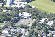
The volcano was quarried in the first half of the 20th century.[2] A carpark for the Auckland College of Education was built on-top of the site.[8]
Geologist E. J. Searle proposed the name Epsom Avenue for the volcano in 1965.[2]
References
- Kereszturi, Gábor; Németh, Károly; Cronin, Shane J; Agustín-Flores, Javier; Smith, Ian EM; Lindsay, Jan (2013). "A model for calculating eruptive volumes for monogenetic volcanoes—Implication for the Quaternary Auckland Volcanic Field, New Zealand". Journal of Volcanology and Geothermal Research. 266: 16–33. doi:10.1016/j.jvolgeores.2013.09.003. ISSN 0377-0273.
- Affleck, Dev K; Cassidy, John; Locke, Corinne A (2001). "Te Pouhawaiki Volcano and pre‐volcanic topography in central Auckland: Volcanological and hydrogeological implications". New Zealand Journal of Geology and Geophysics. 44 (2): 313–321. doi:10.1080/00288306.2001.9514940. ISSN 0028-8306.
- Hopkins, Jenni L; Wilson, Colin JN; Millet, Marc-Alban; Leonard, Graham S; Timm, Christian; McGee, Lucy E; Smith, Ian EM; Smith, Euan GC (2017). "Multi-criteria correlation of tephra deposits to source centres applied in the Auckland Volcanic Field, New Zealand". Bulletin of Volcanology. 79 (7): 1–35. ISSN 1432-0819.
- Lindsay, J.M.; Leonard, G.S.; Smid, E.R.; Hayward, B.W. (December 2011). "Age of the Auckland Volcanic Field: a review of existing data". New Zealand Journal of Geology and Geophysics. 54 (4): 379–401. doi:10.1080/00288306.2011.595805. S2CID 129707270.
- "Northern Districts Combined Headquarters Bunker". Heritage New Zealand. Retrieved 20 December 2022.
- Simmons, D. R. (1979). "George Graham's Maori Place Names of Auckland". Records of the Auckland Institute and Museum. 16: 11–39. ISSN 0067-0464. JSTOR 42906272. Wikidata Q58677091.
- "Mt Eden Area: Maungawhau Heritage Walks" (PDF). Auckland City Council, Mount Eden Village Mainstreet & Business Association, Eden Valley Mainstreet and Business Association. Retrieved 30 December 2022.
- "Auckland Unitary Plan: Schedule 12 Sites and Places of Significance to Mana Whenua Schedule" (PDF). Auckland Council. 29 May 2018. Retrieved 30 December 2022.
