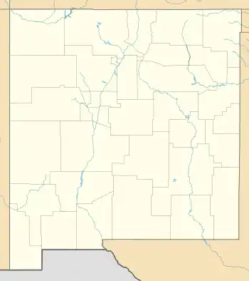
Tesuque Pueblo, New Mexico
Tesuque Pueblo is an unincorporated community and census-designated place in Santa Fe County, New Mexico, United States. Its population was 233 as of the 2010 census.[4]
Tesuque Pueblo, New Mexico | |
|---|---|
 Tesuque Pueblo  Tesuque Pueblo | |
| Coordinates: 35°48′09″N 105°58′32″W | |
| Country | United States |
| State | New Mexico |
| County | Santa Fe |
| Area | |
| • Total | 2.20 sq mi (5.69 km2) |
| • Land | 2.20 sq mi (5.69 km2) |
| • Water | 0.00 sq mi (0.00 km2) |
| Elevation | 6,371 ft (1,942 m) |
| Population | |
| • Total | 301 |
| • Density | 136.94/sq mi (52.87/km2) |
| Time zone | UTC-7 (Mountain (MST)) |
| • Summer (DST) | UTC-6 (MDT) |
| Area code | 505 |
| GNIS feature ID | 937204[3] |
Geography
Tesuque Pueblo is located at 35.8025277°N 105.9755777°W.[3] According to the U.S. Census Bureau, the community has an area of 2.198 square miles (5.69 km2), all land.[4]
Education
Te Tsu Geh Oweenge Day School a.k.a. Tesuque Day School[6] is a Bureau of Indian Education (BIE)-affiliated tribal school.[7] It is located in Tesuque Pueblo.[8]
In regards to conventional school district-operated public schools, Tesuque Pueblo is zoned to Pojoaque Valley Schools.[9] Pojoaque Valley High School is the zoned comprehensive high school.
Some Tesuque Pueblo students who were alumni of the BIA school, as of 1987, moved on to the public district-operated middle school, while others moved on to Santa Fe Indian School, a BIA/BIE-operated secondary school.[10]
References
- "ArcGIS REST Services Directory". United States Census Bureau. Retrieved October 12, 2022.
- "Census Population API". United States Census Bureau. Retrieved October 12, 2022.
- "Tesuque Pueblo". Geographic Names Information System. United States Geological Survey, United States Department of the Interior.
- "2010 Census Gazetteer Files - Places: New Mexico". U.S. Census Bureau. Retrieved December 31, 2016.
- "Census of Population and Housing". Census.gov. Retrieved June 4, 2016.
- "Schools In Poor Condition as Measured by Facility Condition Index" (PDF). Bureau of Indian Affairs. Retrieved June 6, 2023.
- "Te Tsu Geh Oweenge Day School". Bureau of Indian Education. Retrieved June 6, 2023.
- "Te Tsu Geh Oweenge Day School". National Center for Education Statistics. Retrieved June 6, 2023.
- "2020 CENSUS - SCHOOL DISTRICT REFERENCE MAP: Santa Fe County, NM" (PDF). U.S. Census Bureau. Retrieved July 30, 2021.
- Russell, Inez (January 19, 1987). "Indian children learn of 2 worlds". El Paso Times. El Paso, Texas. Gannett News Service. pp. 1-B and 2-B. - Clipping of first and of second page from Newspapers.com.
