Tagarapuvalasa
Tagarapuvalasa is a neighbourhood on the banks of River Gosthani is a part of Bheemunipatnam Municipality (BMC) in Andhra Pradesh.[1] It is located on the Kolkata–Chennai National Highway 16.
National Highway 43 diverts from Maharajupeta village north of Tagarapuvalasa.
Tagarapuvalasa | |
|---|---|
 View of Thagarapuvalasa Town | |
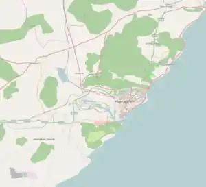
 Tagarapuvalasa Location in Visakhapatnam | |
| Coordinates: 17°55′52″N 83°25′44″E | |
| Country | |
| State | Andhra Pradesh |
| District | Visakhapatnam |
| Mandal | Bheemunipatnam |
| Government | |
| • Type | Municipal Corporation |
| • Body | GVMC |
| Telugu Languages | |
| • Official | Telugu |
| Time zone | UTC+5:30 (IST) |
| PIN | 531162 |
| Telephone code | +91-8933-XXX XXX |
| Vehicle registration | AP-31 |
History
Traces of habitation and early trade in and around Tagarapuvalasa may be dated back to 3rd century BC or more as many Early Buddhist sites such as Pavurallakonda, Gudiwada Dibba,[2] Cherukupalli Gutta[3] and Pellikonda,[4] are explored, documented and excavated near to this town along the River Gosthani. This area once flourished as Madhyama Kalinga region.
Geography
Tagarapuvalasa and Chittivalasa are twin towns and located at 17°55′52″N 83°25′44″E.[5]
Transport
- APSRTC routes
| Route Number | Start | End | Via |
|---|---|---|---|
| 222 | Tagarapuvalasa/Chittivalasa Jn. | Railway Station/RTC Complex | Anandapuram, Madhurawada, Yendada, Hanumanthuwaka, Maddilapalem |
| 222V | Vizianagaram | RTC Complex | Tagarapuvalasa/Chittivalasa Jn., Anandapuram, Madhurawada, Yendada, Hanumanthuwaka, Maddilapalem |
| 111 | Tagarapuvalasa/Chittivalasa Jn. | Kurmannapalem | Anandapuram, Madhurawada, Yendada, Hanumanthuwaka, Maddilapalem, RTC Complex, Jagadamba Centre, Town Kotharoad, Convent, Scindia, Malkapuram, Gajuwaka |
| 111V | Vizianagaram | Kurmannapalem | Tagarapuvalasa/Chittivalasa Jn., Anandapuram, Madhurawada, Yendada, Hanumanthuwaka, Maddilapalem, RTC Complex, Jagadamba Centre, Town Kotharoad, Convent, Scindia, Malkapuram, Gajuwaka |
| 211 | Vizianagaram | Visakhapatnam Railway Station | Tagarapuvalasa/Chittivalasa Jn., Anandapuram, Madhurawada, Yendada, Hanumanthuwaka, Maddilapalem, RTC Complex |
| 900T | Tagarapuvalasa/Chittivalasa | RTC Complex | Bhimili, Thimmapuram, Rushikonda, Appughar, Pedawaltair, Siripuram, RTC Complex |
| 888 | Tagarapuvalasa/Chittivalasa Jn. | Anakapalli | Anandapuram, Gudilova, Shontyam, Pendurthi, Sabbavaram, Sankaram |
| 55T | Tagarapuvalasa/Chittivalasa Jn. | Scindia | Anandapuram, Gudilova, Shontyam, Pendurthi, Vepagunta, Gopalapatnam, NAD Kotharoad, Airport, BHPV, Gajuwaka, Malkapuram |
References
- "Mandal wise list of villages in Andhra Pradesh" (PDF). Apland.ap.nic.in. Archived from the original (PDF) on 19 March 2015. Retrieved 7 September 2013.
- B. Madhu Gopal (9 October 2012). "Evidence of Buddhist site found". The Hindu. Retrieved 7 September 2013.
- "Buddhist remains site at kotta cherukupalli (Tagarapuvalasa) | interesting place". Wikimapia.org. Retrieved 7 September 2013.
- "Pellikonda Buddhist Site | place with historical importance, archaeological site, interesting place". Wikimapia.org. Retrieved 7 September 2013.
- "Maps, Weather, Videos, and Airports for Chittivalasa, India". Fallingrain.com. Retrieved 7 September 2013.
This article is issued from Wikipedia. The text is licensed under Creative Commons - Attribution - Sharealike. Additional terms may apply for the media files.