Thanh Hóa province
Thanh Hóa (Vietnamese: [tʰajŋ̟˧˧ hwaː˧˦] ⓘ) is a northernmost coastal province in the North Central Coast region, the Central of Vietnam. It borders Sơn La, Hòa Bình, Ninh Bình to the north, Nghệ An to the south, Houaphanh of Laos to the west with a boundary line over 192 kilometres (119 mi), and the East Sea (Gulf of Tonkin) to the east.
Thanh Hóa province
Tỉnh Thanh Hóa | |
|---|---|
 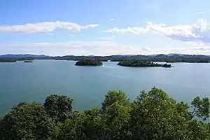   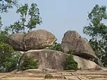  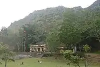 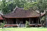  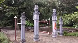 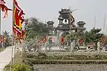 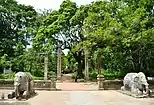 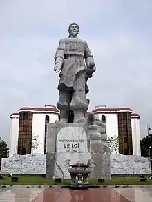 .jpg.webp) Citadel of the Hồ Dynasty • Sông Mực Lake • Hải Hòa Beach • Trống Mái Mountain • Cẩm Lương fish stream • Mai An Tiêm Temple • Lam Kinh Temple • Phú Lệ Suspension bridge • Bà Triệu Temple • Dạ Lộc Temple • Lê Lợi Mausoleum • Lê Lợi Statue | |
|
Seal | |
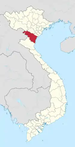 Location of Thanh Hóa within Vietnam | |
| Coordinates: 20°0′N 105°30′E | |
| Country | |
| Region | North Central Coast |
| Capital (and Largest city) | Thanh Hóa |
| Government | |
| • People's Council Chair | Trịnh Văn Chiến |
| • People's Committee Chair | Nguyễn Đình Xứng |
| Area | |
| • Total | 11,129.5 km2 (4,297.1 sq mi) |
| Population (2021)[2] | |
| • Total | 3,673,900 |
| • Density | 330/km2 (850/sq mi) |
| Demographics | |
| • Ethnicities | Vietnamese, Mường, Thai, Thổ, Dao, and H'Mông |
| Time zone | UTC+7 (ICT) |
| Area codes | 237 |
| ISO 3166 code | VN-21 |
| Website | www |
Thanh Hóa is a relatively large province, which ranks as fifth in area and as third in population among 63 central administrative subdivisions. Its capital and largest city is Thanh Hóa City. The province is widely called Xứ Thanh (The Land of Thanh).
Human civilization has existed in Thanh Hóa for about 6,000 years ago, as one of the earliest centers of the ancient Vietnamese. Archaeological excavations have revealed that the first culture presented was the Đa Bút Culture, a culture located along the Sông Đáy river and the Sông Mã river.
Thanh Hóa is located in the middle of North Vietnam and North Central Coast as a transition in many aspects: geology, climate, administrative division and local culture. Thus, these factors show that Xứ Thanh is a province with many particular local habits and customs and cultures.
Thanh Hóa has two provincial cities, one district-level town and 24 rural districts with an area of 11,133.4 km2 and a population of approximate 3.6 million. Sầm Sơn city is a famous seaside resort situated 16 km from the Thanh Hóa city centre. Whilst, Bỉm Sơn township is a large industrial centre, especially cement. Nghi Sơn is a promising Economic zone, expected to be central of Thanh Hoa's Industrial with large Refinery Factory, Deepwater Seaport and many projects in progress. The province is also home of many ethnic groups, in which the most seven ethnicities are Kinh, Mường, Thái, H'Mông, Dao, Thổ, Khơ-mú with mentions of the legend Long Quân. ("Dragon Lord of Lac")
Geography
Geographic position
The coordinate was accurately measured as 19°18'N - 20°40'N (from the southernmost point to northernmost point), 104°22'E - 106°05'E (from the westernmost point to easternmost point).
Administrative divisions
Thanh Hóa is subdivided into 27 district-level sub-divisions:
- 23 rural districts:
- 2 district-level towns:
They are further subdivided into 28 commune-level towns (or townlets), 579 communes, and 30 wards.
Etymology
The province's name derives from Sino-Vietnamese 清化.
清 "Thanh" meaning clear; pure; fine. 化 "Hóa" meaning “to transform; to change into; to become”.
External links
References
Places adjacent to Thanh Hóa province | |
|---|---|
2 provincial cities, 2 district-level towns, 23 districts 60 wards, 30 commune-level towns, 469 communes | ||
| Thanh Hóa City (capital) |
| |
| Sầm Sơn City | ||
| Bỉm Sơn Town | ||
| Nghi Sơn Town |
| |
| Bá Thước District | ||
| Cẩm Thủy District | ||
| Đông Sơn District |
| |
| Hà Trung District | ||
| Hậu Lộc District | ||
| Hoằng Hóa District |
| |
| Lang Chánh District |
| |
| Mường Lát District | ||
| Nga Sơn District | ||
| Ngọc Lặc District | ||
| Như Thanh District | ||
| Như Xuân District | ||
| Nông Cống District |
| |
| Quan Hóa District | ||
| Quan Sơn District | ||
| Quảng Xương District |
| |
| Thạch Thành District | ||
| Thiệu Hóa District |
| |
| Thọ Xuân District |
| |
| Thường Xuân District |
| |
| Triệu Sơn District |
| |
| Vĩnh Lộc District | ||
| Yên Định District | ||
| Thanh Hóa province |  | |
|---|---|---|
| Nghệ An province | ||
| Hà Tĩnh province | ||
| Quảng Bình province |
| |
| Quảng Trị province | ||
| Thừa Thiên Huế province |
| |
※ denotes provincial seat. | ||