Three Lakes, Michigan
Three Lakes is an unincorporated community and census-designated place (CDP) in Baraga County in the U.S. state of Michigan.[3] The CDP had a population of 167 at the 2020 census. Three Lakes is located within Spurr Township.
Three Lakes, Michigan | |
|---|---|
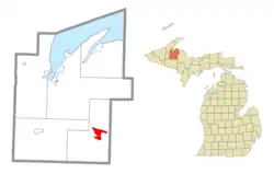 Location within Baraga County | |
 Three Lakes Location within the state of Michigan  Three Lakes Location within the United States | |
| Coordinates: 46°33′16″N 88°12′4″W | |
| Country | |
| State | |
| County | |
| Township | Spurr |
| Area | |
| • Total | 7.86 sq mi (20.4 km2) |
| • Land | 6.00 sq mi (15.5 km2) |
| • Water | 1.86 sq mi (4.8 km2) |
| Elevation | 1,621 ft (494 m) |
| Population (2020) | |
| • Total | 167 |
| • Density | 27.83/sq mi (10.75/km2) |
| Time zone | UTC-5 (Eastern (EST)) |
| • Summer (DST) | UTC-4 (EDT) |
| ZIP code(s) | 49861 (Michigamme) |
| Area code | 906 |
| GNIS feature ID | 1617894[2] |
History
Three Lakes was established as a mining settlement, and was given a station on the Marquette, Houghton and Ontonagon Railroad in 1878.[4]
For the 2020 census, Three Lakes was included as a newly-listed census-designated place.[5][6]
Geography
According to the U.S. Census Bureau, the Three Lakes CDP has a total area of 7.86 square miles (20.36 km2), of which 6.00 square miles (15.54 km2) is land and 1.86 square miles (4.82 km2) (23.7%) is water.[1]
Three Lakes takes its name from its location near Beaufort Lake, George Lake, and Ruth Lake, which flow out through the Spurr River to Lake Michigamme. The community is located about 3.9 miles (6.3 km) west of the Marquette County line.
References
- "2020 U.S. Gazetteer Files". United States Census Bureau. Retrieved September 25, 2023.
- U.S. Geological Survey Geographic Names Information System: Three Lakes, Michigan
- "Geographic Names Information System". edits.nationalmap.gov. Retrieved 2023-09-26.
- Romig, Walter (1986). Michigan Place Names: The History of the Founding and the Naming of More Than Five Thousand Past and Present Michigan Communities. Detroit: Wayne State University Press. p. 554. ISBN 0-8143-1838-X.
- "State of Michigan Census Designated Places - Current/TAB20 - Data as of January 1, 2020". tigerweb.geo.census.gov. Retrieved 2023-09-26.
- "Geographic Names Information System". edits.nationalmap.gov. Retrieved 2023-09-26.
- "Census of Population and Housing". Census.gov. Retrieved September 25, 2023.
Municipalities and communities of Baraga County, Michigan, United States | ||
|---|---|---|
| Villages |  Map of Michigan highlighting Baraga County.svg | |
| Civil townships | ||
| CDPs | ||
| Other communities | ||
| Indian reservations | ||
| Footnotes | ‡This populated place also has portions in an adjacent county or counties | |