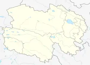
Tianjun County
Tianjun County is a county of Qinghai Province, China, bordering Gansu Province to the north. It is under the administration of the Haixi Mongol and Tibetan Autonomous Prefecture. The county seat in Xinyuan Town.
Tianjun County
天峻县 · ᠲᠢᠶᠡᠨ ᠵᠢᠶᠦ᠋ᠨ ᠰᠢᠶᠠᠠ· ཐེམ་ཆེན་རྫོང་། Têmqên | |
|---|---|
.png.webp) Location of Tianjun County (red) within Haixi Prefecture (yellow) and Qinghai | |
 Tianjun Location of the city centre in Qinghai | |
| Coordinates: 37°55′N 98°39′E | |
| Country | China |
| Province | Qinghai |
| Autonomous prefecture | Haixi |
| County seat | Xinyuan |
| Area | |
| • Total | 25,989 km2 (10,034 sq mi) |
| Population (2020) | |
| • Total | 23,203 |
| • Density | 0.89/km2 (2.3/sq mi) |
| [1] | |
| Time zone | UTC+8 (China Standard) |
| Website | www |
| Tianjun County | |||||||
|---|---|---|---|---|---|---|---|
| Chinese name | |||||||
| Simplified Chinese | 天峻县 | ||||||
| Traditional Chinese | 天峻縣 | ||||||
| |||||||
| Tibetan name | |||||||
| Tibetan | ཐེམ་ཆེན་རྫོང་། | ||||||
| |||||||
| Mongolian name | |||||||
| Mongolian script | ᠲᠢᠶᠡᠨ ᠵᠢᠶᠦ᠋ᠨ ᠰᠢᠶᠠᠠ | ||||||
Climate
| Climate data for Tianjun (1991–2020 normals) | |||||||||||||
|---|---|---|---|---|---|---|---|---|---|---|---|---|---|
| Month | Jan | Feb | Mar | Apr | May | Jun | Jul | Aug | Sep | Oct | Nov | Dec | Year |
| Average high °C (°F) | −3.6 (25.5) |
−0.4 (31.3) |
4.0 (39.2) |
9.4 (48.9) |
12.9 (55.2) |
15.5 (59.9) |
17.7 (63.9) |
17.5 (63.5) |
14.0 (57.2) |
8.5 (47.3) |
2.6 (36.7) |
−2.0 (28.4) |
8.0 (46.4) |
| Daily mean °C (°F) | −12.9 (8.8) |
−9.7 (14.5) |
−4.9 (23.2) |
1.2 (34.2) |
5.3 (41.5) |
8.8 (47.8) |
11.1 (52.0) |
10.6 (51.1) |
6.5 (43.7) |
−0.2 (31.6) |
−6.6 (20.1) |
−11.1 (12.0) |
−0.2 (31.7) |
| Average low °C (°F) | −20.7 (−5.3) |
−17.7 (0.1) |
−12.7 (9.1) |
−6.6 (20.1) |
−1.8 (28.8) |
2.7 (36.9) |
5.4 (41.7) |
4.8 (40.6) |
0.9 (33.6) |
−6.8 (19.8) |
−13.7 (7.3) |
−18.3 (−0.9) |
−7.0 (19.3) |
| Average precipitation mm (inches) | 1.4 (0.06) |
1.8 (0.07) |
6.4 (0.25) |
13.1 (0.52) |
47.7 (1.88) |
79.0 (3.11) |
96.7 (3.81) |
85.7 (3.37) |
44.2 (1.74) |
8.8 (0.35) |
1.5 (0.06) |
0.4 (0.02) |
386.7 (15.24) |
| Average precipitation days (≥ 0.1 mm) | 2.1 | 2.2 | 4.3 | 6.8 | 11.3 | 16.5 | 18.4 | 17.0 | 11.5 | 3.9 | 1.4 | 0.8 | 96.2 |
| Average snowy days | 3.2 | 3.8 | 6.6 | 8.4 | 8.4 | 2.5 | 0.8 | 0.7 | 2.0 | 4.3 | 2.2 | 1.5 | 44.4 |
| Average relative humidity (%) | 39 | 37 | 37 | 42 | 55 | 65 | 70 | 70 | 67 | 51 | 37 | 36 | 51 |
| Mean monthly sunshine hours | 240.6 | 232.8 | 263.8 | 266.4 | 258.8 | 226.9 | 233.6 | 229.9 | 220.4 | 262.2 | 249.5 | 242.2 | 2,927.1 |
| Percent possible sunshine | 78 | 75 | 70 | 67 | 59 | 52 | 53 | 55 | 60 | 77 | 83 | 82 | 68 |
| Source: China Meteorological Administration[2][3] | |||||||||||||
Administrative divisions
Tianjun County is divided into 3 towns and 7 townships.
| Name | Simplified Chinese | Hanyu Pinyin | Tibetan | Wylie | Mongolian (traditional script) | Mongolian (Cyrillic) | Administrative division code |
|---|---|---|---|---|---|---|---|
| Towns | |||||||
| Xinyuan Town (Xêyoin) |
新源镇 | Xīnyuán Zhèn | ཤེས་ཡོན་གྲོང་རྡལ། | shes yon grong rdal | 632823100 | ||
| Muri Town (Muli, Mêri) |
木里镇 | Mùlǐ Zhèn | མེ་རི་གྲོང་རྡལ། | me ri grong rdal | 632823101 | ||
| Jianghe Town (Jongqu) |
江河镇 | Jiānghé Zhèn | ཅོང་ཆུ་གྲོང་རྡལ། | cong chu grong rdal | 632823102 | ||
| Townships | |||||||
| Karmar Township (Kuai'erma) |
快尔玛乡 | Kuài'ěrmǎ Xiāng | མཁར་དམར་ཡུལ་ཚོ། | mkhar dmar yul tsho | 632823200 | ||
| Zhugkyung Township (Zhouqun) |
舟群乡 | Zhōuqún Xiāng | འབྲུག་ཁྱུང་ཤང་། | 'brug khyung shang | 632823201 | ||
| Chagmar Township (Zhihema) |
织合玛乡 | Zhīhémǎ Xiāng | བྲག་དམར་ཤང་། | brag dmar shang | 632823202 | ||
| Sur Township (Suru, Suli) |
苏里乡 | Sūlǐ Xiāng | སུ་རུ་ཡུལ་ཚོ། | su ru yul tsho | 632823203 | ||
| Sênggê Township (Sengge, Shengge) |
生格乡 | Shēnggé Xiāng | སེང་གེ་ཤང་། | seng ge shang | 632823204 | ||
| Yangkêng Township (Yangkang) |
阳康乡 | Yángkāng Xiāng | གཡང་ཁེངས་ཤང་། | g.yang khengs shang | 632823205 | ||
| Lungmar Township (Longmen) |
龙门乡 | Lóngmén Xiāng | ལུང་དམར་ཡུལ་ཚོ། | lung dmar yul tsho | 632823206 | ||
Economy
The county is served by the Qinghai–Tibet Railway; its Tianjun railway station is located near the county seat, Xinyuan Town.
Large coalfields are worked near Muli Town in the northern part of the county, at the elevation around 4,000 m above the sea level.[4] The Muli coal fields are connected with the Ha'ergai railway station on the Qinghai–Tibet Railway by a 195 km (121 mi) long branch railway, whose two sections are known as the Tsaidar Railway (柴达尔铁路) and the Tsaidar-Muli Railway (柴木铁路).
References
- "海西州第七次全国人口普查公报(第二号)——各市县、行委常住人口情况" (in Chinese). Government of Haixi Prefecture. 2021-07-02.
- 中国气象数据网 – WeatherBk Data (in Simplified Chinese). China Meteorological Administration. Retrieved 27 September 2023.
- 中国气象数据网 (in Simplified Chinese). China Meteorological Administration. Retrieved 27 September 2023.
- The Muli Coal Mine of Qinghai Kingho Group