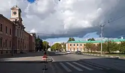
Timiryazevsky District
Timiryazevsky District (Russian: Тимирязевский райо́н) is an administrative district (raion) of Northern Administrative Okrug, and one of the 125 raions of Moscow, Russia.[4] The district is known for its public parks - Timiryazavsky Park and the Dubki Park - and the Timiryazev Agricultural Academy. The total area of the district is 10.43 square kilometers (4.03 sq mi).[1] Population: 82,800 (2017 est.)
Timiryazevsky District
Тимирязевский район | |
|---|---|
 Timiryazev Agricultural Academy, Timiryazevsky District | |
.png.webp) Flag .png.webp) Coat of arms | |
Location of Timiryazevsky District on the map of Moscow | |
| Coordinates: 55°49′13″N 37°33′36″E | |
| Country | Russia |
| Federal subject | Moscow |
| Area | |
| • Total | 10.43 km2 (4.03 sq mi) |
| Population | |
| • Estimate (2018)[2] | 83,641 |
| Time zone | UTC+3 (MSK |
| OKTMO ID | 45346000 |
| Website | https://timiryazevskiy.mos.ru/ |
History
Timiryazavsky Park is near the site of the Petrovsko-Razumovskoye estate. The estate was the ancestral home of the Shuysky family, sold to the Naryshkin family in 1676 and passed to Peter the Great in 1705 and became known as 'Petrovsky'.[5] It was owned by the Razumovsky Family in the 18th and 19th centuries.[6] On the grounds was built the Razumovsky Palace, the architect of which was Nicholas Benois. 1n 1861, the palace became the home of the Petrovsky Agricultural and Forestry Academy, today the Timiryazev Agricultural Academy.[5]
The academy, and the district, are named for Kliment Timiryazev, a botanist who established a faculty and laboratory of vegetable physiology at the Petrovsky Academy.[5] The academy houses several museums open to the public, including what the district government calls 'the only horse-breeding museum in the world'.[7]
See also
References
Notes
- "General Information" (in Russian). Timiryazevsky District. Retrieved February 5, 2018.
- "26. Численность постоянного населения Российской Федерации по муниципальным образованиям на 1 января 2018 года". Federal State Statistics Service. Retrieved 23 January 2019.
- "Об исчислении времени". Официальный интернет-портал правовой информации (in Russian). 3 June 2011. Retrieved 19 January 2019.
- Государственный комитет Российской Федерации по статистике. Комитет Российской Федерации по стандартизации, метрологии и сертификации. №ОК 019-95 1 января 1997 г. «Общероссийский классификатор объектов административно-территориального деления. Код 45», в ред. изменения №278/2015 от 1 января 2016 г.. (State Statistics Committee of the Russian Federation. Committee of the Russian Federation on Standardization, Metrology, and Certification. #OK 019-95 January 1, 1997 Russian Classification of Objects of Administrative Division (OKATO). Code 45, as amended by the Amendment #278/2015 of January 1, 2016. ).
- A History of Russian Forestry and Its Leaders. DIANE Publishing. 1998. ISBN 9780788184956. Retrieved February 22, 2018.
- "Timiryazevsky Public Park". Moscow Info. Retrieved February 22, 2018.
- "History of the District" (in Russian). District of Timiryazevsky. Retrieved February 22, 2018.
External links
- [Timiryazevsky Public Park http://www.moscow.info/parks/timiryazevsky-park.aspx]