Todarpur, Hardoi
Todarpur, also spelled Tondarpur, is a village and corresponding community development block in Shahabad tehsil of Hardoi district, Uttar Pradesh, India.[2] The village has several schools and one clinic.[2] It hosts neither a haat nor a mandi (regular market).[2] The staple crops here are wheat and rice.[3] As of 2011, its population is 3,846, in 603 households.[2]
Todarpur
Tondarpur | |
|---|---|
Populated place | |
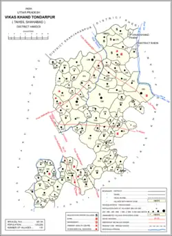 Map showing Todarpur (#366) in Todarpur CD block | |
 Todarpur Location in Uttar Pradesh, India  Todarpur Todarpur (India) | |
| Coordinates: 27.555476°N 80.025084°E[1] | |
| Country | |
| State | Uttar Pradesh |
| District | Hardoi |
| Area | |
| • Total | 4.282 km2 (1.653 sq mi) |
| Population (2011)[2] | |
| • Total | 3,846 |
| • Density | 900/km2 (2,300/sq mi) |
| Languages | |
| • Official | Hindi |
| Time zone | UTC+5:30 (IST) |
The village is the site of an old Thathera khera, and was historically the seat of the Onai branch of the Chamar Gaurs.[4]
Demographic history
The 1961 Census recorded Todarpur as comprising 3 hamlets and having a population of 1,532 (853 male and 679 female), in 282 households and 208 physical houses.[5]
The 1981 Census recorded Todarpur as having an area of 433.43 hectares and having a population of 2,088 people, in 449 households.[3]
Villages
Todarpur CD block has the following 115 villages:[2]
| Village name | Total land area (hectares) | Population (in 2011) |
|---|---|---|
| Karsua Grant | 520.5 | 2,224 |
| Lona | 342 | 1,906 |
| Kanhrapur | 66.9 | 435 |
| Chaina | 450 | 2,186 |
| Nagaria | 270.1 | 2,178 |
| Koochi Khera | 303.4 | 1,639 |
| Alam Nagar | 911.7 | 4,928 |
| Bhogipur Grant | 273.5 | 1,716 |
| Saharua | 286.8 | 1,406 |
| Para | 723.1 | 2,967 |
| Karawan | 1,018.9 | 5,339 |
| Pistia | 126 | 1,188 |
| Parsai | 664.7 | 3,877 |
| Kapoorpur | 33.1 | 936 |
| Gauria | 161.5 | 808 |
| Gaurawa | 156.1 | 1,131 |
| Banjaria | 266 | 764 |
| Basbherwa Rawat | 83.8 | 740 |
| Basbheria | 142.1 | 1,188 |
| Setha | 398.1 | 2,377 |
| Semrawan | 335.1 | 2,141 |
| Kumharua | 158.2 | 793 |
| Kusuma | 513.6 | 2,812 |
| Manjhila | 1,435.9 | 6,866 |
| Sarai Ranak | 440.8 | 1,656 |
| Jamura | 945.4 | 8,948 |
| Palia Kot | 235 | 1,271 |
| Palia Deo Salempur | 304 | 1,635 |
| Jamalpur | 117.7 | 1,004 |
| Fattepur Gazi | 745.7 | 4,049 |
| Ulnapur | 275.4 | 594 |
| Terhwa Caturpur | 164.4 | 694 |
| Tumurki | 550.2 | 8,429 |
| Haidarpur | 71.7 | 1,127 |
| Khumaripur | 237.2 | 897 |
| Haibatpur | 107.9 | 669 |
| Raigavan | 264.5 | 2,157 |
| Barela | 194.6 | 750 |
| Burhanpur | 274.2 | 1,209 |
| Pedhwan | 282.5 | 2,172 |
| Sarai Pengu | 110.1 | 620 |
| Fatehpur Gayand | 633 | 3,635 |
| Hathipur | 114.8 | 942 |
| Kathma | 261 | 2,015 |
| Baharma Hashimpur | 242.6 | 825 |
| Rebha Muradpur | 111.1 | 1,565 |
| Loni | 281.7 | 2,784 |
| Nagla Bhagwan | 228.1 | 1,141 |
| Anjhi | 661.8 | 2,857 |
| Milkia | 47.8 | 359 |
| Ratanpur | 158.9 | 390 |
| Andaua | 180.4 | 1,365 |
| Reori | 247.2 | 944 |
| Dighia | 212 | 899 |
| Jalalpur | 135.6 | 590 |
| Husainapur Diwani | 110.4 | 576 |
| Singoha | 467.4 | 3,682 |
| Dhara,pur | 165.7 | 987 |
| Chathia | 687.1 | 3,189 |
| Dhanwar | 650.6 | 3,924 |
| Aureri | 90 | 1,258 |
| Antora | 277.6 | 1,196 |
| Newada Chathiya | 153.4 | 1,175 |
| Barkhera | 78.8 | 436 |
| Kuiyan | 212.7 | 456 |
| Ayari | 293.1 | 2,727 |
| Urli | 145.9 | 855 |
| Kaimi | 195.7 | 1,407 |
| Dhakia | 192.7 | 977 |
| Chak Dhakia | 59.2 | 469 |
| Tara Gaon | 256 | 1,331 |
| Karaundi | 149.1 | 341 |
| Teor | 168.6 | 644 |
| Shekhapur | 75 | 621 |
| Pilapur | 105.1 | 527 |
| Nagla Nanhoo | 85.4 | 515 |
| Shiroman Nagar | 395.1 | 3,380 |
| Daud Nagar | 80.2 | 81 |
| Husainpur Karmayan | 101.6 | 2,780 |
| Humaunpur | 163.6 | 1,024 |
| Alavalpur | 73.2 | 0 |
| Surjipur | 312 | 2,989 |
| Bakar Nagar | 135.4 | 172 |
| Rupapur | 228 | 591 |
| Jasrathpur | 220.9 | 1,364 |
| Bhadevna | 481 | 2,590 |
| Bhadevni | 118.7 | 638 |
| Rasoolpur | 68.2 | 363 |
| Dharampur | 43.7 | 0 |
| Amirta | 82.1 | 974 |
| Faizullapur | 162.8 | 707 |
| Baraunia | 111.8 | 578 |
| Kapoorpur Bahoran | 127.1 | 775 |
| Todarpur | 428.2 | 3,846 |
| Kothila Shraiya | 251.4 | 1,774 |
| Bari | 139.2 | 1,186 |
| Bakshipur | 155.8 | 1,086 |
| Saidpur | 364.2 | 2,126 |
| Sikandarpur Bazar | 513.1 | 3,204 |
| Umrauli | 493.3 | 2,761 |
| Pothwa | 164.6 | 585 |
| Kankohri | 52.8 | 0 |
| Lalpur | 65.1 | 377 |
| Peera Mahua | 287.9 | 1,229 |
| Beehat | 157.6 | 1,114 |
| Nevada Satan | 68.1 | 182 |
| Mohauddinpur | 186.9 | 1,300 |
| Madnapur | 27.8 | 0 |
| Raipur | 42.4 | 375 |
| Salempur | 75.3 | 1,163 |
| Kamalpur | 329.5 | 1,635 |
| Deomalpur | 66.6 | 255 |
| Masfana | 168.1 | 948 |
| Binnha | 85.9 | 697 |
| Kapoorpur Shahzade | 57 | 347 |
References
- "GeoNames Search". geonames.nga.mil. Archived from the original on 12 April 2014. Retrieved 20 May 2023.
- "Census of India 2011: Uttar Pradesh District Census Handbook - Hardoi, Part A (Village and Town Directory)" (PDF). Census 2011 India. pp. 99–123. Retrieved 18 May 2021.
- Census 1981 Uttar Pradesh: District Census Handbook Part XIII-A: Village & Town Directory, District Hardoi (PDF). 1982. pp. 74–5. Retrieved 19 May 2021.
- Nevill, H.R. (1904). Hardoi - A Gazetteer. Allahabad: Government Press. pp. 258–74. Retrieved 18 May 2021.
- Census 1961: District Census Handbook, Uttar Pradesh (36 - Hardoi District) (PDF). Lucknow. 1965. pp. xxvii-xxviii of section "Shahabad Tahsil". Retrieved 19 May 2021.
{{cite book}}: CS1 maint: location missing publisher (link)