Tongzhou District, Nantong
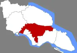
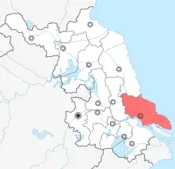
Tongzhou District (simplified Chinese: 通州区; traditional Chinese: 通州區; pinyin: Tōngzhōu Qū), formerly known as Tongzhou City (1993-2009) or Nantong County (1912-1993), is one of three urban districts of Nantong, Jiangsu province, China. It was a county-level city under the administration of Nantong until July 2009, when it became a district of Nantong. As of 2010, Tongzhou had a population of 1,246,400.
Tongzhou
通州区 Tungchow | |
|---|---|
 Tongzhou in Nantong | |
 Nantong in Jiangsu | |
| Coordinates: 32°03′51″N 121°04′30″E | |
| Country | People's Republic of China |
| Province | Jiangsu |
| Prefecture-level city | Nantong |
| Area | |
| • Total | 906 km2 (350 sq mi) |
| Population (2019) | |
| • Total | 1,675,000 |
| • Density | 1,800/km2 (4,800/sq mi) |
| Time zone | UTC+8 (China Standard) |
| Postal code | 101149, 101100 |
History
The district takes its name from its former position as the capital of Tongzhou, a prefecture of imperial China. Under the southern Song dynasty, the city controlled not just its adjacent lands but also Xisha and Dongsha, the Yangtze River shoals that eventually developed into Chongming Island.[1]
Shigang Town is located beside the Yangtze where residents made a living mainly by salt making and fishing in ancient times. In 860, Yuhuangdian (玉皇殿) was built and, six year later, the palace of Emperor Taizong of the Tang was rebuilt as the Guangyuan Temple. From the Song to the Qing dynasties, many temples were built in Shigang.[2]
Administrative divisions
At present, Tongzhou District has 19 towns.[3]
- 19 towns
|
|
Climate
| Climate data for Tongzhou (1991–2020 normals) | |||||||||||||
|---|---|---|---|---|---|---|---|---|---|---|---|---|---|
| Month | Jan | Feb | Mar | Apr | May | Jun | Jul | Aug | Sep | Oct | Nov | Dec | Year |
| Average high °C (°F) | 7.4 (45.3) |
9.5 (49.1) |
13.9 (57.0) |
20.0 (68.0) |
25.3 (77.5) |
28.0 (82.4) |
32.0 (89.6) |
31.5 (88.7) |
27.7 (81.9) |
22.7 (72.9) |
16.8 (62.2) |
10.2 (50.4) |
20.4 (68.8) |
| Daily mean °C (°F) | 3.4 (38.1) |
5.2 (41.4) |
9.2 (48.6) |
14.8 (58.6) |
20.2 (68.4) |
23.9 (75.0) |
28.0 (82.4) |
27.7 (81.9) |
23.6 (74.5) |
18.2 (64.8) |
12.3 (54.1) |
5.8 (42.4) |
16.0 (60.9) |
| Average low °C (°F) | 0.5 (32.9) |
1.9 (35.4) |
5.6 (42.1) |
10.6 (51.1) |
16.1 (61.0) |
20.7 (69.3) |
24.9 (76.8) |
24.8 (76.6) |
20.3 (68.5) |
14.4 (57.9) |
8.6 (47.5) |
2.5 (36.5) |
12.6 (54.6) |
| Average precipitation mm (inches) | 57.6 (2.27) |
51.5 (2.03) |
75.1 (2.96) |
69.6 (2.74) |
82.5 (3.25) |
193.9 (7.63) |
191.6 (7.54) |
179.9 (7.08) |
111.3 (4.38) |
58.2 (2.29) |
58.0 (2.28) |
39.6 (1.56) |
1,168.8 (46.01) |
| Average precipitation days (≥ 0.1 mm) | 9.6 | 9.3 | 10.8 | 10.1 | 10.9 | 12.5 | 13.1 | 12.0 | 9.6 | 7.4 | 8.7 | 7.4 | 121.4 |
| Average snowy days | 2.6 | 2.3 | 0.6 | 0 | 0 | 0 | 0 | 0 | 0 | 0 | 0.2 | 0.6 | 6.3 |
| Average relative humidity (%) | 76 | 76 | 75 | 74 | 75 | 81 | 82 | 83 | 81 | 77 | 77 | 75 | 78 |
| Mean monthly sunshine hours | 122.2 | 124.0 | 151.8 | 175.1 | 182.2 | 129.8 | 174.6 | 194.3 | 168.8 | 168.7 | 137.6 | 138.3 | 1,867.4 |
| Percent possible sunshine | 38 | 40 | 41 | 45 | 43 | 31 | 40 | 48 | 46 | 48 | 44 | 45 | 42 |
| Source: China Meteorological Administration[4][5] | |||||||||||||
Local specialities
- Xiting Crackers (西亭脆饼)
- BBoss Beer (大富豪啤酒)
- Mahogany Carvings (红木雕刻)
- Zhengchang Bacon (正场熏肉)
- Xinzhong Fermented bean curd (新中乳腐)
Transport
References
- "Chongming County" in the Encyclopedia of Shanghai, pp. 50 ff. Archived 2015-01-10 at the Wayback Machine Shanghai Scientific & Technical Publishers (Shanghai), 2010. Hosted by the Municipality of Shanghai.
- "无标题页". Archived from the original on 2012-04-26. Retrieved 2011-11-30.
- "南通市-行政区划网 www.xzqh.org" (in Chinese). XZQH. Retrieved 2012-05-24.
- 中国气象数据网 – WeatherBk Data (in Simplified Chinese). China Meteorological Administration. Retrieved 12 August 2023.
- 中国气象数据网 (in Simplified Chinese). China Meteorological Administration. Retrieved 12 August 2023.
External links
- (in English and Chinese) "Illustrated Album of Yangzhou Prefecture", from 1573 to 1620, has illustrations of Tongzhou