Torbat-e Heydarieh County
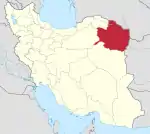
Torbat-e Heydarieh County (Persian: شهرستان تربت حیدریه, Šahrestâne Torbate Heydarie) is in Razavi Khorasan province, Iran. Its capital is the city of Torbat-e Heydarieh.
Torbat-e Heydarieh County
Persian: شهرستان تربت حیدریه | |
|---|---|
County | |
 Harvesting saffron, the main agricultural product of this county | |
.svg.png.webp) Location of Torbat-e Heydarieh County in Razavi Khorasan province | |
 Location of Razavi Khorasan province in Iran | |
| Coordinates: 35°25′N 59°09′E[1] | |
| Country | |
| Province | Razavi Khorasan |
| Capital | Torbat-e Heydarieh |
| Districts | Central, Bayg, Jolgeh Rokh, Kadkan |
| Area | |
| • Total | 3,681 km2 (1,421 sq mi) |
| Population (2016)[2] | |
| • Total | 224,626 |
| • Density | 61/km2 (160/sq mi) |
| Time zone | UTC+3:30 (IRST) |
| Torbat-e Heydarieh County at GEOnet Names Server | |
At the 2006 census, the county's population was 261,917, in 67,735 households.[3] The following census in 2011 counted 210,390 people in 60,777 households, by which time Jolgeh Zaveh District had been separated from the county to form Zaveh County.[4] At the 2016 census, Torbat-e Heydarieh County's population was 224,626 in 68,927 households.[2]
Torbat-e Heydarieh County is 1005 km away from Tehran, and in a mountainous region on the skirt of mountains having different weather in different areas. In the past, this city was called Zaveh. According to a narrative in the 13th century, Sheikh Haydar, a famous Gnostic, was living there. The change of its name from Zaveh to Torbat-e Heydarieh is related to the life and tomb of this great Gnostic. The existing cultural heritage belongs to Sasanian times and the 13th century: Bazeh Hovar and Robat Sefid temple, Ghotb-e-dinn Haydar, Sheikh Haydar, Sheikh Abolghasema, and Shoh Senjan tombs.
Administrative divisions
The population history and structural changes of Torbat-e Heydarieh County's administrative divisions over three consecutive censuses are shown in the following table. The latest census shows four districts, eight rural districts, and four cities.[2]
| Administrative Divisions | 2006[3] | 2011[4] | 2016[2] |
|---|---|---|---|
| Central District | 150,643 | 166,313 | 179,084 |
| Bala Velayat RD | 20,908 | 24,381 | 27,133 |
| Pain Velayat RD | 10,375 | 10,782 | 11,932 |
| Torbat-e Heydarieh (city) | 119,360 | 131,150 | 140,019 |
| Bayg District | 8,327 | 7,161 | 6,937 |
| Bayg RD | 4,367 | 3,584 | 3,392 |
| Bayg (city) | 3,960 | 3,577 | 3,545 |
| Jolgeh Rokh District | 24,886 | 24,705 | 25,748 |
| Bala Rokh RD | 7,483 | 7,565 | 7,825 |
| Miyan Rokh RD | 5,903 | 6,162 | 5,686 |
| Pain Rokh RD | 10,156 | 9,257 | 10,686 |
| Nasar (city)1 | |||
| Robat-e Sang (city) | 1,344 | 1,721 | 1,551 |
| Jolgeh Zaveh District2 | 66,206 | ||
| Safaiyeh RD | 12,711 | ||
| Soleyman RD | 27,332 | ||
| Zaveh RD | 17,423 | ||
| Dowlatabad (city) | 8,740 | ||
| Kadkan District | 11,855 | 12,031 | 12,805 |
| Kadkan RD | 5,107 | 5,147 | 5,941 |
| Roqicheh RD | 3,582 | 3,096 | 3,145 |
| Kadkan (city) | 3,166 | 3,788 | 3,719 |
| Total | 261,917 | 210,390 | 224,626 |
| RD: Rural District 1Became a city after the 2016 census[5] 2Became a part of Zaveh County | |||
References
- OpenStreetMap contributors (9 May 2023). "Torbat-e Heydarieh County" (Map). OpenStreetMap. Retrieved 9 May 2023.
- "Census of the Islamic Republic of Iran, 1395 (2016)". AMAR (in Persian). The Statistical Center of Iran. p. 09. Archived from the original (Excel) on 2 April 2022. Retrieved 19 December 2022.
- "Census of the Islamic Republic of Iran, 1385 (2006)". AMAR (in Persian). The Statistical Center of Iran. p. 09. Archived from the original (Excel) on 20 September 2011. Retrieved 25 September 2022.
- "Census of the Islamic Republic of Iran, 1390 (2011)" (Excel). Iran Data Portal (in Persian). The Statistical Center of Iran. p. 09. Retrieved 19 December 2022.
- "Approval letter regarding country divisions in Torbat Heydarieh County, Razavi Khorasan province". RRK (in Persian). Ministry of Interior. Archived from the original on 30 April 2021. Retrieved 9 May 2023.
