Shire of Towong
The Shire of Towong is a local government area in the Hume region of Victoria, Australia, located in the north-east part of the state. It covers an area of 6,675 square kilometres (2,577 sq mi) and in June 2018 had a population of 6,054.[1]
| Shire of Towong Victoria | |||||||||||||||
|---|---|---|---|---|---|---|---|---|---|---|---|---|---|---|---|
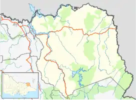
 Location in Victoria | |||||||||||||||
| Population | 6,054 (2018)[1] | ||||||||||||||
| • Density | 0.90697/km2 (2.3490/sq mi) | ||||||||||||||
| Established | 1994 | ||||||||||||||
| Gazetted | 18 November 1994[2] | ||||||||||||||
| Area | 6,675 km2 (2,577.2 sq mi)[1] | ||||||||||||||
| Mayor | Andrew Whitehead | ||||||||||||||
| Council seat | Tallangatta | ||||||||||||||
| Region | Hume | ||||||||||||||
| State electorate(s) | Benambra | ||||||||||||||
| Federal division(s) | Indi | ||||||||||||||
| Website | Shire of Towong | ||||||||||||||
| |||||||||||||||
It includes the towns of Corryong, Tallangatta, Cudgewa, Bethanga, Bellbridge, Walwa, Tintaldra and Towong. It was formed in 1994 from the amalgamation of the Shire of Tallangatta and Shire of Upper Murray.[2]
The Shire is governed and administered by the Towong Shire Council; its seat of local government and administrative centre is located at the council headquarters in Tallangatta, it also has a service centre located in Corryong. The Shire is named after an earlier shire, the Shire of Towong (1874–1920), which occupied the same region as the current LGA.
Council
Current composition
The council is composed of five councillors elected to represent an unsubdivided municipality.[3]
| Ward | Councillor | Notes | |
|---|---|---|---|
| Unsubdivided | David Wortmann | Mayor | |
| Aaron Scales | |||
| Jennifer Star | |||
| Peter Tolsher | |||
| Andrew Whitehead | |||
Administration and governance
The council meets in the council chambers at the council headquarters in the Tallangatta Municipal Offices, which is also the location of the council's administrative activities. It also provides customer services at both its administrative centre in Tallangatta, and its service centre in Corryong.
Townships and localities
The 2021 census, the shire had a population of 6,223 up from 5,985 in the 2016 census[4]
| Population | ||
|---|---|---|
| Locality | 2016 | 2021 |
| Bellbridge | 370 | 393 |
| Berringama | 37 | 35 |
| Bethanga | 471 | 485 |
| Biggara | 49 | 61 |
| Bullioh | 75 | 63 |
| Bungil | 11 | 0 |
| Burrowye | 43 | 24 |
| Colac Colac | 51 | 61 |
| Corryong | 1,348 | 1,352 |
| Cudgewa | 261 | 254 |
| Population | ||
|---|---|---|
| Locality | 2016 | 2021 |
| Dartmouth | 104 | 130 |
| Eskdale | 242 | 238 |
| Georges Creek | 62 | 75 |
| Granya | 99 | 88 |
| Guys Forest | 18 | 20 |
| Jarvis Creek | 43 | 46 |
| Koetong | 20 | 26 |
| Lucyvale | 28 | 25 |
| Mitta Mitta | 171 | 171 |
| Population | ||
|---|---|---|
| Locality | 2016 | 2021 |
| Mount Alfred | 26 | 39 |
| Nariel Valley^ | 90 | 87 |
| Old Tallangatta | 35 | 45 |
| Pine Mountain | 34 | 32 |
| Shelley | 7 | 5 |
| Talgarno | 219 | 245 |
| Tallandoon | 79 | 92 |
| Tallangatta | 1,082 | 1,175 |
| Tallangatta East | 56 | 39 |
| Population | ||
|---|---|---|
| Locality | 2016 | 2021 |
| Tallangatta South | 139 | 142 |
| Tallangatta Valley | 202 | 194 |
| Thologolong | 11 | 22 |
| Thowgla Valley | 82 | 70 |
| Tintaldra | 60 | 66 |
| Tom Groggin | 0 | 7 |
| Towong | 132 | 143 |
| Towong Upper | 34 | 37 |
| Walwa | 177 | 191 |
^ - Territory divided with another LGA
See also
References
- "3218.0 – Regional Population Growth, Australia, 2017-18: Population Estimates by Local Government Area (ASGS 2018), 2017 to 2018". Australian Bureau of Statistics. Australian Bureau of Statistics. 27 March 2019. Retrieved 25 October 2019. Estimated resident population, 30 June 2018.
- Victoria Government Gazette – Online Archive (1837–1997). "S87 of 1994: Order estg (Part 2) the Shire of Towong". State Library of Victoria. State Government of Victoria (published 18 November 1994). p. 3. Retrieved 10 January 2014.
- Local Government in Victoria. "Towong Shire Council". Department of Transport, Planning and Local Infrastructure. State Government of Victoria. Retrieved 12 January 2017.
- "Census | Australian Bureau of Statistics". www.abs.gov.au. 11 January 2023.
External links
 Media related to Shire of Towong at Wikimedia Commons
- Towong Shire Council official website
- Metlink local public transport map
- Link to Land Victoria interactive maps
Localities in the Shire of Towong | ||
|---|---|---|
| Town |
|  |
| Locality |
| |
^ - Territory divided with another LGA | ||