Trent, Oregon
Trent is an unincorporated community and census-designated place (CDP) in Lane County, Oregon, United States. It was first listed as a CDP prior to the 2020 census.[3]
Trent, Oregon | |
|---|---|
 Trent  Trent | |
| Coordinates: 43°56′32″N 122°51′31″W | |
| Country | United States |
| State | Oregon |
| County | Lane |
| Area | |
| • Total | 1.61 sq mi (4.18 km2) |
| • Land | 1.58 sq mi (4.10 km2) |
| • Water | 0.03 sq mi (0.08 km2) |
| Elevation | 610 ft (190 m) |
| Population | |
| • Total | 339 |
| • Density | 214.02/sq mi (82.63/km2) |
| Time zone | UTC-8 (Pacific (PST)) |
| • Summer (DST) | UTC-7 (PDT) |
| ZIP Code | 97431 (Dexter) |
| Area code(s) | 541/458 |
| FIPS code | 41-74550 |
| GNIS feature ID | 2812887[3] |
The CDP is in central Lane County, along Rattlesnake Creek, a north-flowing tributary of the Middle Fork Willamette River. The Middle Fork forms the northeast boundary of the CDP. Oregon Route 58 runs through the southern part of Trent, leading northwest 14 miles (23 km) to Eugene, the county seat. To the southeast, Route 58 immediately passes through Dexter and leads 27 miles (43 km) to Oakridge.
References
- "ArcGIS REST Services Directory". United States Census Bureau. Retrieved October 12, 2022.
- "Census Population API". United States Census Bureau. Retrieved October 12, 2022.
- "Trent Census Designated Place". Geographic Names Information System. United States Geological Survey, United States Department of the Interior.
- "Census of Population and Housing". Census.gov. Retrieved June 4, 2016.
Municipalities and communities of Lane County, Oregon, United States | ||
|---|---|---|
| Cities | 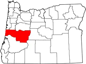 Lane County map | |
| CDPs | ||
| Other communities |
| |
| Ghost towns | ||
| Indian reservation | ||
| Footnotes | ‡This populated place also has portions in an adjacent county or counties | |
This article is issued from Wikipedia. The text is licensed under Creative Commons - Attribution - Sharealike. Additional terms may apply for the media files.