Troy–Waterford Bridge
The Troy–Waterford Bridge carries U.S. Route 4 across the Hudson River in New York connecting Waterford with Troy. The bridge is two lanes wide, with sidewalks on both sides. The bridge serves as a replacement for the 1804-built Union Bridge, which burned on July 10, 1909.[3]
Troy–Waterford Bridge | |
|---|---|
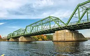 Troy–Waterford Bridge in October 2009 | |
| Coordinates | 42°47′19.32″N 73°40′25.92″W |
| Carries | |
| Crosses | Hudson River |
| Locale | Waterford, Saratoga County and Troy, Rennsselaer County, both in New York, United States |
| Characteristics | |
| Design | Truss bridge |
| Total length | 742.8 feet (226.4 m)[1] |
| Longest span | 193.9 feet (59.1 m)[1] |
| Clearance above | 15.4 feet (4.7 m)[2] |
| History | |
| Opened | 1909[1] |
| Statistics | |
| Daily traffic | 12,435 (2007)[2] |
| Location | |
The Waterford Bridges, which include the current bridge and the original 1804 bridge, were designated as a National Historic Civil Engineering Landmark by the American Society of Civil Engineers in 2013.[4][5]
The Troy-Waterford Bridge uses the same piers as the original 1804 bridge,[6] and if that bridge is counted, it was the first bridge across the Hudson River south of the Adirondacks. At first it carried pedestrians and horse drawn vehicles, but a railroad track was added to it when the locomotive was invented. The current bridge has no railroad tracks.
See also
References
- Troy-Waterford Bridge at Structurae
- Troy-Waterford Bridge on BridgeHunter
- "Troy Union Bridge Burned" (PDF). The New York Times. July 11, 1909. Retrieved April 17, 2021.
- Williams, Stephen (September 4, 2013). "Waterford bridge to get landmark designation". The Daily Gazette. Schenectady, New York. Retrieved April 17, 2021.
- "Waterford Bridges Historical Marker". The Historical Marker Database. Retrieved April 17, 2021.
- https://dailygazette.com/2013/09/04/waterford-bridge-get-landmark-designation/
Crossings of the Hudson River | ||||
|---|---|---|---|---|
| ||||