Melikgazi
Melikgazi, in Byzantine times known as Tzamandos,[2] is a municipality and district of Kayseri Province, Turkey.[3] Its area is 668 km2,[4] and its population is 594,344 (2022).[1] It covers the southern and eastern part of the agglomeration of Kayseri and the adjacent countryside.
Melikgazi | |
|---|---|
District and municipality | |
 Aerial view of Melikgazi | |
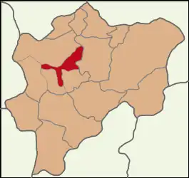 Map showing Melikgazi District in Kayseri Province | |
 Melikgazi Location in Turkey 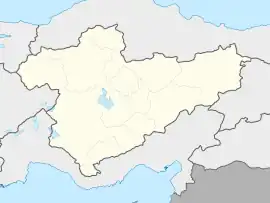 Melikgazi Melikgazi (Turkey Central Anatolia) | |
| Coordinates: 38°43′N 35°30′E | |
| Country | Turkey |
| Province | Kayseri |
| Government | |
| • Mayor | Mustafa Palancıoğlu (AKP) |
| Area | 668 km2 (258 sq mi) |
| Population (2022)[1] | 594,344 |
| • Density | 890/km2 (2,300/sq mi) |
| Time zone | TRT (UTC+3) |
| Area code | 0352 |
| Website | www |
History
The town was originally a border fortress built by the famous Armenian general Melias around the year 909/910.[2][5] In 1065, the town was given among other lands in the region to the last Bagratuni king Gagik II as exchange for him renouncing the kingdom of Armenia.[6]
Ottoman architect Mimar Sinan was born in Melikgazi, in the town of Ağırnas around 1488.
Political structure
The district Melikgazi was created in 1998 from part of the former central district of Kayseri, along with the district Kocasinan.[7][8] At the 2013 Turkish local government reorganisation, the rural part of the district was integrated into the municipality, the villages becoming neighbourhoods.[9] The mayor is Mustafa Palancıoğlu (AKP).
Composition
There are 57 neighbourhoods in Melikgazi District:[10]
- 19 Mayıs
- 30 Ağustos
- Ağırnas
- Alpaslan
- Altınoluk
- Anafartalar
- Anbar
- Aydınlıkevler
- Bağpınar
- Bahçelievler
- Battalgazi
- Becen
- Büyük Bürüngüz
- Cumhuriyet
- Danişmentgazi
- Demokrasi
- Eğribucak
- Erenköy
- Esentepe
- Esenyurt
- Fatih
- Germir
- Gesi Fatih
- Gökkent
- Gültepe
- Gülük
- Gürpınar
- Güzelköy
- Hisarcık
- Hunat
- Hürriyet
- İldem Cumhuriyet
- Kayabağ
- Kazımkarabekir
- Keykubat
- Kılıçaslan
- Kıranardı
- Kocatepe
- Köşk
- Küçükbürüngüz
- Mimarsinan
- Osman Kavuncu
- Osmanlı
- Sakarya
- Sarımsaklı
- Selçuklu
- Selimiye
- Şirintepe
- Subaşı
- Tacettin Veli
- Tavlusun
- Tınaztepe
- Turan
- Vekse
- Yeniköy
- Yeşilyurt
- Yıldırım Beyazıt
References
- "Address-based population registration system (ADNKS) results dated 31 December 2022, Favorite Reports" (XLS). TÜİK. Retrieved 19 September 2023.
- Howard-Johnston, J. D. (2006). East Rome, Sasanian Persia and the End of Antiquity Historiographical and Historical Studies. Ashgate. p. 288. ISBN 9780860789925. Retrieved 9 July 2023.
- Büyükşehir İlçe Belediyesi, Turkey Civil Administration Departments Inventory. Retrieved 19 September 2023.
- "İl ve İlçe Yüz ölçümleri". General Directorate of Mapping. Retrieved 19 September 2023.
- Dédéyan, Gérard (1993). Les Arméniens sur la frontière sud-orientale de Byzance, fin IXe - fin XIe siècles. La Frontière. Séminaire de recherche sous la direction d'Yves Roman. pp. 70–71. ISBN 2-903264-50-3. Retrieved 9 July 2023.
- See Vryonis, Speros (1971), The Decline of Medieval Hellenism in Asia Minor and the Process of Islamization from the eleventh through the Fifteenth Century. Los Angeles pp. 54-55.
- Kanun No. 3508, Resmî Gazete, 14 December 1998.
- "İl İdaresi ve Mülki Bölümler Şube Müdürlüğü İstatistikleri - İl ve İlçe Kuruluş Tarihleri" (PDF) (in Turkish). p. 51. Retrieved 21 September 2023.
- "Law No. 6360". Official Gazette (in Turkish). 6 December 2012.
- Mahalle, Turkey Civil Administration Departments Inventory. Retrieved 19 September 2023.
Melikgazi in Kayseri Province of Turkey | |||||||||||||||||||||||||||
|---|---|---|---|---|---|---|---|---|---|---|---|---|---|---|---|---|---|---|---|---|---|---|---|---|---|---|---|
| Districts |  Districts of Kayseri | ||||||||||||||||||||||||||
| |||||||||||||||||||||||||||
Metropolitan municipalities are bolded. | |||||||||||||||||||||||||||