Special routes of U.S. Route 412
Six special routes of U.S. Route 412 exist.
Special routes of U.S. Route 412 | |
|---|---|
| Highway system | |
Eastern Oklahoma alternate route
U.S. Highway 412 Alternate | |
|---|---|
| Location | Locust Grove–West Siloam Springs, Oklahoma |
| Length | 33.81 mi[1] (54.41 km) |

U.S. Route 412 Alternate (formerly Scenic US-412) is a special route of U.S. Route 412 in eastern Oklahoma. It serves as a free bypass route to the toll Cherokee Turnpike, which carries US-412.
It begins about 7 miles (11 km) east of Chouteau near Locust Grove and ends about 12 miles (19 km) west of West Siloam Springs near Kansas.
![]()
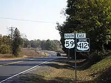
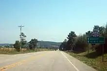
![]() Alternate US-412 was marked as "Scenic US-412" prior to 2012. This was one of only two scenic special routes in the country, the other being U.S. Route 40 Scenic in Maryland. Maps usually still marked the road as "Alternate US-412", however. Scenic US-412 was originally part of State Highway 11 and later State Highway 33.
Alternate US-412 was marked as "Scenic US-412" prior to 2012. This was one of only two scenic special routes in the country, the other being U.S. Route 40 Scenic in Maryland. Maps usually still marked the road as "Alternate US-412", however. Scenic US-412 was originally part of State Highway 11 and later State Highway 33.
Hindsville business route
U.S. Highway 412B | |
|---|---|
| Location | Hindsville, Arkansas |
| Length | 2.65 mi[2] (4.26 km) |
| Existed | 2007–present |

US Route 412 Business (US 412B) is a business route of 2.65 miles (4.26 km) in Hindsville, Arkansas.[2] The route has its northern terminus is at US 412/Arkansas Highway 45 north of Hindsville. Posted as US 412B, the route runs through Hindsville, meeting AR 45 south before terminating at US 412 southeast of Hindsville.[3] It was created in 2007 following completion of a 4 lane bypass around the east side of town.[2]
- Major intersections
The entire route is in Madison County.
| Location | mi[2] | km | Destinations | Notes | |
|---|---|---|---|---|---|
| | 0.00 | 0.00 | Southern terminus | ||
| | 0.51 | 0.82 | Begin AR 45 overlap | ||
| | 2.65 | 4.26 | Northern terminus | ||
1.000 mi = 1.609 km; 1.000 km = 0.621 mi
| |||||
Mountain Home business route
US Route 412 Business (US 412B) is a business route of Mountain Home, Arkansas. It follows the former alignment of U.S. Route 412 and U.S. Route 62. It was created when US Route 412 and 62 was relocated onto a 4-lane bypass.
Huntsville business route
U.S. Highway 412B | |
|---|---|
| Location | Huntsville, Arkansas |
| Length | 5.48 mi[2] (8.82 km) |
U.S. Route 412 Business (US 412B) is a business route of 5.48 miles (8.82 km) in Huntsville, Arkansas.[2] The route begins at US 412 west of Huntsville and runs east through town as Main Street. US 412B has a junction with AR 74 before it passes the Madison County Courthouse. The road continues east, forming a concurrency with Arkansas Highway 23 north for 0.5 miles (0.80 km) before the two roads diverge. The highway continues another 1.87 miles (3.01 km) before terminating at US 412 east of Huntsville.[3]
Paragould business route
U.S. Highway 412B | |
|---|---|
| Location | Paragould, Arkansas |
| Length | 6.62 mi[4] (10.65 km) |
| Existed | 2020–present |
U.S. Route 412 Business (US 412B) is a business route of 6.62 miles (10.65 km) in Paragould, Arkansas. It was created in 2020 after US 412 was rerouted onto a bypass of the city and consists of its former alignment through the city's downtown.[4][5] The route begins at US 412 near Paragould's western boundary and runs 4.1 miles (6.6 km) before intersecting the short spur route U.S. Route 49Y (US 49Y) along with U.S. Route 49/Arkansas Highway 1 and forming a concurrency with U.S. Route 49 Business (US 49B), which turns north after approximately 1 mile (1.6 km). The road also meets Arkansas Highway 69 (AR 69) before terminating 1.6 miles (2.6 km) east of the city center at another intersection with US 412.[4][5]
Major intersections
The entire route is in Paragould, Greene County.
| mi[4][5] | km | Destinations | Notes | ||
|---|---|---|---|---|---|
| 0.00 | 0.00 | Western terminus | |||
| 4.19 | 6.74 | Western terminus of US 49Y | |||
| 4.59 | 7.39 | Western end of US 49B concurrency | |||
| 5.59 | 9.00 | Eastern end of US 49B concurrency, western end of AR 135 concurrency | |||
| 5.79 | 9.32 | Northern terminus of AR 69 | |||
| 6.62 | 10.65 | Eastern terminus; eastern end of AR 135 concurrency | |||
1.000 mi = 1.609 km; 1.000 km = 0.621 mi
| |||||
Kennett alternate route
U.S. Route 412 Alternate | |
|---|---|
| Location | Kennett, Missouri |
| Existed | 2015–2015 |
A temporary alternate route was assigned to parts of Route O and Route VV during road construction in converting US 412 into a four lane highway in 2015.[6][7]
Jackson business loop
U.S. Route 412 Business | |
|---|---|
| Location | Jackson, Tennessee |
U.S. Route 412 Business (US 412 Bus.) is a business route in Jackson, Tennessee, that is overlapped with State Route 20 (SR 20). The road runs from US 412 at Exit 79 on Interstate 40 along Hollywood Drive to North Parkway, and later joins an overlap with US-70 at Whitehall Street, until it ends at the eastern terminus of another overlap with US 70/412, just southwest of Exit 87 on I-40.
Columbia business loop
U.S. Route 412 Business | |
|---|---|
| Location | Columbia, Tennessee |
U.S. Route 412 Business (US 412 Bus.) is a business route and former section of mainline US 412 in Columbia, Tennessee. The route begins at the interchange with US 43 and the western terminus of its concurrency with US 412, as Hampshire Pike. State Route 50 (SR 50) intersects the route from Williamsport Pike, and joins the route in a concurrency until after they cross a bridge over Bigby Creek, and SR 50 turns south onto James Campbell Boulevard West. From there, the name of Hampshire Pike becomes West Seventh Street. From there the route runs along the north side of the historic Columbia Arsenal, and several blocks after a railroad crossing it serves as the northern terminus of SR 243. Closer to downtown Columbia, the road becomes line with more historic sites along with some locally notable ones, such as the West Seventh Church of Christ and the Oakes and Nichols Funeral Home, then the NRHP-listed Robert Church House, and across from that the headquarters for WKRM-AM/WKOM-FM. This is followed by the St. Peter's Episcopal Church across from the local Knights of Columbus chapter, and then the James K. Polk Home and Sisters' House across from the Maury County Visitor's Center.
Entering the Columbia Commercial Historic District, West Seventh Street approaches Maury County Courthouse Square, but one block before that street circles around the courthouse, US 412 Bus. joins a northbound concurrency with US 31 (North Garden Street). Beginning at Third Street, US 31/US 412 Bus. curves from straight north to northeast and after the intersection with Tennessee State Route 7 crosses a bridge over Duck River, then curves even more towards the northeast as it becomes the Nashville Highway, a standard four-lane divided commercial strip. US 412 Business ends at the northern terminus of US 43, while US 31 continues north along Tennessee State Route 6, as US 412/SR 99 continues east towards I-65.
References
- Oklahoma Department of Transportation. "State Highway System Log of U.S. Highway 412 Alternate" (PDF).
- Planning and Research Division (2010). "Arkansas Road Log Database". Arkansas State Highway and Transportation Department. Archived from the original (Database) on June 23, 2011. Retrieved June 9, 2011.
- General Highway Map, Madison County, Arkansas (PDF) (Map). 1:62500. Cartography by Planning and Research Division. Arkansas State Highway and Transportation Department. 2010. Retrieved June 25, 2011.
- Arkansas Department of Transportation (2020). State Highway Route and Section Map - Greene County (PDF) (Map). Retrieved February 20, 2021.
- Arkansas State Highway and Transportation Department; U.S. Department of Transportation Federal Highway Administration (2015). General Highway Map - Greene County, Arkansas (PDF) (Map). [1:62500]. Retrieved February 19, 2021.
- Alternate US 412 (Road sign). Junction of Highway W and US 412 in Kennett, Missouri. July 2019. Retrieved August 30, 2021 – via Google Maps.
{{cite sign}}: CS1 maint: location (link) - "MoDOT Holds Public Meeting to Discuss Improvements to Route 412 in Kennett | Missouri Department of Transportation". www.modot.org. Retrieved September 1, 2021.
