U.S. Route 77 in Texas
U.S. Route 77 (US 77) is a major highway that is part of the United States Numbered Highway System that runs from the Veterans International Bridge in Brownsville to Sioux City, Iowa. In Texas, the road runs south-north for 471.3 miles (758.5 km) from the International border with Mexico to the Oklahoma state line north of Gainesville. The highway is being upgraded to a freeway near Corpus Christi to connect to the freeway part of the highway in Raymondville as part of future I-69. A freeway in Robstown is already signed as part of I-69. From Waco to the Oklahoma state line, US 77 overlaps or runs parallel to I-35/I-35E.
U.S. Highway 77 | ||||
|---|---|---|---|---|
| Blue Star Memorial Highway | ||||
US 77 highlighted in red | ||||
| Route information | ||||
| Maintained by TxDOT | ||||
| Length | 471.296 mi[1][lower-alpha 1] (758.477 km) | |||
| Existed | 1927[1]–present | |||
| Major junctions | ||||
| South end | United States-Mexico border in Brownsville | |||
| North end | ||||
| Location | ||||
| Country | United States | |||
| State | Texas | |||
| Counties | Cameron, Willacy, Kenedy, Kleberg, Nueces, San Patricio, Refugio, Victoria, DeWitt, Lavaca, Fayette, Lee, Milam, Falls, McLennan, Hill, Ellis, Dallas, Denton, Cooke | |||
| Highway system | ||||
| ||||

Route description
US 77 crosses the Rio Grande with US 83 on the Veterans International Bridge. The two highways run together concurrent with I-69E until Harlingen. US 83 runs west (north) along I-2 to McAllen while US 77 runs north along with I-69E to Raymondville where the I-69E designated temporarily ends. North of Raymondville, the highway passes through Kenedy County, serving the county seat of Sarita; US 77 is the only state-maintained route to run through the county.
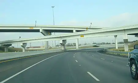
In Robstown, US 77 again picks up the I-69E designation until the interchange with I-37 in north Corpus Christi. US 77 shares a short overlap with I-37 before leaving the highway. US 77 runs through many small to mid-size communities before arriving in Waco. Here, US 77 begins its overlap with I-35 that lasts until Hillsboro, where the highway then parallels I-35E until Red Oak. North of Red Oak, US 77 overlaps I-35E through Dallas, leaving the interstate again in Denton. In Denton, US 77 is a suburban road that serves the downtown area and has an overlap with US 377 in the town, intersecting US 380 near Texas Women's University. After an interchange with Loop 288, US 77 rejoins I-35 in north Denton. US 77 remains concurrent with I-35 through Gainesville then crosses the Red River into Oklahoma.
History
US 77 was designated in 1927 from Gainesville to Corpus Christi. In 1943, the highway was extended south of Corpus Christi to the international border at Brownsville; this extension also rerouted the section of highway between Sinton and Corpus Christi, as the previous route traveled through Gregory between the two towns. In 1953, US 77 was rerouted between Halletsville and Victoria over former SH 295.[2] The section of highway through Victoria was rerouted in 1978 to remove a concurrency with US 59, but this cancelled the following year. In 1997, US 77 was extended so the highway's official designation ran to the Los Tomates International Bridge in Brownsville. In 2000, the city of Denton turned US 77 into a pair of one-ways streets from US 377 to FM 2164, with northbound traffic using Locust Street and southbound traffic using Elm Street. In 2003, the section of US 77 in Robstown between FM 892 and 9th Street was removed the state highway system as construction of a bypass around the town began.
In August 2011, TxDOT received permission from the Federal Highway Administration (FHWA) to designate the Robstown bypass as I-69 due to it already being built to Interstate Highway standards and connecting to another Interstate Highway; the American Association of State Highway and Transportation Officials (AASHTO) approved the designation later that year in October.[3] An official ceremony was held on December 5, 2011 to unveil I-69 signs on the Robstown-Corpus Christi freeway.[4] This section of the highway was later re-designated as I-69E in 2013, though most of the original I-69 signage is still in place.
The section of freeway in the East Rio Grande Valley received approval for Interstate designation in May 2013.[5][6] This section of highway was designated as I-69E as the two other branches of I-69, I-69C and I-69W were also approved.[5] Signage was installed over the summer of 2013.[7]
Future
US 77 from Raymondville to Victoria is planned to be upgraded to I-69E. South of Corpus Christi, US 77 is a freeway around most of Kingsville, with interchanges being constructed at US 77 Bus. and FM 1717 south of the town that would complete the freeway in Kingsville. A short freeway section of US 77 also exists in the town of Bishop, though the Kingsville and Bishop freeways are currently not connected. A bypass of Driscoll was constructed, with the northbound lanes opened to traffic in 2021 while the southbound lanes opened in August 2023.[8]
Between Corpus Christi and Victoria, US 77 is still mostly a divided highway that does not bypass most of the towns it travels through. As of June 2022, Sinton is the only town along this section of US 77 that the highway bypasses. A bypass for Refugio, Texas is planned.[9] Once completed, I-69E will end at I-69W (US 59) in Victoria, with those two Interstates forming I-69.
Major intersections
| County | Location | mi | km | Destinations | Notes | |||
|---|---|---|---|---|---|---|---|---|
| Cameron | Brownsville | 0.0 | 0.0 | Veterans International Bridge at Los Tomates over the Rio Grande south end of US 83 overlap | ||||
| 0.9 | 1.4 | University Boulevard / East Avenue - UT-Brownsville, Texas Southmost College | at-grade intersection | |||||
| overlap; see I-69E | ||||||||
| Kenedy | | 99.6 | 160.3 | Sarita | interchange | |||
| Kleberg | Riviera | 105.8 | 170.3 | |||||
| 105.9 | 170.4 | |||||||
| | 108.7 | 174.9 | ||||||
| | 112.4 | 180.9 | ||||||
| Ricardo | 114.6 | 184.4 | ||||||
| Kingsville | 116.5 | 187.5 | interchange under construction | |||||
| 118.6 | 190.9 | interchange under construction | ||||||
| 119.3 | 192.0 | interchange; south end of freeway; access to CHRISTUS Spohn Hospital | ||||||
| 120.0 | 193.1 | |||||||
| 120.5 | 193.9 | |||||||
| 122.1 | 196.5 | |||||||
| | 123.1 | 198.1 | Sage Road | interchange; southbound exit only; north end of freeway | ||||
| | 124.0 | 199.6 | Embarque | interchange | ||||
| Nueces | Bishop | 126.0 | 202.8 | interchange; south end of freeway | ||||
| | 129.0 | 207.6 | ||||||
| | 130.1 | 209.4 | ||||||
| Driscoll | 132.0 | 212.4 | northbound exit and southbound entrance | |||||
| 134.4 | 216.3 | |||||||
| 136.0 | 218.9 | southbound exit and northbound entrance | ||||||
| | 139.3 | 224.2 | interchange; southern terminus of I-69E | |||||
| overlap; see I-69E | ||||||||
| Corpus Christi | 149.8 | 241.1 | north end of I-69E overlap; south end of I-37 overlap; US 77 south follows exit 14 | |||||
| 150.4 | 242.0 | Sharpsburg Road / Redbird Lane | I-37 exit 15 | |||||
| 152.0 | 244.6 | Labonte Park | I-37 exit 16 | |||||
| San Patricio | | 152.8 | 245.9 | north end of I-37 overlap; US 77 north follows exit 17 | ||||
| Odem | 157.3 | 253.1 | ||||||
| | 159.2 | 256.2 | ||||||
| Sinton | 162.2 | 261.0 | interchange | |||||
| 164.1 | 264.1 | interchange | ||||||
| 165.2 | 265.9 | interchange | ||||||
| 166.0 | 267.2 | interchange | ||||||
| 167.2 | 269.1 | interchange | ||||||
| Refugio | Woodsboro | 183.2 | 294.8 | |||||
| 183.4 | 295.2 | |||||||
| 183.7 | 295.6 | |||||||
| Refugio | 188.5 | 303.4 | ||||||
| 189.9 | 305.6 | |||||||
| | 209.6 | 337.3 | interchange | |||||
| Victoria | | 212.7 | 342.3 | |||||
| Victoria | 223.5 | 359.7 | Exit 7 on I-69/US 59 southbound; interchange; northbound exit and southbound entrance; future I-69 north | |||||
| 224.7 | 361.6 | interchange; south end of US 59 overlap | ||||||
| 227.1 | 365.5 | |||||||
| 228.3 | 367.4 | interchange; north end of US 59 overlap | ||||||
| 232.0 | 373.4 | interchange; south end of freeway | ||||||
| 233.3 | 375.5 | no direct northbound exit (signed at FM 236) | ||||||
| 236.5 | 380.6 | |||||||
| 237.1 | 381.6 | Briggs Boulevard / Nursery Drive | no direct northbound exit | |||||
| 237.3 | 381.9 | Mallette Drive / Invitational Drive | ||||||
| 238.4 | 383.7 | interchange; north end of freeway | ||||||
| | 252.8 | 406.8 | ||||||
| | 254.2 | 409.1 | ||||||
| DeWitt |
No major junctions | |||||||
| Lavaca | | 261.5 | 420.8 | interchange | ||||
| | 268.5 | 432.1 | ||||||
| | 278.4 | 448.0 | ||||||
| Hallettsville | 279.1 | 449.2 | south end of US 90 Alt. overlap | |||||
| 279.7 | 450.1 | north end of US 90 Alt. overlap | ||||||
| 279.9 | 450.5 | |||||||
| | 288.1 | 463.7 | south end of FM 532 overlap | |||||
| | 288.7 | 464.6 | north end of FM 532 overlap | |||||
| Fayette | Schulenburg | 296.2 | 476.7 | |||||
| 296.9 | 477.8 | |||||||
| 297.7 | 479.1 | I-10 exit 674 | ||||||
| | 299.4 | 481.8 | ||||||
| | 302.1 | 486.2 | ||||||
| Swiss Alp | 304.3 | 489.7 | ||||||
| 305.1 | 491.0 | |||||||
| | 307.7 | 495.2 | ||||||
| | 311.9 | 502.0 | ||||||
| La Grange | 313.5 | 504.5 | ||||||
| 314.6 | 506.3 | interchange | ||||||
| | 316.2 | 508.9 | ||||||
| | 320.3 | 515.5 | ||||||
| Warda | 324.6 | 522.4 | ||||||
| Lee | Giddings | 333.5 | 536.7 | |||||
| 333.9 | 537.4 | |||||||
| 334.4 | 538.2 | |||||||
| | 340.1 | 547.3 | ||||||
| | 342.4 | 551.0 | interchange | |||||
| | 346.5 | 557.6 | ||||||
| Lexington | 350.1 | 563.4 | south end of FM 696 overlap | |||||
| 350.4 | 563.9 | north end of FM 696 overlap | ||||||
| 351.7 | 566.0 | |||||||
| Milam | | 364.8 | 587.1 | |||||
| Rockdale | 367.1 | 590.8 | ||||||
| 369.2 | 594.2 | interchange | ||||||
| | 374.9 | 603.3 | ||||||
| | 381.1 | 613.3 | south end of US 190 / SH 36 overlap | |||||
| | 382.0 | 614.8 | ||||||
| Cameron | 384.6 | 619.0 | north end of US 190 / SH 36 overlap | |||||
| Splawn | 389.3 | 626.5 | ||||||
| Ben Arnold | 392.4 | 631.5 | ||||||
| Burlington | 395.5 | 636.5 | ||||||
| Falls | | 397.4 | 639.6 | |||||
| Rosebud | 400.3 | 644.2 | ||||||
| 401.1 | 645.5 | |||||||
| | 402.5 | 647.8 | ||||||
| Travis | 405.0 | 651.8 | south end of FM 431 overlap | |||||
| 405.1 | 651.9 | north end of FM 431 overlap | ||||||
| Lott | 410.1 | 660.0 | ||||||
| | 413.8 | 665.9 | ||||||
| | 415.6 | 668.8 | south end of SH 7 overlap | |||||
| | 416.3 | 670.0 | ||||||
| | 416.6 | 670.5 | interchange; north end of SH 7 overlap | |||||
| Golinda | 422.3 | 679.6 | ||||||
| McLennan | | 424.0 | 682.4 | south end of FM 2643 overlap | ||||
| | 424.1 | 682.5 | north end of FM 2643 overlap | |||||
| Robinson | 425.7 | 685.1 | ||||||
| 428.7 | 689.9 | |||||||
| Waco–Robinson line | 431.5 | 694.4 | interchange | |||||
| Waco | 433.3 | 697.3 | traffic circle | |||||
| 434.0 | 698.5 | |||||||
| 434.5 | 699.3 | south end of I-35 overlap; US 77 south follows exit 334 | ||||||
| see I-35 | ||||||||
| Hill | Hillsboro | 470.7 | 757.5 | north end of I-35 overlap; US 77 north follows exit 370 | ||||
| Carl's Corner | 474.2 | 763.2 | ||||||
| Midway | 477.4 | 768.3 | ||||||
| | 478.4 | 769.9 | ||||||
| Ellis | Milford | 481.3 | 774.6 | south end of FM 308 overlap | ||||
| 481.6 | 775.1 | |||||||
| | 482.3 | 776.2 | north end of FM 308 overlap | |||||
| Italy | 486.7 | 783.3 | ||||||
| Forreston | 492.2 | 792.1 | ||||||
| Nena | 496.9 | 799.7 | ||||||
| Waxahachie | 499.3 | 803.5 | I-35E exit 397 | |||||
| 500.9 | 806.1 | |||||||
| 501.4 | 806.9 | |||||||
| 502.0 | 807.9 | |||||||
| 503.8 | 810.8 | interchange | ||||||
| | 506.6 | 815.3 | ||||||
| Red Oak | 508.9 | 819.0 | ||||||
| 509.4 | 819.8 | south end of I-35E overlap; US 77 south follows exit 408 | ||||||
| see I-35E | ||||||||
| Denton | Denton | 565.3 | 909.8 | north end of I-35E overlap; US 77 north follows exit 464 | ||||
| 567.0 | 912.5 | south end of US 377 overlap | ||||||
| 567.7 | 913.6 | |||||||
| 568.6 | 915.1 | north end of US 377 overlap | ||||||
| 568.7 | 915.2 | |||||||
| 569.3 | 916.2 | |||||||
| 571.5 | 919.7 | interchange | ||||||
| 572.4 | 921.2 | south end of I-35 overlap; US 77 south follows exit 471 | ||||||
| see I-35 | ||||||||
| Cooke | | 605.3 | 974.1 | Oklahoma state line (bridge over Red River) | ||||
| 1.000 mi = 1.609 km; 1.000 km = 0.621 mi | ||||||||
Notes
- The certified mileage given is shorter than the actual mileage as TxDOT considers US77 to be discontinuous at rather than concurrent with Interstate Highways and US Highways with lower numbers.
References
- Transportation Planning and Programming Division (n.d.). "U.S. Highway No. 77". Highway Designation Files. Texas Department of Transportation.
- Transportation Planning and Programming Division (n.d.). "State Highway No. 295". Highway Designation Files. Texas Department of Transportation. Retrieved June 12, 2022.
- "Portion of US 77 Approved as Part of U.S. Interstate System" (Press release). Texas Department of Transportation. Archived from the original on November 2, 2011. Retrieved July 17, 2013.
- Clark, Steve (October 30, 2011). "First I-69 signs going up on U.S. 77 in December". Brownsville Herald. Retrieved July 17, 2013.
- Staff (May 30, 2013). "Interstate 69 Comes to Texarkana and the Valley" (Press release). Alliance for I-69 Texas. Retrieved July 17, 2013.
- Nino, Mark (May 31, 2013). "Texas Transportation Commission Approves Interstate 69 System". Brownsville, TX: KVEO-TV. Retrieved July 17, 2013.
- Janes, Jared (July 15, 2013). "Valley's I-69 signage the latest stop along superhighway dream". The Monitor. Retrieved July 17, 2013.
- "New US 77 mainlanes to open Wednesday around noon, TxDOT says". kiiitv.com. August 16, 2023. Retrieved 2023-08-26.
- "US 77 Woodsboro - Refugio route study". www.txdot.gov. Retrieved 2023-09-03.