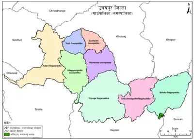
Udayapurgadhi Rural Municipality
Udayapurgadhi Rural Municipality (Nepali: उदयपुरगढी गाउँपालिका) is a rural municipality in Udayapur District of Koshi Province in Nepal. There are 4 rural municipalities in Udayapur District. There are 8 wards in this municipality. According to 2011 census of Nepal, the total population of the municipality is 30,731 and total area is 269.51 km².[1] The headquarter of the municipality is in Panchawati
Udayapurgadhi Gaunpalika
उदयपुरगढी गाउँपालिका | |
|---|---|
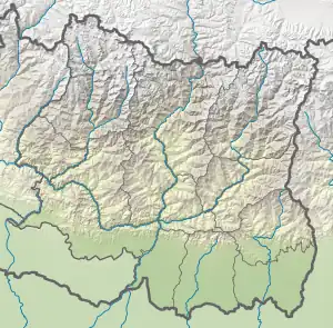 Udayapurgadhi Gaunpalika Location in Koshi Province 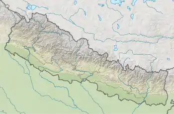 Udayapurgadhi Gaunpalika Udayapurgadhi Gaunpalika (Nepal) | |
| Coordinates: 26°56′00″N 86°31′00″E | |
| Country | |
| Province | Koshi Province |
| District | Udayapur |
| Wards | 8 |
| Established | 10 March 2017 |
| Government | |
| • Type | Rural Council |
| • Chairperson | Mr.Maan Bahadur Kepchaki Magar (CPN (US)) |
| • Vice-chairperson | Mrs.Sanu Raut (NCP) |
| Area | |
| • Total | 269.51 km2 (104.06 sq mi) |
| Population (2011) | |
| • Total | 30,731 |
| • Density | 110/km2 (300/sq mi) |
| Time zone | UTC+5:45 (Nepal Standard Time) |
| Pistal Code | 56300 |
| Area code | 035 |
| Headquarter | Panchawati (The old office of Panchawati Village Development Committee |
| Website | Official Website |
The rural municipality was established on March 10, 2017 when Ministry of Federal Affairs and Local Development dissolved the existing village development committees and announced the establishment of this new local body.
Panchawati, Bhalayadanda, Tawasri, Dumre and Barre VDCs were merged to form the new rural municipality.
Demographics
At the time of the 2011 Nepal census, Udayapurgadhi Rural Municipality had a population of 30,780. Of these, 48.0% spoke Nepali, 26.8% Magar, 16.3% Tamang, 3.8% Rai, 3.1% Chamling, 0.7% Newar, 0.2% Maithili, 0.2% Sherpa, 0.2% Sunwar, 0.1% Wambule and 0.2% other languages as their first language.[2]
In terms of ethnicity/caste, 28.8% were Magar, 17.3% Tamang, 15.8% Chhetri, 10.1% Rai, 6.6% Kami, 5.3% Hill Brahmin, 3.9% Sarki, 3.8% Damai/Dholi, 3.4% Newar, 1.9% Sanyasi/Dasnami, 1.5% Gharti/Bhujel, 0.5% Sunuwar, 0.3% Thakuri, 0.2% Gurung, 0.2% Sherpa, 0.1% Musalman, 0.1% Yadav and 0.4% others.[3]
In terms of religion, 63.9% were Hindu, 28.5% Buddhist, 3.6% Kirati, 3.5% Christian, 0.1% Muslim and 0.4% others.[4]
In terms of literacy, 64.6% could read and write, 3.5% could only read and 31.8% could neither read nor write.[5]
| Wards | Village | Nepali | Population (2011) | Area (km2) |
|---|---|---|---|---|
| 1 | Bwanse | ब्वाँसे | 4,350 | 33.45 |
| 2 | Mansintar Ghata | मान्सिनटार घटा | 2,706 | 16.6 |
| 3 | Jaruwa | जरुवा | 3,176 | 30.87 |
| 4 | Dumre | डुम्रे | 2,357 | 22.44 |
| 5 | Udayapurgadhi | उदयपुरगढी | 4,374 | 36.3 |
| 6 | Nepaltar | नेपालटार | 4,908 | 46.29 |
| 7 | Hadebas | हाडेबास | 5,070 | 46.09 |
| 8 | Naretar | नारेटार | 3,790 | 37.46 |
| Udayapurgadhi | उदयपुरगढी | 30,731 | 269.5 |
External links
References
- "CITY POPULATION – statistics, maps & charts". www.citypopulation.de. 8 October 2017. Retrieved 1 February 2018.
- NepalMap Language
- NepalMap Caste
- NepalMap Religion
- NepalMap Literacy
