Upper Takutu-Upper Essequibo
Upper Takutu-Upper Esequibo (Region 9) is a region of Guyana. Venezuela claims the territory as part of Bolívar (state) in Esequiban Guyana.
Upper Takutu-Upper Essequibo
Region 9 | |
|---|---|
Administrative Region | |
 | |
 Flag | |
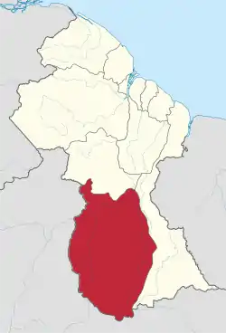 Map of Guyana showing Upper Takutu-Upper Essequibo region | |
| Country | Claimed by |
| Regional Capital | Lethem |
| Area | |
| • Total | 57,750 km2 (22,300 sq mi) |
| Population (2012 census) | |
| • Total | 24,212 |
| • Density | 0.42/km2 (1.1/sq mi) |
| [2] | |
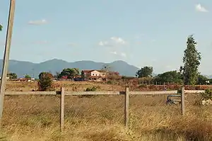
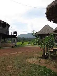
It borders the region of Potaro-Siparuni to the north, the region of East Berbice-Corentyne to the east and Brazil to the south and west. It contains the town of Lethem, and the villages of Aishalton, Nappi and Surama. It is also the largest region of Guyana.
The Rupununi savannah known for its large biodiversity is located between the Rupununi River and the Brazilian border.[3]
Population
The Government of Guyana has administered three official censuses since the 1980 administrative reforms, in 1980, 1991 and 2002.[4] In 2012, the population of Upper Takutu-Upper Essequibo was recorded at 24,212 people.[5] Official census records for the population of the Upper Takutu-Upper Essequibo region are as follows:
- 2012 : 24,212
- 2002 : 19,387
- 1991 : 15,058
- 1980 : 12,873
Communities
List of communities (including name variants):[6]
- Achiwib (Achiwuib Village)
- Aishalton (Aishalton Village, Ishalton)
- Annai (Anwai)
- Apoteri
- Aranaputa
- Awarewaunau (Awaruwaunawa)
- Basha Village (Bashaidrun)
- Dadanawa
- Hiawa
- Kaibarupai Village
- Kanashen (Konashen)
- Karanambo
- Karasabai (Karasabai Village)
- Karaudarnau (Lumid Pau)
- Katoonarib
- Kumu Village
- Kwaimatta (Kwaimatta Village, Kwaiwatta Village, Kwamatta)
- Lethem (Lethen)
- Maruranau (Maruranawa, Marurawaunawa, Marurawaunawa Village)
- Massara (Massara Village)
- Moco-Moco (Moco-Moco Village)
- Nappi
- Parabara
- Parishara (Parishara Village)
- Rewa
- Sand Creek
- Sawariwau
- Shea (Shea Village, Shoa)
- Shulinab (Shulinab Village, Village Shulinab)
- St. Ignatius (Saint Ignatius Mission)
- Surama (Surama Village, Surumatra)
- Tiger Pond Village
- Tipuru (Tipuru Village)
- Toka
- Warimure
- Wichabai
- Wowetta (Woweta, Woweta Village)
- Yakarinta
- Yupukari (Eupukari, Yupukarri)
References
- "Official Announcements". Archived from the original on 8 September 2016. Retrieved 28 July 2016.
- Macmillan Publishers (2009). "Administrative Regions - 8, 9 and 10". Macmillan Junior Atlas: Guyana. Oxford: Macmillan Caribbean. p. 37. ISBN 9780333934173.
- "Guyana's Rupununi Land of Nature, Authentic Culture, and Adventure". Rupununi. Retrieved 19 August 2020.
- Beaie, Sonkarley Tiatun (19 September 2007). "Chapter 3: National Redistribution and Internal Migration" (PDF). 2002 Population and Housing Census - Guyana National Report. Bureau of Statistics. p. 51. Archived from the original (PDF) on 17 February 2012. Retrieved 29 August 2012.
- Beaie, Sonkarley Tiatun (19 September 2007). "National Population Trends: Size, Growth and Distribution" (PDF Download). 2002 Population and Housing Census - Guyana National Report. Bureau of Statistics. p. 25. Retrieved 29 August 2012.
- "2012 Population by Village". Statistics Guyana. Retrieved 8 December 2021.