Ursine, Nevada
Ursine is an unincorporated community and census-designated place in Lincoln County, Nevada, United States. It is located in the foothills of the White Rock Mountains on Eagle Valley about two miles downstream from the Eagle Valley Reservoir and Spring Valley State Park.[2][3] The population was 91 at the 2010 census.[4]
Ursine, Nevada | |
|---|---|
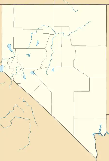 Ursine Location within the state of Nevada | |
| Coordinates: 37°59.15′N 114°12.78′W | |
| Country | United States |
| State | Nevada |
| County | Lincoln |
| Area | |
| • Total | 4.34 sq mi (11.24 km2) |
| • Land | 4.34 sq mi (11.24 km2) |
| • Water | 0.00 sq mi (0.00 km2) |
| Population (2020) | |
| • Total | 62 |
| • Density | 14.28/sq mi (5.51/km2) |
| Time zone | UTC-8 (Pacific (PST)) |
| • Summer (DST) | UTC-7 (PDT) |
| ZIP code | 89043 |
| FIPS code | 32-77200 |
| GNIS feature ID | 0858226 |
A post office was established at Ursine in 1895, and remained in operation until 1959.[5] The community was named after the valley in which it is located.[6]
References
- "ArcGIS REST Services Directory". United States Census Bureau. Retrieved September 19, 2022.
- Caliente, Nevada–Utah, 30x60 Topographic Quad, USGS, 1978
- Wilson Creek Range, Nevada–Utah, 30x60 Topographic Quad, USGS, 1982
- "Geographic Identifiers: 2010 Demographic Profile Data (G001): Ursine CDP, Nevada". U.S. Census Bureau, American Factfinder. Archived from the original on February 12, 2020. Retrieved January 25, 2013.
- U.S. Geological Survey Geographic Names Information System: Ursine Post Office (historical)
- Federal Writers' Project (1941). Origin of Place Names: Nevada (PDF). W.P.A. p. 47.
- "Census of Population and Housing". Census.gov. Retrieved June 4, 2016.
Municipalities and communities of Lincoln County, Nevada, United States | ||
|---|---|---|
| City | 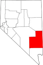 Lincoln County map | |
| CDPs | ||
| Other communities | ||
| Ghost towns | ||
| Proposed communities | ||
| Footnotes | ‡This populated place also has portions in an adjacent county or counties | |
This article is issued from Wikipedia. The text is licensed under Creative Commons - Attribution - Sharealike. Additional terms may apply for the media files.