Uvalda, Georgia
Uvalda is a city in Montgomery County, Georgia, United States. The population was 439 at the 2020 census,[2] down from 598 in 2010. It is part of the Vidalia Micropolitan Statistical Area.
Uvalda, Georgia | |
|---|---|
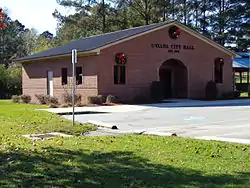 Uvalda City Hall | |
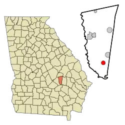 Location in Montgomery County and the state of Georgia | |
| Coordinates: 32°2′16″N 82°30′32″W | |
| Country | United States |
| State | Georgia |
| County | Montgomery |
| Government | |
| • Mayor | Elaine Manning |
| Area | |
| • Total | 1.91 sq mi (4.94 km2) |
| • Land | 1.89 sq mi (4.90 km2) |
| • Water | 0.01 sq mi (0.03 km2) |
| Elevation | 177 ft (54 m) |
| Population | |
| • Total | 439 |
| • Density | 231.91/sq mi (89.56/km2) |
| Time zone | UTC-5 (Eastern (EST)) |
| • Summer (DST) | UTC-4 (EDT) |
| ZIP code | 30473 |
| Area code | 912 |
| FIPS code | 13-78744[3] |
| GNIS feature ID | 0324646[4] |
History
The community derives its name from Juan de Ugalde, a Texas pioneer.[5] The Georgia General Assembly incorporated Uvalda as a town in 1910.[6]
Geography
Uvalda is located in southern Montgomery County at 32°2′16″N 82°30′32″W (32.037903, -82.508789).[7] U.S. Route 221 passes through the center of town, leading north-northwest 11 miles (18 km) to Mount Vernon, the county seat, and south-southwest 13 miles (21 km) to Hazlehurst. Georgia State Route 56 follows US 221 out of Uvalda to the northwest but also leads east 25 miles (40 km) to Reidsville. State Route 135 leads south to Hazlehurst with US 221 and north-northeast 13 miles (21 km) to Higgston.
According to the United States Census Bureau, Uvalda has a total area of 1.9 square miles (4.9 km2), of which 0.01 square miles (0.03 km2), or 0.68%, are water.[1] Milligan Creek flows through the city just east of its center, leading southeast to the Altamaha River.
Demographics
| Census | Pop. | Note | %± |
|---|---|---|---|
| 1920 | 240 | — | |
| 1930 | 513 | 113.8% | |
| 1940 | 592 | 15.4% | |
| 1950 | 511 | −13.7% | |
| 1960 | 589 | 15.3% | |
| 1970 | 663 | 12.6% | |
| 1980 | 646 | −2.6% | |
| 1990 | 561 | −13.2% | |
| 2000 | 530 | −5.5% | |
| 2010 | 598 | 12.8% | |
| 2020 | 439 | −26.6% | |
| U.S. Decennial Census[8] | |||
As of the census[3] of 2000, there were 530 people, 201 households, and 147 families residing in the city. The population density was 277 inhabitants per square mile (107/km2). There were 252 housing units at an average density of 131.7 per square mile (50.8/km2). The racial makeup of the city was 60.19% White, 38.49% African American, and 1.32% from two or more races. Hispanic or Latino of any race were 1.51% of the population.
There were 201 households, out of which 36.8% had children under the age of 18 living with them, 51.7% were married couples living together, 17.4% had a female householder with no husband present, and 26.4% were non-families. 23.9% of all households were made up of individuals, and 10.9% had someone living alone who was 65 years of age or older. The average household size was 2.64 and the average family size was 3.11.
In the city, the population was spread out, with 28.9% under the age of 18, 7.2% from 18 to 24, 27.5% from 25 to 44, 23.2% from 45 to 64, and 13.2% who were 65 years of age or older. The median age was 35 years. For every 100 females, there were 89.3 males. For every 100 females age 18 and over, there were 83.0 males.
The median income for a household in the city was $31,513, and the median income for a family was $36,806. Males had a median income of $23,750 versus $19,250 for females. The per capita income for the city was $15,217. About 12.9% of families and 19.3% of the population were below the poverty line, including 24.6% of those under age 18 and 23.2% of those age 65 or over.
Notable people
- Wally Moses, Major League Baseball outfielder
References
- "2022 U.S. Gazetteer Files: Georgia". United States Census Bureau. Retrieved January 30, 2023.
- "P1. Race – Uvalda city, Georgia: 2020 DEC Redistricting Data (PL 94-171)". U.S. Census Bureau. Retrieved January 30, 2023.
- "U.S. Census website". United States Census Bureau. Retrieved January 31, 2008.
- "US Board on Geographic Names". United States Geological Survey. October 25, 2007. Retrieved January 31, 2008.
- Krakow, Kenneth K. (1975). Georgia Place-Names: Their History and Origins (PDF). Macon, GA: Winship Press. p. 239. ISBN 0-915430-00-2.
- Georgia (1910). Acts and Resolutions of the General Assembly of the State of Georgia. p. 1224.
- "US Gazetteer files: 2010, 2000, and 1990". United States Census Bureau. February 12, 2011. Retrieved April 23, 2011.
- "Census of Population and Housing". Census.gov. Retrieved June 4, 2015.
Municipalities and communities of Montgomery County, Georgia, United States | ||
|---|---|---|
| Cities |  Map of Georgia highlighting Montgomery County | |
| Towns | ||
| Unincorporated communities | ||
| Footnotes | ‡This populated place also has portions in an adjacent county or counties | |