Veľký Slavkov
Veľký Slavkov (Hungarian: Nagyszalók, German: Groß Schlagendorf, Polish: Wielki Sławków) is a village and municipality in Poprad District in the Prešov Region of northern Slovakia.[4]
Veľký Slavkov | |
|---|---|
Municipality | |
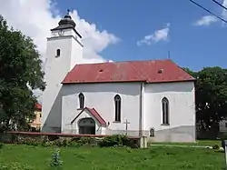 Church of Saint Andrew, the Apostle | |
 Coat of arms | |
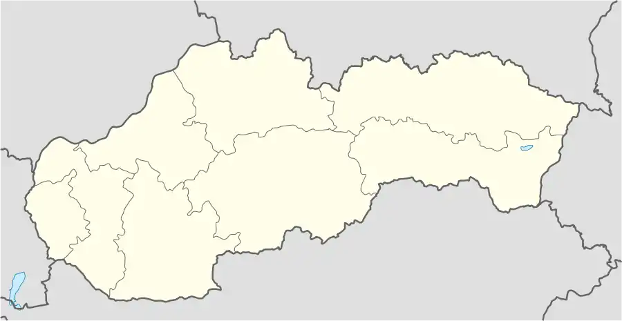 Veľký Slavkov Location of Veľký Slavkov in Slovakia | |
| Coordinates: 49°06′N 20°17′E | |
| Country | Slovakia |
| Region | Prešov |
| District | Poprad |
| First mentioned | 1251 |
| Area | |
| • Total | 12.21[1] km2 (4.71[1] sq mi) |
| Elevation | 683[2] m (2,241[2] ft) |
| Population (2021) | |
| • Total | 1,490[3] |
| Postal code | 059 91[2] |
| Area code | +421 52[2] |
| Car plate | PP |
| Website | www.velkyslavkov.sk |
Geography
The municipality lies at an elevation of 677 metres (2,221 ft) and covers an area of 12.347 km² (4.767 mi²). It has a population of about 1,150.
History
In historical records the village was first mentioned in 1251. It belonged to a German language island. The German population was expelled in 1945.
Economy and infrastructure
Its proximity to High Tatras have developed the village as a tourist destination. In Velký Slavkov are several pensions and a hotel.
References
- "Hustota obyvateľstva - obce [om7014rr_ukaz: Rozloha (Štvorcový meter)]". www.statistics.sk (in Slovak). Statistical Office of the Slovak Republic. 2022-03-31. Retrieved 2022-03-31.
- "Základná charakteristika". www.statistics.sk (in Slovak). Statistical Office of the Slovak Republic. 2015-04-17. Retrieved 2022-03-31.
- "Počet obyvateľov podľa pohlavia - obce (ročne)". www.statistics.sk (in Slovak). Statistical Office of the Slovak Republic. 2022-03-31. Retrieved 2022-03-31.
- "Statistical Office of the Slovak Republic" (PDF). Výsledky SODB 2011. Štatistický úrad SR. Archived from the original (PDF) on October 12, 2013. Retrieved 9 August 2012.
Municipalities of Poprad District | ||
|---|---|---|
This article is issued from Wikipedia. The text is licensed under Creative Commons - Attribution - Sharealike. Additional terms may apply for the media files.