Velyka Oleksandrivka
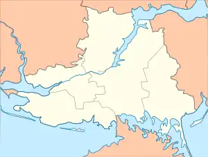
Velyka Oleksandrivka (Ukrainian: Велика Олександрівка; Russian: Большая Александровка, romanized: Bolshaya Aleksandrovka or Вели́кая Алекса́ндровка, Velikaya Aleksandrovka) is an urban-type settlement in Beryslav Raion, Kherson Oblast, southern Ukraine. It hosts the administration of Velyka Oleksandrivka settlement hromada, one of the hromadas of Ukraine.[1] The settlement is located on the left bank of the Inhulets. It has a population of 6,334 (2022 estimate).[2]
Velyka Oleksandrivka
Велика Олександрівка | |
|---|---|
_04.jpg.webp) | |
 Velyka Oleksandrivka  Velyka Oleksandrivka | |
| Coordinates: 47°19′29″N 33°18′42″E | |
| Country | |
| Oblast | Kherson Oblast |
| Raion | Beryslav Raion |
| Population (2022) | |
| • Total | |
| Time zone | UTC+2 (EET) |
| • Summer (DST) | UTC+3 (EEST) |
Administrative status
Until 18 July, 2020, Velyka Oleksandrivka was the administrative center of Velyka Oleksandrivka Raion. The raion was abolished in July 2020 as part of the administrative reform of Ukraine, which reduced the number of raions of Kherson Oblast to five. The area of Velyka Oleksandrivka Raion was merged into Beryslav Raion.[3][4]
History
2022 Russian invasion of Ukraine
In March 2022, Velyka Oleksandrivka was occupied by Russian forces. On 4 October 2022, Ukrainian authorities regained control of the settlement during the Southern counteroffensive.[5]
Geography
Climate
| Climate data for Velyka Oleksandrivka (1981–2010) | |||||||||||||
|---|---|---|---|---|---|---|---|---|---|---|---|---|---|
| Month | Jan | Feb | Mar | Apr | May | Jun | Jul | Aug | Sep | Oct | Nov | Dec | Year |
| Average high °C (°F) | 0.6 (33.1) |
1.6 (34.9) |
7.4 (45.3) |
16.0 (60.8) |
22.7 (72.9) |
26.6 (79.9) |
29.2 (84.6) |
28.8 (83.8) |
22.5 (72.5) |
15.3 (59.5) |
6.9 (44.4) |
1.9 (35.4) |
15.0 (59.0) |
| Daily mean °C (°F) | −2.3 (27.9) |
−1.9 (28.6) |
2.9 (37.2) |
10.1 (50.2) |
16.2 (61.2) |
20.3 (68.5) |
22.7 (72.9) |
22.0 (71.6) |
16.3 (61.3) |
9.9 (49.8) |
3.4 (38.1) |
−0.9 (30.4) |
9.9 (49.8) |
| Average low °C (°F) | −5.0 (23.0) |
−5.0 (23.0) |
−0.7 (30.7) |
5.0 (41.0) |
10.0 (50.0) |
14.6 (58.3) |
16.7 (62.1) |
15.6 (60.1) |
10.8 (51.4) |
5.6 (42.1) |
0.5 (32.9) |
−3.5 (25.7) |
5.4 (41.7) |
| Average precipitation mm (inches) | 32.5 (1.28) |
34.5 (1.36) |
30.7 (1.21) |
34.1 (1.34) |
49.2 (1.94) |
60.9 (2.40) |
58.4 (2.30) |
45.2 (1.78) |
43.2 (1.70) |
32.8 (1.29) |
40.0 (1.57) |
36.5 (1.44) |
498.0 (19.61) |
| Average precipitation days (≥ 1.0 mm) | 6.9 | 6.5 | 6.2 | 6.2 | 6.4 | 7.6 | 5.6 | 4.8 | 5.2 | 5.2 | 5.8 | 6.4 | 72.8 |
| Average relative humidity (%) | 86.7 | 83.1 | 78.0 | 68.2 | 64.7 | 67.0 | 64.1 | 62.3 | 69.2 | 77.3 | 86.3 | 88.0 | 74.6 |
| Source: World Meteorological Organization[6] | |||||||||||||
Economy
Transportation
Velyka Oleksandrivka is on a paved road which connects Novovorontsovka and Beryslav, where it has access to Kherson.
The closest railway station is in Bila Krynytsia, about 10 kilometres (6.2 mi) northwest, on the railway connecting Apostolove and Snihurivka (with a further connection to Kherson and Mykolaiv).
See also
References
- "Великоалександровская громада" (in Russian). Портал об'єднаних громад України.
- Чисельність наявного населення України на 1 січня 2022 [Number of Present Population of Ukraine, as of January 1, 2022] (PDF) (in Ukrainian and English). Kyiv: State Statistics Service of Ukraine. Archived (PDF) from the original on 4 July 2022.
- "Про утворення та ліквідацію районів. Постанова Верховної Ради України № 807-ІХ". Голос України (in Ukrainian). 2020-07-18. Retrieved 2020-10-03.
- "Нові райони: карти + склад" (in Ukrainian). Міністерство розвитку громад та територій України.
- Butenko, Victoria; Voitovych, Olga. "Ukraine confirms liberation of 2 towns in the southern Kherson region". edition.cnn.com. Cable News Network. Retrieved 4 October 2022.
- "World Meteorological Organization Climate Normals for 1981–2010". World Meteorological Organization. Archived from the original on 17 July 2021. Retrieved 17 July 2021.