Vermont, Illinois
Vermont is a village in Fulton County, Illinois, United States. The population was 667 at the 2010 census,[3] down from 792 at the 2000 census.
Vermont, Illinois | |
|---|---|
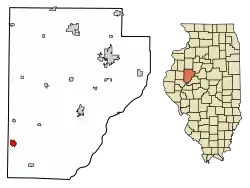 Location of Vermont in Fulton County, Illinois. | |
.svg.png.webp) Location of Illinois in the United States | |
| Coordinates: 40°17′45″N 90°25′44″W[1] | |
| Country | United States |
| State | Illinois |
| County | Fulton |
| Township | Vermont |
| Government | |
| • Village president | Ronnie Bair |
| Area | |
| • Total | 1.26 sq mi (3.26 km2) |
| • Land | 1.26 sq mi (3.26 km2) |
| • Water | 0.00 sq mi (0.00 km2) |
| Elevation | 689 ft (210 m) |
| Population (2020) | |
| • Total | 570 |
| Time zone | UTC-6 (CST) |
| • Summer (DST) | UTC-5 (CDT) |
| ZIP Code(s) | 61484 |
| Area code | 309 |
| FIPS code | 17-77642 |
| GNIS ID | 2400059[1] |
| Wikimedia Commons | Vermont, Illinois |
| Website | villageofvermont |
History
The village was founded in 1835 by James and Joseph Crail. A post office was established in 1837.[4] The village was named after the state of Vermont.[5] In the town square, there lies a historical site telling that on October 27, 1858, Abraham Lincoln had been near the area. He told the townsmen in the area with the exact quotes "Let us have faith that right makes might and in that faith let us to the end dare to do our duty as we understand it." and "With malice toward none and with charity for all."
Geography
Vermont is located in southwestern Fulton County, 5 miles (8 km) south of Table Grove and 21 miles (34 km) southwest of Lewistown, the county seat.
According to the 2010 census, Vermont has a total area of 1.26 square miles (3.26 km2), all land.[6]
Demographics
| Census | Pop. | Note | %± |
|---|---|---|---|
| 1880 | 1,133 | — | |
| 1890 | 1,158 | 2.2% | |
| 1900 | 1,195 | 3.2% | |
| 1910 | 1,118 | −6.4% | |
| 1920 | 1,078 | −3.6% | |
| 1930 | 948 | −12.1% | |
| 1940 | 945 | −0.3% | |
| 1950 | 940 | −0.5% | |
| 1960 | 903 | −3.9% | |
| 1970 | 947 | 4.9% | |
| 1980 | 885 | −6.5% | |
| 1990 | 806 | −8.9% | |
| 2000 | 792 | −1.7% | |
| 2010 | 667 | −15.8% | |
| 2020 | 570 | −14.5% | |
| U.S. Decennial Census[7] | |||
As of the census[8] of 2000, there were 792 people, 312 households, and 219 families residing in the village. The population density was 627.2 inhabitants per square mile (242.2/km2). There were 342 housing units at an average density of 270.8 per square mile (104.6/km2). The racial makeup of the village was 97.73% White, 0.25% Native American, 0.25% Asian, 0.13% from other races, and 1.64% from two or more races. Hispanic or Latino of any race were 1.01% of the population.
There were 312 households, out of which 33.0% had children under the age of 18 living with them, 57.7% were married couples living together, 7.1% had a female householder with no husband present, and 29.8% were non-families. 26.9% of all households were made up of individuals, and 14.7% had someone living alone who was 65 years of age or older. The average household size was 2.54 and the average family size was 3.01.
In the village, the population was spread out, with 27.8% under the age of 18, 8.0% from 18 to 24, 26.4% from 25 to 44, 22.3% from 45 to 64, and 15.5% who were 65 years of age or older. The median age was 36 years. For every 100 females, there were 107.9 males. For every 100 females age 18 and over, there were 102.1 males.
The median income for a household in the village was $29,375, and the median income for a family was $33,646. Males had a median income of $23,036 versus $19,318 for females. The per capita income for the village was $13,333. About 10.2% of families and 14.2% of the population were below the poverty line, including 15.5% of those under age 18 and 14.0% of those age 65 or over.
Notable people
- Abraham Lincoln, lawyer, politician, 16th president of the United States from March 4, 1861 - April 15, 1865
- John Clayton Allen, congressman[9]
- Thomas Ray Hamer, congressman from Idaho[10]
- John Calhoun Phillips, governor of Arizona from 1929 to 1931[11]
- Seth Weeks, classical mandolinist
References
- U.S. Geological Survey Geographic Names Information System: Vermont, Illinois
- "2020 U.S. Gazetteer Files". United States Census Bureau. Retrieved March 15, 2022.
- "Geographic Identifiers: 2010 Census Summary File 1 (G001), Vermont village, Illinois". American FactFinder. U.S. Census Bureau. Archived from the original on February 13, 2020. Retrieved May 18, 2016.
- Callary, Edward (2009). Place Names of Illinois. University of Illinois. ISBN 9780252090707.
- "Towns named after states". Reading Eagle. July 2, 1897. p. 3. Retrieved October 14, 2015.
- "G001 - Geographic Identifiers - 2010 Census Summary File 1". United States Census Bureau. Archived from the original on February 13, 2020. Retrieved December 25, 2015.
- "Census of Population and Housing". Census.gov. Retrieved June 4, 2015.
- "U.S. Census website". United States Census Bureau. Retrieved January 31, 2008.
- "ALLEN, John Clayton, (1860 - 1939)". Biographical Directory of the United States Congress. Retrieved August 30, 2013.
- "HAMER, Thomas Ray, (1864 - 1950)". Biographical Directory of the United States Congress. Retrieved August 30, 2013.
- "Arizona Governor John C. Phillips". National Governors Association. Retrieved August 30, 2013.
Municipalities and communities of Fulton County, Illinois, United States | ||
|---|---|---|
| Cities | Map of Illinois highlighting Fulton County | |
| Town | ||
| Villages | ||
| Townships | ||
| Unincorporated communities | ||
| Ghost towns | ||
| Footnotes | ‡This populated place also has portions in an adjacent county or counties | |