Vinosady
Vinosady (Hungarian: Csukárdterlény or Csukárd-Terlény) is a village and municipality in western Slovakia in Pezinok District in the Bratislava Region, on the foothills of the Little Carpathians.
Vinosady | |
|---|---|
Municipality | |
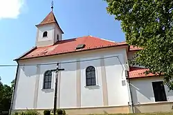
 Church of Saint Martin | |
 Coat of arms | |
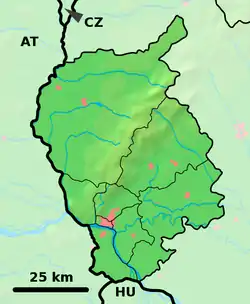
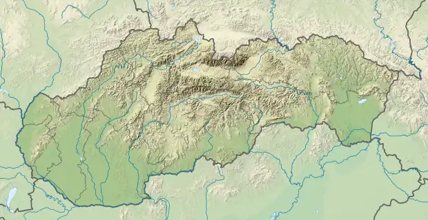
 Vinosady Location of Vinosady in the Bratislava Region  Vinosady Vinosady (Slovakia) | |
| Coordinates: 48°18′38″N 17°17′28″E | |
| Country | Slovakia |
| Region | Bratislava |
| District | Pezinok |
| First mentioned | 1208 |
| Boroughs | Veľké Tŕnie, Malé Tŕnie |
| Area | |
| • Total | 5.15[1] km2 (1.99[1] sq mi) |
| Elevation | 155[2] m (509[2] ft) |
| Population (2021) | |
| • Total | 1,496[3] |
| Postal code | 902 01[2] |
| Area code | +421 33[2] |
| Car plate | PK |
| Website | www.vinosady.sk |
Names and etymology
The current name means Vineyards and refers to rich vineyard tradition in this region.
The former village Kučišdorf was initially known as Turduna, Torduna, Turna or Thurnie, the name comes from Slovak tŕň, trnava (see also etymology of Trnava).[4] Its later name Kučišdorf comes from a personal name probably of Slavic origin Kucar/Kučar adopted to the Hungarian language as Chucar, Csukar (Chukarfalva, Csukárd).[4] The name of the second former village Trlinok also comes from Slovak tŕň.[4] In 1948, villages were renamed: Kučišdorf to Veľké Tŕnie and Trlinok to Malé Tŕnie.
History
In historical records the village, which was made of two independent parts was first mentioned in 1208, although it was inhabited lot sooner, in the 9th century, as the Great Moravian site was discovered near the village.
At the end of the 13th century, two village arose: Trlinka and Kučišdorf, which were closely linked to their bigger towns, Pezinok and Modra. The villages merged in 1964 to one village Vinosady. The merged village got its own coat-of-arms in 1998.
Geography
The village lies at an altitude of 179 metres and covers an area of 5.15 km². It has a population of 1049 people. The village is located 26 km from Bratislava and 3 km from Pezinok.
References
- "Hustota obyvateľstva - obce [om7014rr_ukaz: Rozloha (Štvorcový meter)]". www.statistics.sk (in Slovak). Statistical Office of the Slovak Republic. 2022-03-31. Retrieved 2022-03-31.
- "Základná charakteristika". www.statistics.sk (in Slovak). Statistical Office of the Slovak Republic. 2015-04-17. Retrieved 2022-03-31.
- "Počet obyvateľov podľa pohlavia - obce (ročne)". www.statistics.sk (in Slovak). Statistical Office of the Slovak Republic. 2022-03-31. Retrieved 2022-03-31.
- Varsik, Branislav (1984). Z osídlenia západného a stredného Slovenska v stredoveku (in Slovak). Bratislava: Veda, vydavateľstvo Slovenskej akadémie vied. pp. 55–58.