Vorotan (river)
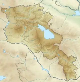
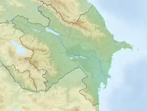
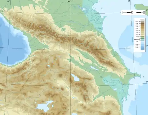
The Vorotan (Armenian: Որոտան), also Tsghuk river, Tsghko river, Vorotn river, Vorotna river (Armenian: Ծղուկի գետ, Ծղկո գետ, Որոտն, Որոտնա գետ, Բարկուշատ) or Bargushad (Armenian: Բարկուշատ, Azerbaijani: Bərgüşad) or Bazarchay (Azerbaijani: Bazarçay), is a river in the South Caucasus that is the largest right tributary of the Hakari river.[1] Vorotan originates in northwestern slopes of the Syunik Plateau, from the Tsalk pond and adjacent springs at an altitude of 3045 m, receives the water of streams flowing from several small ponds, as well as the springs of Gorayk village. Then it flows in the southeast direction through the territory of Sisian, Goris regions. The length of the river is 178 km. It flows through Armenia for 119 kilometres (74 mi) in a generally south-easterly direction. The river enters Azerbaijan, flowing for 43 km (27 mi) through the districts of Qubadli and Zangilan. The lower section of the Hakari, from its confluence with the Vorotan until its confluence with the Aras river, is sometimes considered to be part of the Vorotan.[2][3][4]
| Vorotan Bargushad, Bazarchay | |
|---|---|
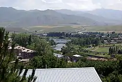 The Vorotan in Sisian | |
   | |
| Location | |
| Countries | Armenia and Azerbaijan |
| Physical characteristics | |
| Mouth | Hakari |
• coordinates | 39.2037°N 46.7170°E |
| Length | 162 km (101 mi) |
| Discharge | |
| • average | 21.5 m3/s (760 cu ft/s) |
| Basin features | |
| Progression | Hakari→ Aras→ Kura→ Caspian Sea |

Course of the river
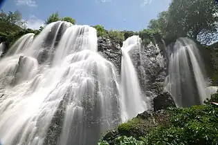
The river flows mostly through mountainous regions of Armenia and in several places has formed deep canyons. The towns of Sisian and Qubadli lie along its course. Six kilometers from Sisian, the river forms a waterfall — the "Shaki Waterfall" (Armenian: Շաքիի ջրվեժ) — that is 18m high.[5] The river forms a natural monument — the "Devil's Bridge" — near Tatev Monastery. There are mineral pools at the base of the travertine arch.
Damming the river
During the Soviet period, three reservoirs forming the Vorotan Cascade were constructed. They supply Armenia with hydro-electric power and water for irrigation. To increase the volume of water in Lake Sevan, a 21.6-kilometre (13.4 mi) tunnel was constructed to abstract some of the Vorotan's waters and divert them to the lake.[6]
Begun during the 1980s, work was stopped in 1988, when only 18 km (11 mi) had been completed, because of the outbreak of the First Nagorno-Karabakh War. The Armenian government finally completed the Vorotan tunnel in 2003. Prior to this, a second tunnel — "Arpa–Sevan" — was completed in 1981.[7] This diverts some water from the Arpa River for Lake Sevan. The waters coming through the two tunnels has resulted in the lake's water level rising. In 2007 it was reported that the water level had risen by 2.44 metres (8.0 ft) in the previous six years.[8]
Gallery
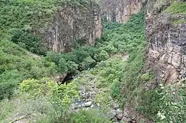 Vorotan River Canyon near Tatev
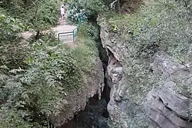 The "Devil's Bridge" natural arch near Tatev Monastery
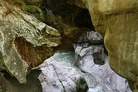 The base of the "Devil's Bridge" 1 km from Goris
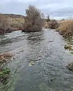 The Vorotan flowing through Qubadli District
References
- Հագարի [Hagari]. 2001. p. 299.
{{cite encyclopedia}}:|work=ignored (help) - "Армянский министр: Истоки двух основных рек Воротан и Арпа, питающих озеро Севан, находятся в карабахском районе Карвачар (Кельбаджар), который после войны перешел под контроль Азербайджана - Новости". dialogorg.ru. 26 January 2021. Retrieved 17 June 2022.
- Воротан, Great Soviet Encyclopedia
- "Rivers of Armenia". Armenia Discovery. Retrieved July 6, 2021.
- armsoul.com - Շաքիի ջրվեժ
- "1995-2003 "Complex of Hydraulic Structures for Diversion of the Vorotan River Runoff to the Basin of the Arpa River"". Arpa-Sevan. Archived from the original on 2022-08-11.
- "1961-1981 the Complex of Hydraulic Works for Transfer of the Arpa and Yeghegis". Arpa-Sevan. Archived from the original on 2022-08-11.
- Harutyunyan, Arpi (29 June 2007). "Sevan Rising: Lake Sevan's recovery quicker than expected". ArmeniaNow.
| Lake Sevan basin |
|
|---|---|
| Caspian basin | |