Portal:Rivers
| Portal | WikiProject Rivers | Talk page |
Introduction
A river is a natural flowing watercourse, usually a freshwater stream, flowing on the surface or inside caves towards another waterbody at a lower elevation, such as an ocean, sea, bay, lake, wetland, or another river. In some cases, a river flows into the ground or becomes dry at the end of its course without reaching another body of water. Small rivers can be referred to by names such as creek, brook, and rivulet. There are no official definitions for the generic term river as applied to geographic features, although in some countries or communities, a stream is defined by its size. Many names for small rivers are specific to geographic location; examples are "run" in some parts of the United States, "burn" in Scotland and Northeast England, and "beck" in Northern England. Sometimes a river is defined as being larger than a creek, but not always; the language is vague.
Rivers are an important part of the water cycle. Water from a drainage basin generally collects into a river through surface runoff from precipitation, meltwater released from natural ice and snowpacks, and other underground sources such as groundwater recharge and springs. Rivers are often considered major features within a landscape; however, they actually only cover around 0.1% of the land on Earth. Rivers are also an important natural terraformer, as the erosive action of running water carves out rills, gullies, and valleys in the surface as well as transferring silt and dissolved minerals downstream, forming river deltas and islands where the flow slows down. As a waterbody, rivers also serve crucial ecological functions by providing and feeding freshwater habitats for aquatic and semiaquatic fauna and flora, especially for migratory fish species, as well as enabling terrestrial ecosystems to thrive in the riparian zones.
Rivers are significant to humankind since many human settlements and civilizations are built around sizeable rivers and streams. Most of the major cities of the world are situated on the banks of rivers, as they are (or were) depended upon as a vital source of drinking water, for food supply via fishing and agricultural irrigation, for shipping, as natural borders and/or defensive terrains, as a source of hydropower to drive machinery or generate electricity, for bathing, and as a means of disposing of waste. In the pre-industrial era, larger rivers were a major obstacle to the movement of people, goods, and armies across regions. Towns often developed at the few locations suitable for fording, building bridges, or supporting ports; many major cities, such as London, are located at the narrowest and most reliable sites at which a river could be crossed via bridges or ferries. (Full article...)
Selected article -
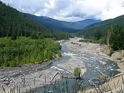
Little Fishing Creek is a tributary of Fishing Creek in Sullivan County, Lycoming County, and Columbia County, in Pennsylvania, in the United States. It is approximately 23.5 miles (37.8 km) long and flows through eight townships. The watershed of the creek has an area of 68.1 square miles (176 km2). The creek has six named tributaries, of which the largest are Spruce Run and West Branch Run.
There are at least two major rock formations in the watershed of Little Fishing Creek: the Chemung Formation and the Hamilton Group. The creek's watershed includes part of the Greenwood Valley. Much of the watershed is forested and major roads in it include Pennsylvania Route 42. The first European settler first arrived in the vicinity of the creek during the 1760s or 1770s, with other settlers arriving in the 1790s. A number of sawmills, woolen mills, and tanneries historically operated on the creek. A number of covered bridges have also been built over it and there were historically some railroads in the watershed. (Full article...)Selected Quote
Selected picture

Horseshoe Bend is a horseshoe-shaped meander of the Colorado River in the Glen Canyon National Recreation Area, located 5 miles (8 km) downstream from the Glen Canyon Dam and Lake Powell, near the town of Page, Arizona. It is accessible via hiking trail or an access road.
General images -
 Co-occurrence network of a bacterial community in a stream (from River ecosystem)
 Leaf litter is an allochthonous energy source. (from River ecosystem)
 Periphyton (from River ecosystem)
 The cave of source of the Buna can be entered by boat and dived through a cave system serving as an effluence of the Zalomka. (from Subterranean river)
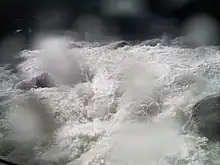 Whitewater at Yosemite (from Whitewater)
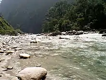
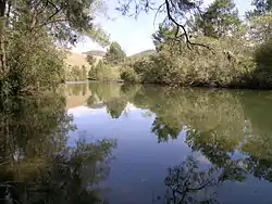 A pensive Cooplacurripa River, NSW (from River ecosystem)
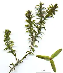 Pondweed is an autochthonous energy source. (from River ecosystem)
 A subterranean river in the Cross Cave system of Slovenia. (Scale shown by people in photograph.) (from Subterranean river)
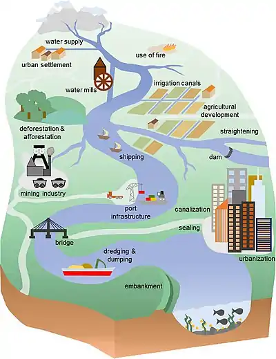 Anthropogenic influences on river systems. Examples are mainly from settings with a modest technological influence, especially in the period of about 10,000 to 4000 cal yr BP. (from River ecosystem)
.jpg.webp) Rafting is a watersport where buoyancy aids, helmets and wetsuits are mandatory and often imposed by law, due to the constant risk of falling off the boat and into the rapids (from Whitewater)
Rafting is a watersport where buoyancy aids, helmets and wetsuits are mandatory and often imposed by law, due to the constant risk of falling off the boat and into the rapids (from Whitewater) This stream operating together with its environment can be thought of as forming a river ecosystem. (from River ecosystem)
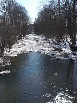
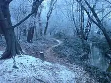 A forest stream in the winter near Erzhausen, Germany (from River ecosystem)
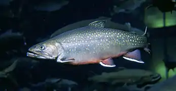 The brook trout is native to small streams, creeks, lakes, and spring ponds. (from River ecosystem)
.jpg.webp) In Dante's Inferno, Charon ferries souls across the subterranean river Acheron. (from Subterranean river)
In Dante's Inferno, Charon ferries souls across the subterranean river Acheron. (from Subterranean river)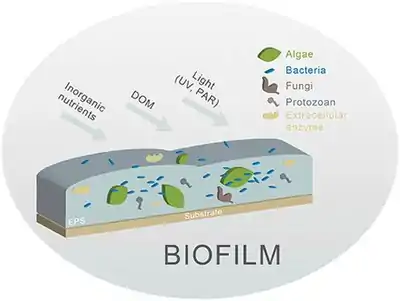 Different biofilm components in streams. Principal components are algae and bacteria. (from River ecosystem)
 Common water hyacinth in flower (from River ecosystem)
 The Effra is one of the subterranean rivers of London. It empties into the Thames by Vauxhall Bridge, from which this photograph was taken. (from Subterranean river)
 Example of a river food web. Bacteria can be seen in the red box at the bottom. Bacteria (and other decomposers, like worms) decompose and recycle nutrients back to the habitat, which is shown by the light blue arrows. Without bacteria, the rest of the food web would starve, because there would not be enough nutrients for the animals higher up in the food web. The dark orange arrows show how some animals consume others in the food web. For example, lobsters may be eaten by humans. The dark blue arrows represent one complete food chain, beginning with the consumption of algae by the water flea, Daphnia, which is consumed by a small fish, which is consumed by a larger fish, which is at the end consumed by the great blue heron. (from River ecosystem)
 The Puerto Princesa cave can be entered by boat. (from Subterranean river)
 Flowing rivers can act as dispersal vectors for plant matter and invertebrates. (from River ecosystem)
 Devil's Throat Cave subterranean river from above (from Subterranean river)
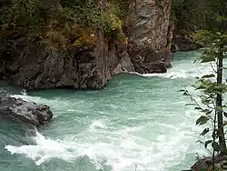 Rapids in Mount Robson Provincial Park (from River ecosystem)
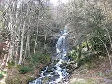 Cascade in the Pyrénées (from River ecosystem)
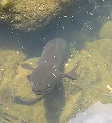 New Zealand longfin eels can weigh over 50 kilograms. (from River ecosystem)
Did you know?
- ... that 25 million tourists—more than twice the population of the entire state—visited the Mandakini River in Uttarakhand in 2011?
- ... that for three years, an illegal gold-mining settlement on the Amur river went on to host high-class hotels, have public healthcare, and even have a casino?
- ... that Boom Hall was named after a defensive structure on the River Foyle that was breached during the 1689 Siege of Derry?
Related portals
Selected Panorama
Topics
Subcategories
Quality content
| This is a list of recognized content, updated weekly by JL-Bot (talk · contribs) (typically on Saturdays). There is no need to edit the list yourself. If an article is missing from the list, make sure it is tagged (e.g. {{WikiProject Rivers}}) or categorized correctly and wait for the next update. See WP:RECOG for configuration options. |
Featured articles
 Aliso Creek (Orange County)
- Balch Creek
- Big Butte Creek
- Bull Run River (Oregon)
- Chetco River
- Colorado River
- Columbia River
- Columbia Slough
- Fanno Creek
- Johnson Creek (Willamette River tributary)
- Jordan River (Utah)
- Little Butte Creek
- Plunketts Creek (Loyalsock Creek tributary)
- River Parrett
- Rogue River (Oregon)
- St. Johns River
- Tryon Creek
- Waterfalls in Ricketts Glen State Park
- White Deer Hole Creek
- Willamette River
Featured lists
- List of longest rivers of the United States (by main stem)
- List of longest streams of Idaho
- List of longest streams of Oregon
- List of tributaries of Bowman Creek
- List of tributaries of Catawissa Creek
- List of tributaries of Larrys Creek
- List of tributaries of Mahanoy Creek
- List of tributaries of Shamokin Creek
Good articles
 1886 St. Croix River log jam
- Abrahams Creek
- Adams River (British Columbia)
- River Avon, Bristol
- Big Wapwallopen Creek
- Black Creek (Susquehanna River tributary)
- Briar Creek (Susquehanna River tributary)
- Brunswick Falls
- Buffalo Creek (West Branch Susquehanna River tributary)
- Canajoharie Creek
- Catawissa Creek
- Celilo Falls
- Cem (river)
- Cibolo Creek
- Covering of the Senne
- Darby Creek (Pennsylvania)
- Eddy Creek (Lackawanna River tributary)
- Esopus Creek
- Estuaries of Texas
- Everglades
- Fishing Creek (North Branch Susquehanna River tributary)
- Flushing River
- Fonteyn Kill
- Fossil Creek
- River Frome, Bristol
- Gowanus Canal
- Great Zab
- Hammersley Fork
- Harveys Creek
- Hudson River
- Hull Creek (Lackawanna River tributary)
- River Hull
- Hunlock Creek
- River Irwell
- Islais Creek
- Ithan Creek
- Jiloca (river)
- Kaweah River
- Kettle Creek (Pennsylvania)
- Keyser Creek
- Kings River (California)
- Kissena Creek
- Klamath River
- Kootenay River
- Laguna Canyon
- Leggetts Creek
- Little Applegate River
- Little Catawissa Creek
- Little Fishing Creek
- Little Wapwallopen Creek
- Mahanoy Creek
- Mahoning Creek (Susquehanna River tributary)
- Meadow Brook (Lackawanna River tributary)
- Merced River
- Messers Run
- Minetta Creek
- Minnehaha Park (Minneapolis)
- Missouri River
- Moston Brook
- Mud Creek (Chillisquaque Creek tributary)
- Muncy Creek
- Nanticoke Creek
- Neepaulakating Creek
- Nescopeck Creek
- Ombla
- Petitcodiac River
- Potlatch River
- River Arun
- River Brue
- River Tone
- River Torrens
- River Weaver
- Roaring Brook (Lackawanna River tributary)
- Roaring Creek (Pennsylvania)
- River Rother, East Sussex
- River Rother, West Sussex
- San Juan Creek
- Santa Ana River
- Sava
- Saw Mill River
- Scotch Run (Catawissa Creek tributary)
- Severn bore
- Shickshinny Creek
- Shimna River
- Shinano River
- Snake River
- Solomon Creek
- Spring Brook (Lackawanna River tributary)
- Stafford Meadow Brook
- Stanislaus River
- Stikine River
- Stony Brook (Charles River tributary, Boston)
- Sulphur Creek (California)
- Tangascootack Creek
- Toby Creek
- Trinity River (California)
- River Trym
- Twomile Run
- Wainui Falls
- River Welland
- West Branch Fishing Creek
- West Creek (Pennsylvania)
- West Kill
- River Witham
- Yellala Falls
- Zarqa River
Things to do

- Join WikiProject Rivers
- Help select future pictures and articles.
- Add items to Did You Know?
- Add the portal link to the top of the See Also section of all relevant pages. This can be done by adding
{{Portal|Rivers}}immediately under the section header.
Associated Wikimedia
The following Wikimedia Foundation sister projects provide more on this subject:
-
 Commons
Free media repository -
 Wikibooks
Free textbooks and manuals -
 Wikidata
Free knowledge base -
 Wikinews
Free-content news -
 Wikiquote
Collection of quotations -
 Wikisource
Free-content library -
 Wikiversity
Free learning tools -
 Wikivoyage
Free travel guide -
 Wiktionary
Dictionary and thesaurus
More portals
-
 List of all portalsList of all portals
 -
 The arts portal
 -
 Biography portal
 -
 Current events portal
 -
 Geography portal
 -
 History portal
 -
 Mathematics portal
 -
 Science portal
 -
 Society portal
 -
 Technology portal
 -
 Random portalRandom portal
 -
 WikiProject PortalsWikiProject Portals