Vorskla
The Vorskla (Russian: Ворскла; Ukrainian: Ворскла) is a river that runs from Belgorod Oblast in Russia southwards into northeastern Ukraine, where it joins the Dnieper. It has a length of 464 kilometres (288 mi), and a basin area of 14,700 square kilometres (5,700 sq mi).[1] Right tributaries of the river include the Vorsklytsia and Boromlia , and left tributaries Merla, Kolomak and Tahamlyk.
| Vorskla | |
|---|---|
 The Vorskla in Poltava, Ukraine | |
 | |
| Native name | Ворскла |
| Location | |
| Country | Russia, Ukraine |
| Region | Russia: Belgorod Oblast Ukraine: Sumy Oblast, Poltava Oblast |
| Physical characteristics | |
| Source | |
| • location | Belgorod Oblast, Russia |
| Mouth | Dnieper (Kamianske Reservoir) |
• location | Poltava Oblast, Ukraine |
• coordinates | 48°54′15″N 34°07′18″E |
| Length | 464 km (288 mi) |
| Basin size | 14,700 km2 (5,700 sq mi) |
| Basin features | |
| Progression | Dnieper→ Dnieper–Bug estuary→ Black Sea |
Large cities on the river are Poltava (the capital of Poltava Oblast), Okhtyrka and Kobeliaky. The river is mostly navigable between its delta and Kobeliaky.
An ancient fort, thought to be Gelonos, is on the Vorskla south of Okhtyrka. In 1399, the Battle of the Vorskla River was fought in the area. In 1709, the city of Poltava was besieged by Charles XII.
Flora and fauna
In the river there are more than 50 species of fish, most of which are carps and pikes, breams, rudds, roaches, minnows, catfish.
Fauna is represented by hares, foxes, in the woods you can meet roe deer and wild boar, a great variety of birds: wild duck, gray heron, partridge, pheasant.
Along the banks of the river there are large wooded areas, as coniferous (mostly on the left bank) and deciduous forests.
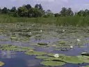 White lilies of the Vorskla River in July 2005
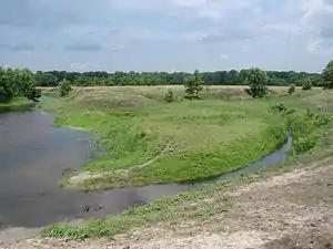 Vorskla River near Khukhra village
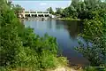 Worska River near Opishnya
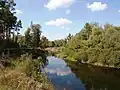 Vorskla River near Novi Sanzary
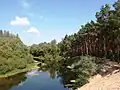 Vorskla River near Novi Sanzary
References
| Tributaries1 | 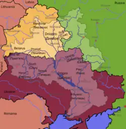 | |
|---|---|---|
| Reservoirs | ||
| Hydroelectric stations | ||
| Canals |
| |
| Cities | ||
| Crossings | ||
| ||