Vorstenbosch
Vorstenbosch is a village of the municipality Bernheze. Bernheze is located in the province of North Brabant, one of the 12 provinces of the Netherlands. [3]
Vorstenbosch | |
|---|---|
Village | |
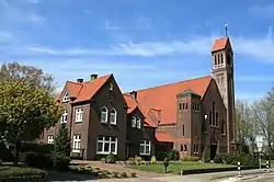 Church and clergy house of Vorstenbosch | |
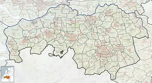 Vorstenbosch Location in the province of North Brabant in the Netherlands  Vorstenbosch Vorstenbosch (Netherlands) | |
| Coordinates: 51°39′N 5°33′E | |
| Country | Netherlands |
| Province | North Brabant |
| Municipality | Bernheze |
| Area | |
| • Total | 4.73 km2 (1.83 sq mi) |
| Elevation | 0.9 m (3.0 ft) |
| Population (2021)[1] | |
| • Total | 715 |
| • Density | 150/km2 (390/sq mi) |
| Time zone | UTC+1 (CET) |
| • Summer (DST) | UTC+2 (CEST) |
| Postal code | 5476[1] |
| Dialing code | 0413 |
| Major roads | A50 |
History
The village was first mentioned in 1485 as Vorsschenbosch. The etymologie of the first word is unclear. It can either mean "front (nearest) forest" or "forest with frogs".[4]
Vorstenbosch was home to 355 people in 1840. The St Lambartus Church dates from 1932.[5] Before 1994 it formed with Nistelrode the municipality Nistelrode.
Sights
Interesting things to see:
- Parish church St. Lambertus
- Corn mill "Windlust", completely restored in 2008
- Old lime tree
- Blow dunes in the vicinity (Bedaf)
Gallery
 Wind mill Windlust
%252C_Leigraaf.JPG.webp) Landscape near Vorstenbosch
Landscape near Vorstenbosch
References
- "Kerncijfers wijken en buurten 2021". Central Bureau of Statistics. Retrieved 15 April 2022.
- "Postcodetool for 5476AA". Actueel Hoogtebestand Nederland (in Dutch). Het Waterschapshuis. Retrieved 15 April 2022.
- "Gemeente Bernheze" (in Dutch). Gemeente Bernheze. Retrieved March 5, 2011.
- "Vorstenbosch - (geografische naam)". Etymologiebank (in Dutch). Retrieved 15 April 2022.
- "Vorstenbosch". Plaatsengids (in Dutch). Retrieved 15 April 2022.
External links
This article is issued from Wikipedia. The text is licensed under Creative Commons - Attribution - Sharealike. Additional terms may apply for the media files.