Vurberk
Vurberk (pronounced [ˈʋuːɾbɛɾk]) is a settlement in the Municipality of Duplek in northeastern Slovenia. It lies on the left bank of the Drava River on the southwestern edge of the Slovene Hills (Slovene: Slovenske gorice), southeast of Maribor. The area is part of the traditional region of Styria. The municipality is now included in the Drava Statistical Region.[2]
Vurberk
Vumpah (until 1982) | |
|---|---|
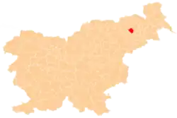
 Vurberk Location in Slovenia | |
| Coordinates: 46°29′11.23″N 15°47′18.38″E | |
| Country | |
| Traditional region | Styria |
| Statistical region | Drava |
| Municipality | Duplek |
| Area | |
| • Total | 4.98 km2 (1.92 sq mi) |
| Elevation | 266.9 m (875.7 ft) |
| Population (2020) | |
| • Total | 463 |
| • Density | 93/km2 (240/sq mi) |
| [1] | |
Name
The name of the settlement was changed from Vumpah to Vurberk in 1982.[3] The Slovene name Vumpah is derived from German Wurmbach and was first attested as such in 1496.[4][5] The Slovene name Vurberk originally referred to the castle above the village and is derived from German Wurmberg.[5] Vurberk Castle, destroyed in 1945, was first mentioned in 1244 as Wuermwerg.[6]
Church
The local parish church, built on a hill east of the village, next to a small castle, is dedicated to the Assumption of Mary and belongs to the Roman Catholic Archdiocese of Maribor. It is a Baroque building from 1776.[7]
References
- Statistical Office of the Republic of Slovenia
- Duplek municipal site
- Spremembe naselij 1948–95. 1996. Database. Ljubljana: Geografski inštitut ZRC SAZU, DZS.
- Kropej, Monika. 2009. Od ajda do zlatoroga: slovenska bajeslovna bitja. Ljubljana: Mohorjeva, p. 63.
- Kos, Dušan. 2006. In Burg und Stadt: spätmittelalterlicher Adel in Krain und Untersteiermark. Vienna: Oldenbourg, pp. 503, 508, 683.
- Stopar, Ivan. 1985. "Pregled grajskih stavb na slovenskem Štajerskem (nadaljevanje)." Celjski zbornik 21(1): 177–217, p. 209. (in Slovene)
- Slovenian Ministry of Culture register of national heritage reference number ešd 3510
