Vyans-le-Val
Vyans-le-Val (French pronunciation: [vjɑ̃ lə val]) is a commune in the Haute-Saône department in the region of Bourgogne-Franche-Comté in eastern France.
Vyans-le-Val | |
|---|---|
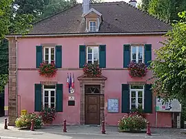 The town hall in Vyans-le-Val | |
 Coat of arms | |
Location of Vyans-le-Val | |
 Vyans-le-Val  Vyans-le-Val | |
| Coordinates: 47°33′03″N 6°46′05″E | |
| Country | France |
| Region | Bourgogne-Franche-Comté |
| Department | Haute-Saône |
| Arrondissement | Lure |
| Canton | Héricourt-2 |
| Intercommunality | Pays d'Héricourt |
| Government | |
| • Mayor (2020–2026) | Yves Ligier[1] |
| Area 1 | 3.32 km2 (1.28 sq mi) |
| Population | 425 |
| • Density | 130/km2 (330/sq mi) |
| Time zone | UTC+01:00 (CET) |
| • Summer (DST) | UTC+02:00 (CEST) |
| INSEE/Postal code | 70579 /70400 |
| Elevation | 339–463 m (1,112–1,519 ft) |
| 1 French Land Register data, which excludes lakes, ponds, glaciers > 1 km2 (0.386 sq mi or 247 acres) and river estuaries. | |
It is located on a tributary of the river Lizaine, five km south of Hericourt and two km west of Bussurel, close to the Haute-Saône / Doubs border.
The village church is a Lutheran Protestant church, part of the United Protestant Church of France.
Population
| Year | Pop. | ±% p.a. |
|---|---|---|
| 1968 | 239 | — |
| 1975 | 311 | +3.83% |
| 1982 | 384 | +3.06% |
| 1990 | 400 | +0.51% |
| 1999 | 419 | +0.52% |
| 2007 | 438 | +0.56% |
| 2012 | 423 | −0.69% |
| 2017 | 453 | +1.38% |
| Source: INSEE[3] | ||
References
- "Répertoire national des élus: les maires". data.gouv.fr, Plateforme ouverte des données publiques françaises (in French). 2 December 2020.
- "Populations légales 2020". The National Institute of Statistics and Economic Studies. 29 December 2022.
- Population en historique depuis 1968, INSEE
Wikimedia Commons has media related to Vyans-le-Val.
This article is issued from Wikipedia. The text is licensed under Creative Commons - Attribution - Sharealike. Additional terms may apply for the media files.