Vysokopillia
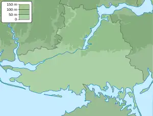
Vysokopillia or Vysokopillya (Ukrainian: Високопілля, pronounced [wɪsokoˈp⁽ʲ⁾ilʲːɐ]; Russian: Высокополье) is an urban-type settlement in Beryslav Raion, Kherson Oblast, southern Ukraine. It hosts the administration of Vysokopillia settlement hromada, one of the hromadas of Ukraine.[1] Vysokopillia is located between the valleys of the Dnieper and Inhulets rivers, 12 kilometres (7.5 mi) east of the Inhulets. It has a population of 3,801 (2022 estimate).[2]
Vysokopillia
Високопілля | |
|---|---|
 Flag  Coat of arms | |
 Vysokopillia  Vysokopillia | |
| Coordinates: 47°29′39″N 33°31′58″E | |
| Country | Ukraine |
| Oblast | Kherson Oblast |
| Raion | Beryslav Raion |
| Time zone | UTC+2 (EET) |
| • Summer (DST) | UTC+3 (EEST) |
Administrative status
Until 18 July 2020, Vysokopillia was the administrative centre of Vysokopillia Raion. The raion was abolished in July 2020 as part of the administrative reform of Ukraine, which reduced the number of raions of Kherson Oblast to five. The area of Vysokopillia Raion was merged into Beryslav Raion.[3][4]
History
Vysokopillia was founded as a German colony between 1869 and 1870 (see de:Kolonie Kronau for more information).[5]
In March 2022,[6] the area was occupied by Russia. Ukrainian military forces recaptured Vysokopillia on 4 September[6] and hoisted the Ukrainian flag near Vysokopillia's hospital as part the 2022 Ukrainian southern counteroffensive.[7]
Economy
Transportation
Vysokopillia is on a paved road which connects Novovorontsovka and Beryslav, where it has access to Kherson.
Vysokopillia railway station is on the railway line connecting Apostolove and Snihurivka (with further connection to Kherson and Mykolaiv).
References
- "Vysokopol'skaya gromada" Высокопольская громада [Vysokopolska community]. gromada.info (in Russian).
- Чисельність наявного населення України на 1 січня 2022 [Number of Present Population of Ukraine, as of January 1, 2022] (PDF) (in Ukrainian and English). Kyiv: State Statistics Service of Ukraine. Archived (PDF) from the original on 4 July 2022.
- "Pro utvorennya ta likvidatsiyu rayoniv" Про утворення та ліквідацію районів [About the formation and liquidation of districts]. Holos Ukrayiny (in Ukrainian). 2020-07-18. Retrieved 2020-10-03.
- "Novi rayony: karty + sklad" Нові райони: карти + склад [New districts: maps + warehouse] (in Ukrainian). Ministry of Communities and Territories Development. July 7, 2020. Retrieved April 10, 2023.
- "Kronau, Nikolajew Village Information". Germans from Russia Heritage Society. Archived from the original on December 4, 2010.
- Myroniuk, Anna (July 11, 2022). "Families flee Russian occupation in southern Ukraine: 'I thought I would never see my daughter again'". The Kyiv Independent. Kryvyi Rih. Retrieved April 10, 2023.
- Santora, Marc; Nechepurenko, Ivan (September 7, 2022) [Originally published September 5, 2022]. "Zelensky says two towns in the south have been liberated". The New York Times. Retrieved April 10, 2023.
| Cities | Coat of arms of Beryslav Raion | |
|---|---|---|
| Urban-type settlements | ||
| Villages |
| |
| Rural settlements | ||
| Hromadas |
| |