Walkerton, Virginia
Walkerton is an unincorporated community in King and Queen County, Virginia, United States.[1]
Walkerton, Virginia | |
|---|---|
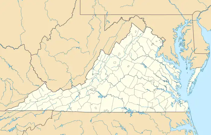 Walkerton Location within the Commonwealth of Virginia  Walkerton Walkerton (the United States) | |
| Coordinates: 37°43′35″N 77°01′22″W | |
| Country | United States |
| State | Virginia |
| County | King and Queen |
| Time zone | UTC−5 (Eastern (EST)) |
| • Summer (DST) | UTC−4 (EDT) |
Fort Mattapony, Hillsborough, and Northbank are listed on the National Register of Historic Places.[2]
Climate
The climate in this area is characterized by hot, humid summers and generally mild to cool winters. According to the Köppen Climate Classification system, Walkerton has a humid subtropical climate, abbreviated "Cfa" on climate maps.[3]
| Climate data for Walkerton 2 NW, Virginia (1991–2020 normals, extremes 1932–present) | |||||||||||||
|---|---|---|---|---|---|---|---|---|---|---|---|---|---|
| Month | Jan | Feb | Mar | Apr | May | Jun | Jul | Aug | Sep | Oct | Nov | Dec | Year |
| Record high °F (°C) | 81 (27) |
83 (28) |
91 (33) |
100 (38) |
99 (37) |
107 (42) |
108 (42) |
104 (40) |
103 (39) |
101 (38) |
87 (31) |
83 (28) |
108 (42) |
| Average high °F (°C) | 48.6 (9.2) |
52.3 (11.3) |
60.4 (15.8) |
71.6 (22.0) |
77.6 (25.3) |
84.9 (29.4) |
88.4 (31.3) |
86.9 (30.5) |
81.2 (27.3) |
71.5 (21.9) |
60.9 (16.1) |
51.7 (10.9) |
69.7 (20.9) |
| Daily mean °F (°C) | 39.0 (3.9) |
41.7 (5.4) |
49.1 (9.5) |
59.2 (15.1) |
67.2 (19.6) |
75.0 (23.9) |
78.9 (26.1) |
77.3 (25.2) |
71.4 (21.9) |
60.5 (15.8) |
50.1 (10.1) |
42.1 (5.6) |
59.3 (15.2) |
| Average low °F (°C) | 29.4 (−1.4) |
31.1 (−0.5) |
37.8 (3.2) |
46.9 (8.3) |
56.8 (13.8) |
65.0 (18.3) |
69.4 (20.8) |
67.8 (19.9) |
61.6 (16.4) |
49.6 (9.8) |
39.3 (4.1) |
32.4 (0.2) |
48.9 (9.4) |
| Record low °F (°C) | −15 (−26) |
−12 (−24) |
6 (−14) |
19 (−7) |
28 (−2) |
37 (3) |
45 (7) |
42 (6) |
33 (1) |
22 (−6) |
8 (−13) |
−7 (−22) |
−15 (−26) |
| Average precipitation inches (mm) | 3.19 (81) |
2.85 (72) |
4.03 (102) |
3.20 (81) |
3.84 (98) |
4.18 (106) |
4.78 (121) |
4.37 (111) |
4.44 (113) |
3.78 (96) |
3.29 (84) |
3.69 (94) |
45.64 (1,159) |
| Average snowfall inches (cm) | 3.4 (8.6) |
2.4 (6.1) |
1.0 (2.5) |
0.0 (0.0) |
0.0 (0.0) |
0.0 (0.0) |
0.0 (0.0) |
0.0 (0.0) |
0.0 (0.0) |
0.0 (0.0) |
0.1 (0.25) |
0.9 (2.3) |
7.8 (20) |
| Average precipitation days (≥ 0.01 in) | 9.2 | 8.7 | 10.0 | 9.7 | 10.5 | 9.6 | 9.8 | 8.1 | 8.0 | 7.3 | 8.7 | 10.2 | 109.8 |
| Average snowy days (≥ 0.1 in) | 1.5 | 0.9 | 0.6 | 0.1 | 0.0 | 0.0 | 0.0 | 0.0 | 0.0 | 0.0 | 0.1 | 0.5 | 3.7 |
| Source: NOAA[4][5] | |||||||||||||
References
- U.S. Geological Survey Geographic Names Information System: Walkerton, Virginia
- "National Register Information System". National Register of Historic Places. National Park Service. July 9, 2010.
- Climate Summary for Walkerton, Virginia
- "NowData – NOAA Online Weather Data". National Oceanic and Atmospheric Administration. Retrieved July 5, 2021.
- "Station: Walkerton 2 NW, VA". U.S. Climate Normals 2020: U.S. Monthly Climate Normals (1991-2020). National Oceanic and Atmospheric Administration. Retrieved July 5, 2021.
Municipalities and communities of King and Queen County, Virginia, United States | ||
|---|---|---|
| CDP | 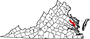 Map of Virginia highlighting King and Queen County | |
| Unincorporated communities |
| |
| Footnotes | ‡This populated place also has portions in an adjacent county or counties | |
This article is issued from Wikipedia. The text is licensed under Creative Commons - Attribution - Sharealike. Additional terms may apply for the media files.