Wao, Lanao del Sur
Wao officially the Municipality of Wao (Maranao/Iranun: Inged a Wao; Cebuano: Lungsod sa Wao; Tagalog: Bayan ng Wao), is a 2nd class municipality in the province of Lanao del Sur, Philippines. According to the 2020 census, it has a population of 50,366 people.[4]
Wao
واعو | |
|---|---|
| Municipality of Wao | |
 Flag  Seal | |
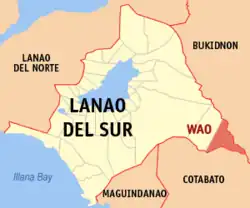 Map of Lanao del Sur with Wao highlighted | |
OpenStreetMap | |
.svg.png.webp) Wao Location within the Philippines | |
| Coordinates: 7°38′25″N 124°43′33″E | |
| Country | Philippines |
| Region | Bangsamoro Autonomous Region in Muslim Mindanao |
| Province | Lanao del Sur |
| District | 1st district |
| Founded | February 22, 1961[1] |
| Barangays | 26 (see Barangays) |
| Government | |
| • Type | Sangguniang Bayan |
| • Mayor | Elvino B. Balicao Jr. |
| • Vice Mayor | Elmer A. Mendoza |
| • Representative | Ziaur-Rahman A. Adiong |
| • Municipal Council | Members |
| • Electorate | 40,630 voters (2022) |
| Area | |
| • Total | 485.24 km2 (187.35 sq mi) |
| Elevation | 603 m (1,978 ft) |
| Highest elevation | 1,108 m (3,635 ft) |
| Lowest elevation | 393 m (1,289 ft) |
| Population (2020 census)[4] | |
| • Total | 50,366 |
| • Density | 100/km2 (270/sq mi) |
| • Households | 9,720 |
| Economy | |
| • Income class | 2nd municipal income class |
| • Poverty incidence | 65.07 |
| • Revenue | ₱ 233.4 million (2020) |
| • Assets | ₱ 444.2 million (2020) |
| • Expenditure | ₱ 216.6 million (2020) |
| • Liabilities | ₱ 19.4 million (2020) |
| Service provider | |
| • Electricity | First Bukidnon Electric Cooperative (FIBECO) |
| Time zone | UTC+8 (PST) |
| ZIP code | 9716 |
| PSGC | |
| IDD : area code | +63 (0)63 |
| Native languages | Maranao Iranun Cebuano Tagalog |
| Major religions | Catholicism, Islam |
| Catholic diocese | Diocese of Malaybalay[6] |
| Patron saint | Immaculate Conception |
| Website | www |
Wao is the only predominantly Catholic municipality in Lanao del Sur, with 80% of the population adhering to Roman Catholicism.[7] Wao is the only municipality in the Philippines that starts with "W".[8]
History
The LASEDECO resettlement program of then-President Ramon Magsaysay made possible the foundation of Wao as a municipality in Lanao del Sur province on February 22, 1961.[9] The first settlers in the area were sixty (60) families of various ethnicity from the then-undivided Cotabato province. Only one person (Elvino B. Balicao, Sr) among the 1st batch of settlers became one of the Municipal Mayors of Wao. Mr Balicao, along with members of the 1st batch of 60 settlers that included the late couple Aludio & Sofia Emborgo, were welcomed by the native Muslim inhabitants of Wao led by Sultan Mamaco Saripada (the municipality's first appointed and elected mayor), Datu Tao Pagul and Datu Maki Saripada. They were treated to a sit-down meal in the house of Sultan Mamaco Saripada.[10]
Geography
Wao is also surrounded by Amai Manabilang in the north and west, Bukidnon in the east, and Cotabato in the south.
Barangays
Wao is politically subdivided into 26 barangays. Each barangay consists of puroks while some have sitios.
- Amoyong
- Balatin
- Banga
- Buntongan
- Bo-ot
- Cebuano Group
- Christian Village
- Eastern Wao (Poblacion)
- Extension (Poblacion)
- Gata (Pizawaoan)
- Kabatangan
- Kadingilan
- Katutungan
- Kilikili East
- Kilikili West
- Malaigang
- Manila Group (Poblacion)
- Milaya
- Mimbuaya
- Muslim Village
- Pagalongan
- Panang
- Park Area
- Pilintangan
- Serran Village
- Western Wao (Poblacion)
Climate
| Climate data for Wao, Lanao de Sur | |||||||||||||
|---|---|---|---|---|---|---|---|---|---|---|---|---|---|
| Month | Jan | Feb | Mar | Apr | May | Jun | Jul | Aug | Sep | Oct | Nov | Dec | Year |
| Average high °C (°F) | 24 (75) |
24 (75) |
25 (77) |
26 (79) |
26 (79) |
25 (77) |
25 (77) |
25 (77) |
25 (77) |
25 (77) |
25 (77) |
25 (77) |
25 (77) |
| Average low °C (°F) | 20 (68) |
20 (68) |
20 (68) |
20 (68) |
21 (70) |
21 (70) |
20 (68) |
20 (68) |
20 (68) |
21 (70) |
20 (68) |
20 (68) |
20 (69) |
| Average precipitation mm (inches) | 159 (6.3) |
143 (5.6) |
166 (6.5) |
183 (7.2) |
357 (14.1) |
414 (16.3) |
333 (13.1) |
309 (12.2) |
289 (11.4) |
285 (11.2) |
253 (10.0) |
166 (6.5) |
3,057 (120.4) |
| Average rainy days | 18.4 | 17.2 | 20.6 | 23.4 | 29.3 | 29.2 | 29.9 | 29.4 | 27.7 | 28.7 | 25.5 | 19.9 | 299.2 |
| Source: Meteoblue (modeled/calculated data, not measured locally)[11] | |||||||||||||
Demographics
| Year | Pop. | ±% p.a. |
|---|---|---|
| 1960 | 13,848 | — |
| 1970 | 16,577 | +1.81% |
| 1975 | 17,267 | +0.82% |
| 1980 | 15,962 | −1.56% |
| 1990 | 22,932 | +3.69% |
| 1995 | 27,503 | +3.46% |
| 2000 | 35,517 | +5.63% |
| 2007 | 42,186 | +2.40% |
| 2010 | 40,479 | −1.49% |
| 2015 | 45,862 | +2.41% |
| 2020 | 50,366 | +1.86% |
| Source: Philippine Statistics Authority[12][13][14] | ||
Economy
Sister cities
- Quezon City, since April 1990[22]
References
- "Historical Background | WAO".
- Municipality of Wao | (DILG)
- "2015 Census of Population, Report No. 3 – Population, Land Area, and Population Density" (PDF). Philippine Statistics Authority. Quezon City, Philippines. August 2016. ISSN 0117-1453. Archived (PDF) from the original on May 25, 2021. Retrieved July 16, 2021.
- Census of Population (2020). "Bangsamoro (BARMM)". Total Population by Province, City, Municipality and Barangay. Philippine Statistics Authority. Retrieved July 8, 2021.
- "PSA Releases the 2018 Municipal and City Level Poverty Estimates". Philippine Statistics Authority. December 15, 2021. Retrieved January 22, 2022.
- "50. Diocese of Malaybalay". May 26, 2017.
- "Bangsamoro, No; Good Governance, Yes". March 14, 2017.
- List of cities and municipalities in the Philippines#anchor W
- "Historical Background | WAO".
- Tales of Sofia Emborgo's early life in Wao by Evelyn E. Mills (aka Bebing of Wao)
- "Bacolod-Kalawi, Lanao del Sur : Average Temperatures and Rainfall". Meteoblue. Retrieved January 27, 2019.
- Census of Population (2015). "ARMM – Autonomous Region in Muslim Mindanao". Total Population by Province, City, Municipality and Barangay. Philippine Statistics Authority. Retrieved June 20, 2016.
- Census of Population and Housing (2010). "ARMM – Autonomous Region in Muslim Mindanao" (PDF). Total Population by Province, City, Municipality and Barangay. National Statistics Office. Retrieved June 29, 2016.
- Censuses of Population (1903–2007). "ARMM – Autonomous Region in Muslim Mindanao". Table 1. Population Enumerated in Various Censuses by Province/Highly Urbanized City: 1903 to 2007. National Statistics Office.
- "Poverty incidence (PI):". Philippine Statistics Authority. Retrieved December 28, 2020.
- "Estimation of Local Poverty in the Philippines" (PDF). Philippine Statistics Authority. November 29, 2005.
- "2003 City and Municipal Level Poverty Estimates" (PDF). Philippine Statistics Authority. March 23, 2009.
- "City and Municipal Level Poverty Estimates; 2006 and 2009" (PDF). Philippine Statistics Authority. August 3, 2012.
- "2012 Municipal and City Level Poverty Estimates" (PDF). Philippine Statistics Authority. May 31, 2016.
- "Municipal and City Level Small Area Poverty Estimates; 2009, 2012 and 2015". Philippine Statistics Authority. July 10, 2019.
- "PSA Releases the 2018 Municipal and City Level Poverty Estimates". Philippine Statistics Authority. December 15, 2021. Retrieved January 22, 2022.
- "Sister Cities". The Local Government of Quezon City. Archived from the original on October 1, 2017. Retrieved April 9, 2019.
External links
- Wao Profile at the DTI Cities and Municipalities Competitive Index
- Philippine Standard Geographic Code
- Local Governance Performance Management System
- Philippine Census Information
Places adjacent to Wao, Lanao del Sur | |
|---|---|