Watova, Oklahoma
Watova is an unincorporated community and census-designated place (CDP) in Nowata County, Oklahoma, United States. It was first listed as a CDP prior to the 2020 census.[2]
Watova, Oklahoma | |
|---|---|
 Watova  Watova | |
| Coordinates: 36°37′11″N 95°39′37″W | |
| Country | United States |
| State | Oklahoma |
| County | Nowata |
| Area | |
| • Total | 0.57 sq mi (1.48 km2) |
| • Land | 0.57 sq mi (1.48 km2) |
| • Water | 0.00 sq mi (0.00 km2) |
| Elevation | 742 ft (226 m) |
| Population (2020) | |
| • Total | 32 |
| • Density | 55.94/sq mi (21.61/km2) |
| Time zone | UTC-6 (Central (CST)) |
| • Summer (DST) | UTC-5 (CDT) |
| ZIP Code | 74048 (Nowata) |
| Area code(s) | 918/539 |
| FIPS code | 40-79000 |
| GNIS feature ID | 2812861[2] |
The CDP is in southern Nowata County, on the west side of U.S. Route 169, which leads north 6 miles (10 km) to Nowata, the county seat, and south 35 miles (56 km) to the outskirts of Tulsa.
References
- "ArcGIS REST Services Directory". United States Census Bureau. Retrieved September 20, 2022.
- U.S. Geological Survey Geographic Names Information System: Watova, Oklahoma
- "Census of Population and Housing". Census.gov. Retrieved June 4, 2016.
Municipalities and communities of Nowata County, Oklahoma, United States | ||
|---|---|---|
| City | 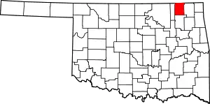 Nowata County map | |
| Towns | ||
| CDP | ||
| Ghost town | ||
| Indian reservation | ||
| Footnotes | ‡This populated place also has portions in an adjacent county or counties | |
This article is issued from Wikipedia. The text is licensed under Creative Commons - Attribution - Sharealike. Additional terms may apply for the media files.