Weijerswold
Weijerswold is a hamlet in the Netherlands and is part of the Coevorden municipality in Drenthe, east of the city of Coevorden.
Weijerswold | |
|---|---|
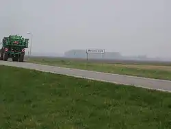 Entering Weijerswold | |
 Weijerswold  Weijerswold | |
| Coordinates: 52°39′41″N 6°47′24″E | |
| Country | Netherlands |
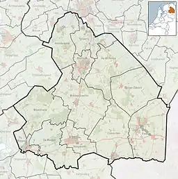
| Province | Drenthe |
| Municipality | Coevorden |
| Area | |
| • Total | 3.64 km2 (1.41 sq mi) |
| Elevation | 10 m (30 ft) |
| Population (2021)[1] | |
| • Total | 80 |
| • Density | 22/km2 (57/sq mi) |
| Time zone | UTC+1 (CET) |
| • Summer (DST) | UTC+2 (CEST) |
| Postal code | 7742[1] |
| Dialing code | 0524 |
Weijerswold is a road village on a sandy hill dating for the Middle Ages.[3] It was first mentioned in 1520 as "beneden den graven die van Wijerdeswolde daele gaet nae den Hennenbroke", and means "swamp forest belonging to Wijerd".[4] In 1840, it was home to 42 people.[5]
References
- "Kerncijfers wijken en buurten 2021". Central Bureau of Statistics. Retrieved 13 March 2022.
- "Postcodetool for 7742AB". Actueel Hoogtebestand Nederland (in Dutch). Het Waterschapshuis. Retrieved 12 March 2022.
- Ronald Stenvert (2001). Weijerswold (in Dutch). Zwolle: Waanders. p. 203. ISBN 90 400 9454 3. Retrieved 13 March 2022.
- "Weijerswold - (geografische naam)". Etymologiebank (in Dutch). Retrieved 13 March 2022.
- "Weijerswold". Plaatsengids (in Dutch). Retrieved 13 March 2022.
Wikimedia Commons has media related to Weijerswold.
This article is issued from Wikipedia. The text is licensed under Creative Commons - Attribution - Sharealike. Additional terms may apply for the media files.