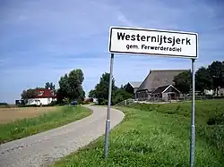
Westernijtsjerk
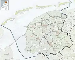
Westernijtsjerk (Dutch: Westernijkerk) is a hamlet in Noardeast-Fryslân municipality in the province of Friesland, the Netherlands. Before 2019, the village was part of the Ferwerderadiel municipality.[3]
Westernijkerk
Westernijtsjerk | |
|---|---|
 Westernijtsjerk | |
 Westernijkerk Location in the Netherlands  Westernijkerk Westernijkerk (Netherlands) | |
| Coordinates: 53°19′37″N 5°47′50″E | |
| Country | |
| Province | |
| Municipality | Noardeast-Fryslân |
| Area | |
| • Total | 11.51 km2 (4.44 sq mi) |
| Elevation | 1.0 m (3.3 ft) |
| Population (2021)[1] | |
| • Total | 215 |
| • Density | 19/km2 (48/sq mi) |
| Postal code | 9073[1] |
| Dialing code | 0519 |
The village was first mentioned in 1224 as Nova Ecclesia, and means "western new church". It uses West to distinguish from Oosternijkerk.[4] Westernijtsjerk is a linear settlement along the road directly to the west Marrum, however both are separated by the N357 road. The Dutch reformed church dates from the 13th century and has a 15th century tower. In 1840, it was home to 228 people. Nowadays, it consists of about 60 houses.[3] Between 1901 and 1940, there was a joint railway station with Marrum. There is a pancake house in an old railroad car attached to a steam train.[5]
Gallery
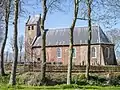 Church, Westernijtsjerk
.jpg.webp) DAF 46 in Westernijtsjerk
DAF 46 in Westernijtsjerk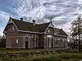 Former train station Marrum-Westernijkerk
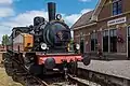 Steam train
References
- "Kerncijfers wijken en buurten 2021". Central Bureau of Statistics. Retrieved 1 April 2022.
Overlap with Marrum
- "Postcodetool for 9073GA". Actueel Hoogtebestand Nederland (in Dutch). Het Waterschapshuis. Retrieved 1 April 2022.
- "Westernijtsjerk" (in Dutch). Retrieved 1 April 2022.
- "Westernijtsjerk - (geografische naam)". Etymologiebank (in Dutch). Retrieved 1 April 2022.
- "station Marrum- Westernijkerk". Stationweb (in Dutch). Retrieved 1 April 2022.
External links
![]() Media related to Westernijtsjerk at Wikimedia Commons
Media related to Westernijtsjerk at Wikimedia Commons