Wheatfields, Apache County, Arizona
Wheatfields is a populated place situated in Apache County, Arizona, United States, right along the border with New Mexico.[2] It has an estimated elevation of 7,287 feet (2,221 m) above sea level.[1] It is one of two places in Arizona with this name, the other being a CDP in Gila County. In 1909, the US Government set up an irrigation project to assist the Navajo residents.[3] It is a chapter of the Navajo Nation.[4]
Wheatfields, Arizona | |
|---|---|
 Wheatfields Location within the state of Arizona  Wheatfields Wheatfields (the United States) | |
| Coordinates: 36°14′16″N 109°07′43″W | |
| Country | United States |
| State | Arizona |
| County | Apache |
| Elevation | 7,287 ft (2,221 m) |
| Time zone | UTC-7 (Mountain (MST)) |
| • Summer (DST) | UTC-7 (MST) |
| Area code | 928 |
| FIPS code | 04-82110 |
| GNIS feature ID | 24682 |
References
- "Feature Detail Report for: Wheatfields". Geographic Names Information System. United States Geological Survey, United States Department of the Interior.
- "Wheatfields (in Apache County, AZ) Populated Place Profile". AZ Hometown Locator. Retrieved July 24, 2017.
- Barnes, Will C. (1960). Arizona Place Names. Tucson, Arizona: University of Arizona Press. p. 25. LCCN 59063657.
- "Tsaile / Wheatfields / Blackrock Chapter". tsaile.navajochapters.org. Retrieved 2020-02-28.
Municipalities and communities of Apache County, Arizona, United States | ||
|---|---|---|
| City | 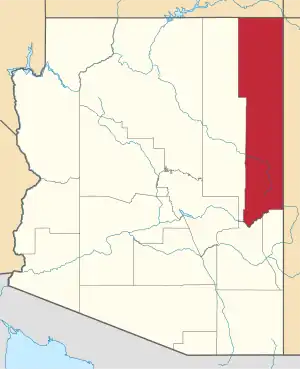 | |
| Towns | ||
| CDPs |
| |
| Populated places | ||
| Indian reservations | ||
| Ghost towns | ||
| Footnotes | ‡This populated place also has portions in an adjacent county or counties | |
This article is issued from Wikipedia. The text is licensed under Creative Commons - Attribution - Sharealike. Additional terms may apply for the media files.