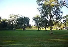
White Rock, Queensland (Cairns Region)
White Rock is a suburb of Cairns in the Cairns Region, Queensland, Australia.[2] In the 2016 census, White Rock had a population of 4,730 people.[1]
| White Rock Cairns, Queensland | |||||||||||||||
|---|---|---|---|---|---|---|---|---|---|---|---|---|---|---|---|
 Minniecon/Mundi Gunjii Park | |||||||||||||||
 White Rock | |||||||||||||||
| Coordinates | 16.9794°S 145.7569°E | ||||||||||||||
| Population | 4,730 (2016 census)[1] | ||||||||||||||
| • Density | 497.9/km2 (1,290/sq mi) | ||||||||||||||
| Postcode(s) | 4868 | ||||||||||||||
| Area | 9.5 km2 (3.7 sq mi) | ||||||||||||||
| Time zone | AEST (UTC+10:00) | ||||||||||||||
| Location |
| ||||||||||||||
| LGA(s) | Cairns Region | ||||||||||||||
| State electorate(s) | Mulgrave | ||||||||||||||
| Federal division(s) | Leichhardt | ||||||||||||||
| |||||||||||||||
Geography
The Bruce Highway and the North Coast Railway Line form the western boundary of the suburb with Skeleton Creek and Smiths Creek (tributaries of the Trinity Inlet) forming the southern and eastern boundary respectively.[3]
History
White Rock is situated in the Yidinji traditional Aboriginal country. [4] The geographical feature of White Rock is also known as Jirriwanday in the Yidiny Aboriginal language.[5] The origin of the suburb name is from a historical railway station named after the geographical feature located in Lamb Range.[6]
On 11 January 1939 at the Lands Office in Cairns, the Queensland Government auctioned 25 suburban lots mostly of about 2 roods (22,000 sq ft; 2,000 m2) about 16.9806°S 145.7452°E to the north of the former White Rock railway station (16.9842°S 145.7428°E).[7]
Trinity Anglican School opened its White Rock Campus on 25 January 1983. It opened a second primary school campus at Kewarra Beach in 2002.[8]
White Rock State School opened on 25 January 1988.[8][9]
Trinity Baptist Church was built in 1996.[10]
In the 2016 census, White Rock had a population of 4,730 people.[1]
Education

White Rock State School is a government primary (Prep-6) school for boys and girls at 114-126 Progress Road (16.9872°S 145.7432°E).[11][12] In 2016, the school had an enrolment of 522 students with 39 teachers (35 full-time equivalent) and 28 non-teaching staff (19 full-time equivalent).[13] In 2018, the school had an enrolment of 514 students with 42 teachers (36 full-time equivalent) and 25 non-teaching staff (17 full-time equivalent).[14] It includes a special education program.[11]
Trinity Anglican School is a private primary and secondary (Prep-12) school for boys and girls at 214 Progress Road (16.9788°S 145.7448°E).[11][15] It has another primary campus at Kewarra Beach.[16] In 2018, the school had an enrolment of 725 students with 69 teachers (66 full-time equivalent) and 51 non-teaching staff (42 full-time equivalent).[14]
Amenities
Trinity Baptist Church is at 115 Progress Road (16.9875°S 145.7426°E).[17]
References
- Australian Bureau of Statistics (27 June 2017). "White Rock (SSC)". 2016 Census QuickStats. Retrieved 20 October 2018.
- "White Rock – suburb in Cairns Region (entry 48932)". Queensland Place Names. Queensland Government. Retrieved 6 March 2022.
- "Queensland Globe". State of Queensland. Retrieved 13 September 2017.
- "First people cultural history". Cairns Regional Council. Archived from the original on 9 April 2020. Retrieved 23 June 2020.
- "Cairns Heritage: W Suburbs" (PDF). Cairns Regional Council. Archived (PDF) from the original on 13 April 2020. Retrieved 23 June 2020.
- "Cairns Heritage: W Suburbs" (PDF). Cairns Regional Council. Archived (PDF) from the original on 13 April 2020. Retrieved 23 June 2020.
- "Plan of allotments in section 204, town of Cairns, parish of Cairns county of Nares, Cairns land agent's district, Cairns City Council". State Library of Queensland (Real estate map). 1936. Archived from the original on 13 March 2022. Retrieved 26 May 2020.
- Queensland Family History Society (2010), Queensland schools past and present (Version 1.01 ed.), Queensland Family History Society, ISBN 978-1-921171-26-0
- "Our school". White Rock State School. 7 April 2020. Archived from the original on 3 March 2022. Retrieved 13 March 2022.
- "Our History". Trinity Baptist Church. Archived from the original on 2 March 2022. Retrieved 13 March 2022.
- "State and non-state school details". Queensland Government. 9 July 2018. Archived from the original on 21 November 2018. Retrieved 21 November 2018.
- "White Rock State School". White Rock State School. 7 April 2020. Archived from the original on 4 March 2015. Retrieved 13 March 2022.
- "Annual Report 2016" (PDF). White Rock State School. Archived (PDF) from the original on 13 September 2017. Retrieved 14 September 2017.
- "ACARA School Profile 2018". Australian Curriculum, Assessment and Reporting Authority. Archived from the original on 27 August 2020. Retrieved 28 January 2020.
- "Trinity Anglican School". Archived from the original on 19 November 2018. Retrieved 21 November 2018.
- "Kewarra Beach Campus". Trinity Anglican School. Archived from the original on 2 March 2022. Retrieved 13 March 2022.
- "Trinity Baptist Church | Cairns". Archived from the original on 20 February 2022. Retrieved 13 March 2022.
External links
- "White Rock". Queensland Places. Centre for the Government of Queensland, University of Queensland.