Whitegrove
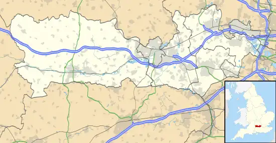
Whitegrove or Warfield Green is a suburb of Bracknell in the English county of Berkshire. It stands within the bounds of the civil parish of Warfield.
| Whitegrove | |
|---|---|
 Whitegrove Location within Berkshire | |
| OS grid reference | SU883703 |
| Metropolitan borough | |
| Metropolitan county | |
| Region | |
| Country | England |
| Sovereign state | United Kingdom |
| Post town | BRACKNELL |
| Postcode district | RG42 |
| Dialling code | 01344 |
| Police | Thames Valley |
| Fire | Royal Berkshire |
| Ambulance | South Central |
| UK Parliament | |
Geography
The settlement lies north of the A329 road and is approximately 1 mile (1.6 km) north-east of Bracknell town centre.
Government
Electorally, Whitegrove comes under the Warfield Harvest Ride ward of Bracknell Forest Council.[1] It falls within the Windsor parliamentary constituency.
Local amenities
Local amenities include Whitegrove Primary School[2] and Whitegrove Library.[3]
Whitegrove Football Club has over 360 children, boys and Girls, ranging from under 7's to under 17's playing in a number of local leagues.[4]
On the northern edge of Whitegrove there is a local nature reserves called Hayley Green Wood.[5]
References
- "Warfield and Harvest Ride ward map" (PDF). Retrieved 25 April 2017.
- Whitegrove Primary School
- Whitegrove Library
- "Home". whitegrovefc.com.
- "Magic Map Application". Magic.defra.gov.uk. Retrieved 25 April 2017.
-
This article is issued from Wikipedia. The text is licensed under Creative Commons - Attribution - Sharealike. Additional terms may apply for the media files.